+++*

Symbolic Forest

A homage to loading screens.

Blog : Post Category : In With The Old : Page 4

A more unusual cemetery post

Or, what to do with your faithful companions if you're rich

Last night was a wild night. Howling wind, hammering rain, the sort of storm that wakes you up as it’s trying to blow your bins down the street.

I was surprised, then, this morning, to find the storm had passed and it was a bright, sunny, fresh winter’s day. Not wanting to waste it, and wanting to get some post-Yuletide fresh air, we headed out to Ashton Court. If you know Bristol, you probably know Ashton Court. If you don’t: it’s an ancient manor, already a manor before the Norman invasion, which was bought by the City Council in the 1950s to avoid it becoming completely derelict.

Ashton Court

This is, according to the internet, a much-hacked-about 16th century gatehouse. The interior of Ashton Court is a bit of a mystery, as not much of it is ever open to the public, but its enormous grounds are effectively a public park, albeit a public park that still hosts a herd of red deer. It also hosts a slightly less medieval golf course (boo) and miniature railway (hurrah).

Naturally, today, the railway wasn’t running and I’ve never seen what’s attractive about golf, so we wandered the various gardens and parkland and woods on the estate, nearly slipped over in the soggy, slippy mud from last night’s storm, managed not to fall into the waterlogged haha, and stood by the deer park fence watching the deer.

At the edge of the garden, though, we found something a little more unusual and a little more interesting: the pet cemetery of the last family to live in the house, in the first half of the 20th century. It does not, a hundredish years later, look particularly well cared for.

Pet cemetery

Presumably most of the graves are of dogs, although the headstones generally stick to euphemisms like “faithful companion” and similar. You have to assume this is the grave of a dog, not a servant.

Grave of Matthew

Some of them are in better condition than others.

Pet grave

Pet grave

If I’d known it was there, I’d have brought the Proper Camera, a sketchbook and a measuring tape. If we have another nice day, maybe I should come back again.

Grave of Sylvie

On Troopers Hill

Or, photo post of the week

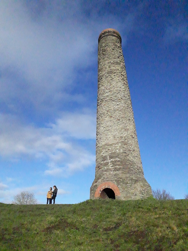
As it is such a lovely, sunny, bright and winter day, we went out for a walk, for a picnic on Troopers Hill. The lumpy, bumpy and steep slope overlooking the Avon, crowned with a rough and slightly wonky chimney. It was busyish, not crowded, but full of groups of families, walking dogs, eating picnics and flying kites. We sat and ate our food, tried to look at the view without squinting, and watched buzzards hovering and circling over the woods.

The chimney

The chimney was probably built in the late 18th century for copper smelting. Various copper and brass works lined the Avon and Frome in the 18th century; it was Bristol’s major industry, powering the city’s corner of the transatlantic slave trade. The chimney on Troopers Hill fumed to turn copper and zinc ore into brass kettles and other ware, for sale in West Africa in exchange for people, to be shipped as slaves to the Caribbean for the enrichment of Bristolian merchants. Quite a dark history for a local landmark. The brass works did not survive the end of the slave trade, as they no longer had a guaranteed profitable market for most of their products; by the mid-19th century, the copper smelters had closed. Troopers Hill was still covered by other heavy industries, though: coal mining, clay mining, stone quarrying, and a tar distillery. As the industries declined through the twentieth century, though, it slowly turned into a slightly wild and unruly green space. The chimney, though, was left looking over everything.

A view from a hill

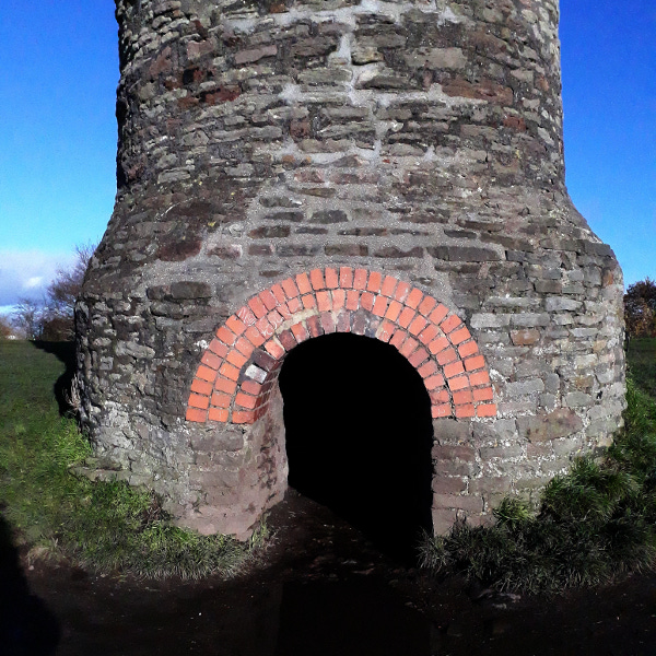
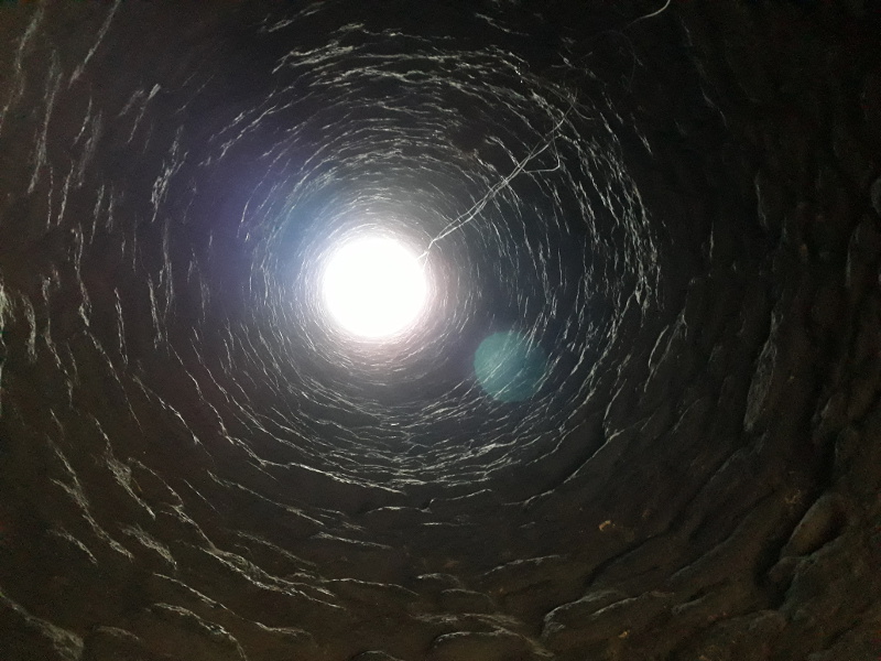
The council have repaired the base of the chimney, where the flues would originally have entered it, and built a little passageway into it. Inside, you can see the light at the end of the tunnel.

Chimney entrance

Inside the chimney

Books I Haven't Read (part eleven)

On myth, poetry, and all that

When I first moved down to South-West England, I was intrigued to note that one of the major local commercial property firms, their boards decorating every half-empty high street, was called Alder King. No doubt this is because at some point in the distant past Mr Alder and Mr King got together to form a business (their website is sadly unhelpful on the subject), but in my own private imagination I liked to think that their founder was deliberately trying to invoke a mythical archetype, implying that the cycle of closure, vacancy and opening on the High Street echoed the ancient cycle of death, sacrifice and rebirth, the brief but spiritually charged reign of the sacred king destroyed by the Great Goddess as described by James Frazer and popularised by one of the twentieth century’s best-known English-language poets. No doubt that poet, if he had lived to the 2010s and had seen Alder King’s advertising boards himself, would have thought the same. Rather, he would not just have thought “that’s an amusing coincidence of naming,” as I did: he would have thought it yet more evidence that all of his theories about mythology and prehistory were incontrovertibly, emotionally and poetically true, and that anyone who disagreed with him was probably a contemptible writer-of-prose or Apollonian poetaster with a degree from Cambridge. At least, I assume that’s what he would have thought. I’ve never managed to finish reading his book on the subject, and I’ve threatened to write a blog post about it more than once in the distant past. Today’s Book I Haven’t Read is, as you potentially have already guessed from this introduction, The White Goddess by Robert Graves.

I have a strange relationship with Graves. I’ve been intrigued with him, puzzled by him, almost obsessed with him, since I was a teenager and my English teacher loaned me his own copy of Goodbye To All That, Graves’s infamous autobiography. He wrote it in a great rush to raise cash in the late 1920s after abandoning his final full-time salaried job, and it’s a fascinating mixture of anecdote and recollection dominated heavily by the one great horror at the heart of his life. He had the bad luck to be born into the English upper-middle-class in the mid-1890s: he left public school, and was about to join Oxford University, in the summer of 1914. He became an army officer without even having to try; whilst still a teenager he was a lieutenant, and by the time he would theoretically have been graduating, he had almost been declared dead and was no longer fit for front-line service. Writing your autobiography at the age of 32 might seem somewhat precocious, but the greatest part of Graves’s is purely about his life between the ages of 19 and 23. I hadn’t even realised, when reading the book, that I was reading the now-standard second edition. It was revised by Graves when some thirty years older to take out the more controversial parts: some passages that hugely upset his close friend Siegfried Sasson, and any references to his 1920s attempt at “feminist” polyamory. The original text is a lot harder to find these days, which is no doubt what Graves would have wanted.

I have a strange relationship with Graves, but I don’t think I could ever like him, and certainly I don’t think we would ever have got on if I should happen to somehow go back in time and meet him. He was a mass of contradictions and swirling neuroses. He always insisted he was a poet, but the majority of his income was from novels and biography, books that he himself always derided as “potboilers”. He had a great skill for making stories make narrative sense, though. His retelling of mythology in the Greek Myths has almost become a standard from a literary standpoint, but he picks and chooses sources and details indiscriminately according to his own subjective view of what feels “more mythological”, or in other words, what he feels best fits the story he wanted to tell. Similarly his best-known novel, I, Claudius, is no use at all as history precisely because its point is to fit a narratively-satisfying story on top of a patch of history which Graves felt needed a better explanation than evidence alone could provide. Above all that, he seems to have been a fairly horrible person: misanthropic, homophobic, racist, and with an irrational hatred of anyone with a degree from Cambridge.*

This post, though, is supposed to be a review of The White Goddess and why I’ve never read it all the way through, or, indeed, got more than a few chapters in. Its subtitle is A Historical Grammar Of Poetic Myth, and in it, Graves first gives a very narrow definition of poetry, before explaining why his interpretation of ancient Celtic sources proves that his definition of poetry is correct in an almost geometrically-perfect circular argument. In short: poetry is verse which inspires subconscious terror, fear, and makes your hair stand on end,** because its subject is always male devotion to the all-commanding White Goddess, the triple-goddess of birth, fecundity and death, the goddess who marries her suitor the Alder King for one glorious day before he is destroyed as a sacrifice to her.

All true poetry—true by Housman’s practical test—celebrates some incident or scene in this very ancient story (p20 of the fourth edition)

“Hang on a minute, Captain Graves,” I can almost hear you saying. “I mean that’s fine for you to say, but I’ve written some poetry and it wasn’t about that!”

In that case, according to Graves’ rules, you’re not a poet and you weren’t writing Poetry. To you and me this might indeed sound like nothing more than highest-order gatekeeping, but Graves goes into great effort to explain that it’s true, much of what you might think is poetry just isn’t Poetry by the standards of Graves The Dedicated Poet. Indeed, according to his standards, the English have barely understand poetry at all.

The Anglo-Saxons had no sacrosanct master-poets, but only gleemen; and English poetic lore is borrowed at third hand… This explains why there is not the same instinctive reverence for the name of poet in the English countryside as there is in the remotest parts of Wales, Ireland and the Highlands. (p19)

So, Robert, you’re saying that the True Poets are those dashing chaps in flappy shirts like Byron and Shelley and so on, who were always saying they wanted to dedicate themselves to their muses?

This is not to identify the true poet with the Romantic poet. … The typical Romantic poet of the nineteenth century was physically degenerate, or ailing, addicted to drugs and melancholia, critically unbalanced and a true poet only in his fatalistic regard for the Goddess as the mistress who commanded his destiny. (p21)

In other words, the only true poets in the world are, really, Robert Graves and a handful of contemporaries he respected (Alun Lewis being one example he quotes approvingly). Others? Sorry, no, whatever you thought you were doing, you’re just not writing poetry by Graves’ standards. The problem I have with this is not just the way it immediately writes off huge swathes of literature, but that this is apparently done so in order to centre Graves, his neuroses and his relationships as the epitome of Poetry, the pinnacle of literature. Graves described himself as a feminist as far back as the 1920s, but his feminism was one in which in reality he was at the centre of things: in which he chose a woman, elevated her onto a holy pedestal, and jealously ensured she stayed there. An emotional masochist, he poured his creative energy into worshipping his chosen muse almost in the hope that she would make him suffer for it. In this sense, his explanation of what makes True Poetry is nothing more than a recapitualation of his personal relationships of the 1920s and 1930s, which he claims to be some sort of universal religious truth. Jealousy itself is elevated to being a vital emotion for the True Poet to have.

What evidence is there, in The White Goddess, that Graves’ inner demons really are the key to both True Poetry and to the ancient mystery religion he claims to be decoding? A dense and cryptic analysis of medieval Welsh poetry, specifically the poem Cad Goddeu, taking it like a set of crossword clues and reordering lines and stanzas in order to produce something that Graves thought made more sense than the original poem. Graves’s “poetic logic” here is much like his logic in writing I, Claudius, or his Greek Myths, or his novel about the life of Jesus: his rewrite of the poem makes a better story, because rewritten it supports his argument, and therefore his argument must be true, because the poem supports it. As a key to understanding Cad Goddeu it is not really anything other than speculation, and certainly not the self-evidently true reconstruction that Graves insists he has produced. To be fair, Cad Goddeu is a famously impenetrable poem and most interpretations of it are little more than speculation, but at least most of the people who attempt to understand it admit that they have no clue what it really consists of.

I said earlier that Graves’ life was governed and steered by the pure luck of being born where and when he was. Similarly, he wrote The White Goddess at just the right time for it to become highly influential: at precisely the time that a new religion was being created in Dorset. As Ronald Hutton has documented in The Triumph Of The Moon, Wicca arose from a seething mixture of British and Irish cultural influences from the late 19th to mid 20th centuries, and The White Goddess, coming at the very end of that period, was one of the most influential on later Wiccan development. Its goddess and its underlying Frazerian story are now widely adopted in modern Paganism, and I’m sure you can find pagans who not only worship Graves’ goddess themselves but believe the ancient Welsh did too. The book has stayed in print for many years, although I do wonder how many of the sold copies have been read all the way through.

So why haven’t I—as of the time of writing—been unable to complete it, despite several attempts? I suspect I’m just too well aware that its basic premise is wrong, or at least, fundamentally flawed. Graves seems to always have been greatly annoyed that academics in both literature and archaeology didn’t think much of it, and that any reviews that did come from academia were generally scathing. He showed it in quite a passive-aggressive way: not only did he write long letters of reply to magazines that gave it a bad review, but some are printed as an appendix to the modern Faber edition. Sadly, they largely show nothing more than his own arrogance and lack of understanding: his insistance that his own outdated knowledge of archaeology and anthropology was far more accurate than that of the professors criticising him. Given I received an introduction to Welsh myth and archaeology at university, I am well aware firstly that much of Graves’ understanding was wrong (even at the time it was written, and it has only grown more wrong since), and secondly that some of his statements make huge leaps in logic and present whole towers of assumption and supposition as if they were solid fact. The entirety of the text rests on sweeping syncretism, with claims such as that the Welsh mythological magician Gwydion is the same character as the Norse god Odin, or that Gwydion’s nephew Lleu Llaw Gyffes is the same character as Hercules and the Mesopotamian god Tammuz. The text resembles a grand conspiracy theory as any similarity between stories and people, however weak, is jumped upon as meaning an equivalence. I opened the book at random to find an example and found this passage, on the ancient Irish poem Song of Amergin:

Tethra [a name mentioned in the poem] was the king of the Undersea-land from which the People of the Sea were later supposed to have originated. He is perhaps a masculinisation of Tethys, the Pelasgian Sea-goddess, also known as Thetis […]. The Sidhe are now popularly regarded as fairies: but in early Irish poetry they appear as a real people. […] All had blue eyes, pales faces, and long curly yellow hair. […] They were, in fact, Picts (tattooed men), and all that can be learned about them corresponds with Xenophon’s observations […] on the primitive Mosynoechians of the Black Sea coast. […] They occupied the territory assigned in early Greek legend to the matriarchal Amazons. The ‘blue eyes’ of the Sidhe I take to be blue interlocking rings tattooed around the eyes, for which the Thracians were known in Classical times. Their pallor was perhaps also artificial—white ‘war-paint’ of chalk or powdered gypsum, in honour of the White Goddess, such as we know, from a scene in Aristophanes’s Clouds where Socrates whitens Strepsiades, was used in Orphic rites of initiation.

There you are: the “real identity” of the mythological Sidhe is uncovered by picking apart random coincidental parallels with things Graves had picked up in his Classical-themed public school education. It’s more like a word association game than genuine historical research. Apologies for editing out the description of the Mosynoechians; it’s impossible to tell from Graves’ account whether there genuinely were coincidental similarities between them and the mythological Sidhe, or whether Graves is being Graves and jumping to conclusions based on the flimiest of matches.

Hopefully one day I will complete reading The White Goddess. The last time I picked it up, I was tempted to live-tweet every time I came to a passage that infuriated me, but soon realised what a thankless and hopeless task this would be after just the second page of the introduction contained the line that Judaism is “a Semitic [religion] grafted onto a Celtic stock”, which is closer to conspiracy-history than anything grounded in fact. I’m certainly not ready to read it just yet. Maybe, instead, I should write something better. Something that is full of open inspirational ideas, not closed and self-justifying ones.

* As someone whose degree is from one of the Ancient Scots Universities, I don’t really have a horse in this race; but I do wonder if he generally thought that any universities other than Oxford were beyond contempt, or if it was just Cambridge specifically.

** This isn’t me colloquialising. He specifically says: a verse is a poem if it makes your hair stand on end if you recite it silently whilst shaving. I can imagine that’s quite handy if you have a dimple or tricky bits around your chin; as a test, it’s attributed to A E Housman. I can’t really imagine Housman agreeing with the rest of Graves’ thesis, and how either of them thought people who don’t shave were meant to separate out poetry and verse is, naturally, not recorded.

That local cemetery again

A bit more local history

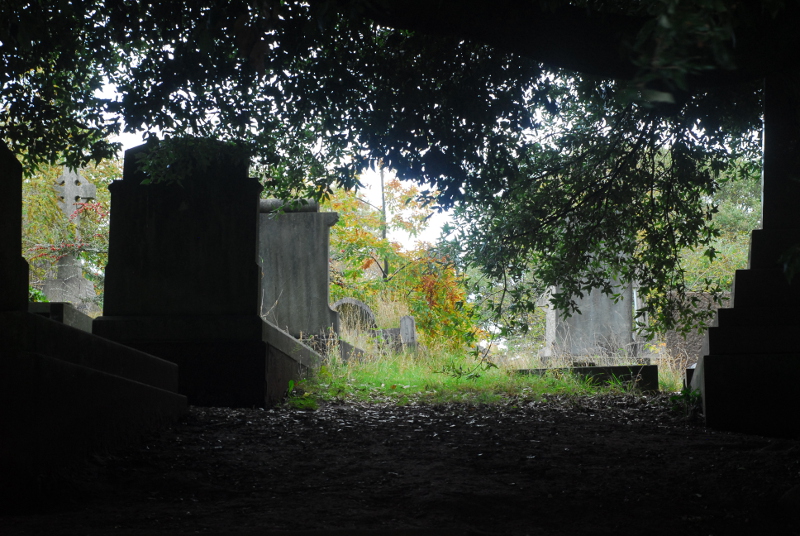
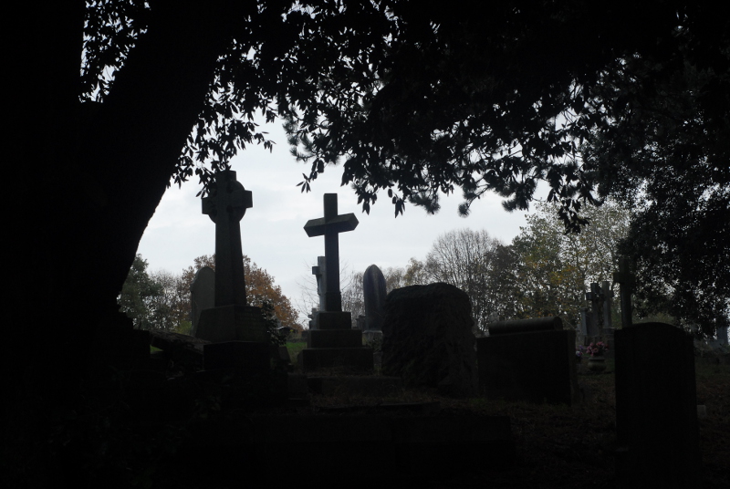
A damp, misty, gloomy November weekend: so obviously, we livened it up by taking another walk around Greenbank Cemetery!

Regular readers might recall the post a while back tracking the evolution of the cemetery through maps. When it first opened, an open stream ran to the north of it; over time, this small beck was culverted as the land either side became first allotments then cemetery. This stream is the Coombe Brook; on the 1880s map, it seems to have risen in Speedwell near the Belgium Pit colliery and ran westwards, joining the River Frome just behind the Black Swan, the infamous Easton pub/club originally built in the 17th century. The modern confluence is, presumably, somewhere in a tunnel system deep under the M32 motorway.

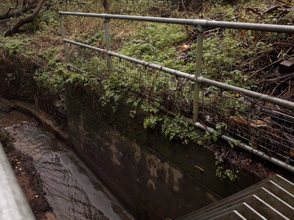
Not much of the Coombe Brook is still above-ground at all nowadays. However, if you explore Royate Hill nature reserve, just alongside the cemetery, you can find the point at which it disappears underground.

Coombe Brook

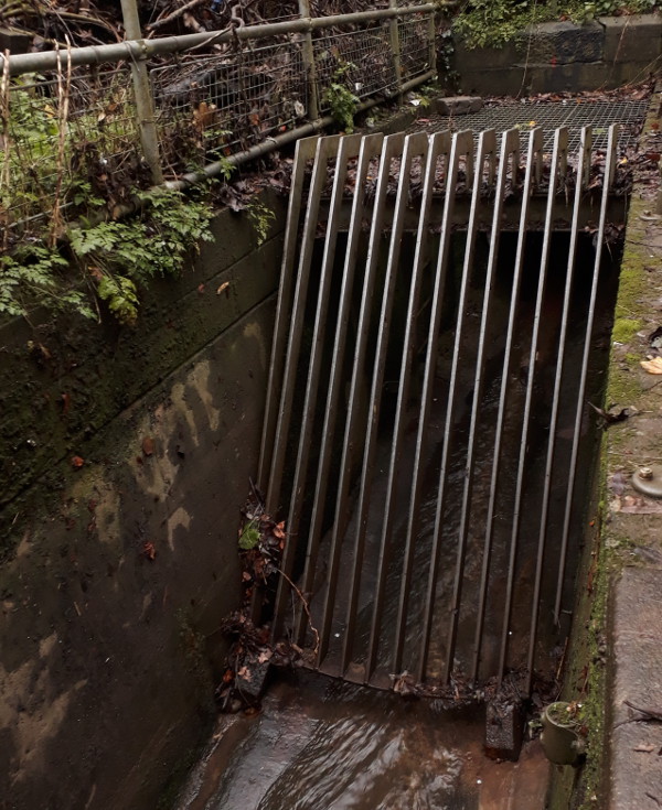
Water disappearing into this tunnel, assuming it doesn’t get syphoned off into a storm sewer, will come out into daylight again in the River Frome alongside Riverside Park. Unfortunately you can’t see the mouth of the 19th century culvert under the cemetery because it is protected behind the romantically-named Royate Hill Trash Screen.

Royate Hill Trash Screen

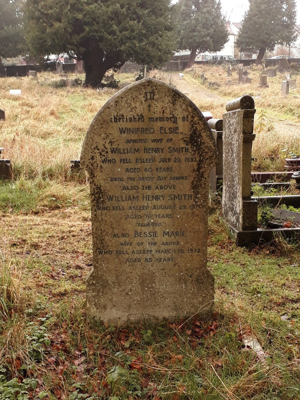
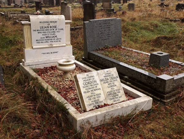
As it was a bit muddy down here today, we headed back into the cemetery. I took a few more photos of 1930s graves in the part of the cemetery that was formerly allotments: more evidence for my previous post about the cemetery being expanded a few years before the maps says. Moreover, they’re fairly interesting gravestones too.

1930s grave

1930s grave

More on the spread of death

Or, the perils of trusting a map

Semi-regular readers might remember that, about a month ago, I posted about Greenbank Cemetery and its history, and looked at the available historic maps online to track its growth through the late nineteenth and early twentieth centuries. This weekend I went back to Greenbank for the first time since I wrote that post, partly for the autumnal atmosphere and partly to see how much evidence is visible on the ground for the different phases of growth I identified on the maps.

The cemetery today is bounded by roads to the north and south, Greenbank Road and Greenbank View. One thing I discovered when writing the previous post is that, according to the maps, there was a phase when there were bands of allotments between the roads and the cemetery itself. The allotments seem to have been created in the Edwardian period; later, the cemetery was extended and swallowed them up. When I visited the cemetery this weekend I went to look for evidence of the northern allotment. The boundary between the cemetery and the allotments (not to mention the field that preceded them) is still clearly evident on the ground.

Former boundary of the cemetery, now a path

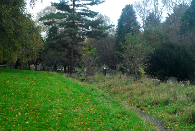
The area on the left has been part of the cemetery since, I think, its first expansion in 1880. The area on the right, where graves are packed in much more closely together, was a field at that point, then became allotments, then cemetery. If you poke around, there’s some signs that the edge of the cemetery might have been a haha-style sunken wall.

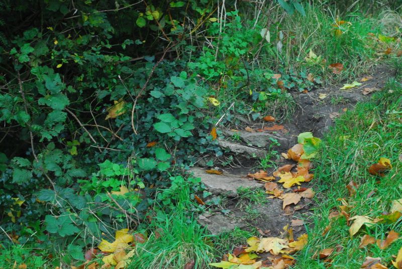
Possible former cemetery wall, with walling stones now used as makeshift steps

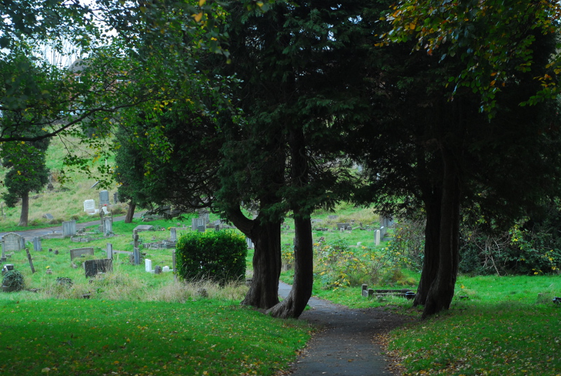
These four trees would have been on the boundary originally. I wonder if they were planted because there was a gate here from the allotments? There’s nothing marked on the map, though, and the map is quite thorough at including the cemetery’s paths, so they may not have been planted until the cemetery was extended.

Four trees straddling the former cemetery boundary - possibly a former gateway?

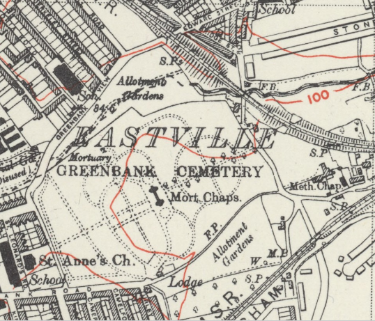
I said previously that the extension of the cemetery over the allotments “must have happened some time after 1938, as a 6-inch-scale map revised that year still shows the allotments”. That map’s available on the National Library of Scotland website; here’s an extract from it.

Greenbank in 1938, apparently

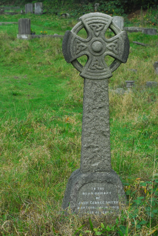
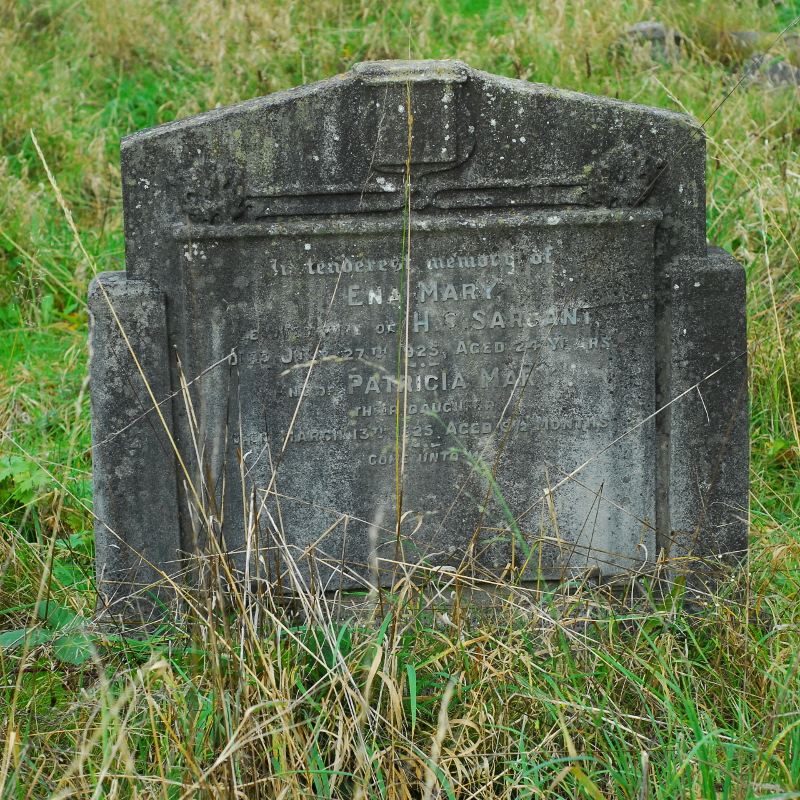
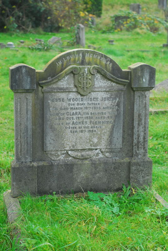
However, on walking round the area of allotments shown on this map, I quickly found that an awful lot of graves are of people who died before 1938. The dates on the headstones run back over ten years before that, to the mid-1920s.

Monument to John Smyth, d. 10th Feb 1926

Monument to Ena Sargant (d. 27th July 1925) and Patricia Sargant (d. 13th March 1925)

Monument to Jesse Jordan (d. 16th March 1930), Clara Jordan (d. 19th December 1930) and Agnes Flemming (d. 18th September 1924)

The 1920s-dated monuments run all the way up to the road, so it wasn’t a case of the cemetery taking over the allotment step by step either. Although it’s not unheard of for people to be reburied, or for people to be commemorated on headstones in spots they’re not buried in, there are so many 1920s monuments in this part of the cemetery that you can’t really use that explanation for all of them. So, unless I do at some point find some evidence that there genuinely was some sort of mass reburial and movement of graves in Greenbank Cemetery in the late 1930s, something like a Bristolian version of the building of the Paris catacombs, we have to conclude that this is a mistake on the map; or, more likely, that the map isn’t a full revision and the change in size of the cemetery was one of those changes in the real world that the Ordnance Survey didn’t bother to draw onto their maps at that point in time.

If I had copious amounts of free time, it would be very tempting to create a full catalogue of all of the monuments in Greenbank and their dates, and then develop a typology of changes in funerary design, spotting trends between different undertakers and stonemasons. It would be even more interesting still to then do the same for another large Victorian cemetery in a different part of the country, and track the regional differences. Sadly, I have nowhere near enough free time to embark on such a project. I’ll just have to wander around the cemetery, spot things like this occasionally, and enjoy the views.

Greenbank Cemetery

Greenbank Cemetery

Maps in this post were reproduced with the permission of the National Library of Scotland.

In the lead

Or, two Hallowe'en posts in one week!

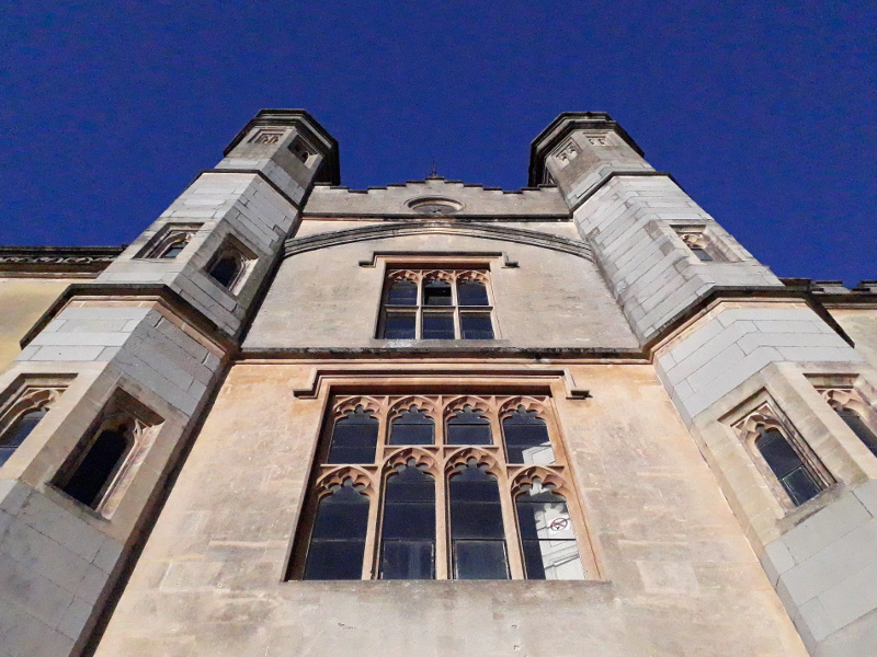
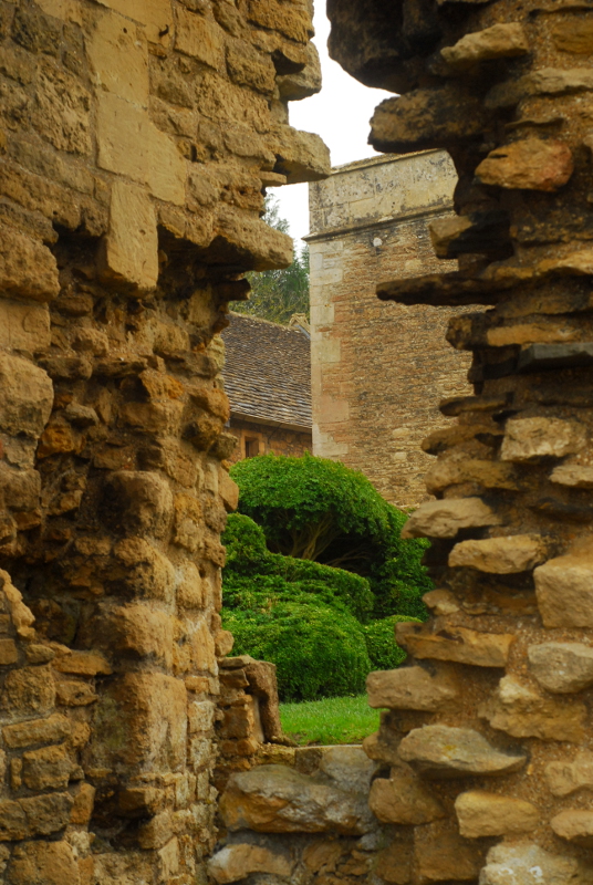
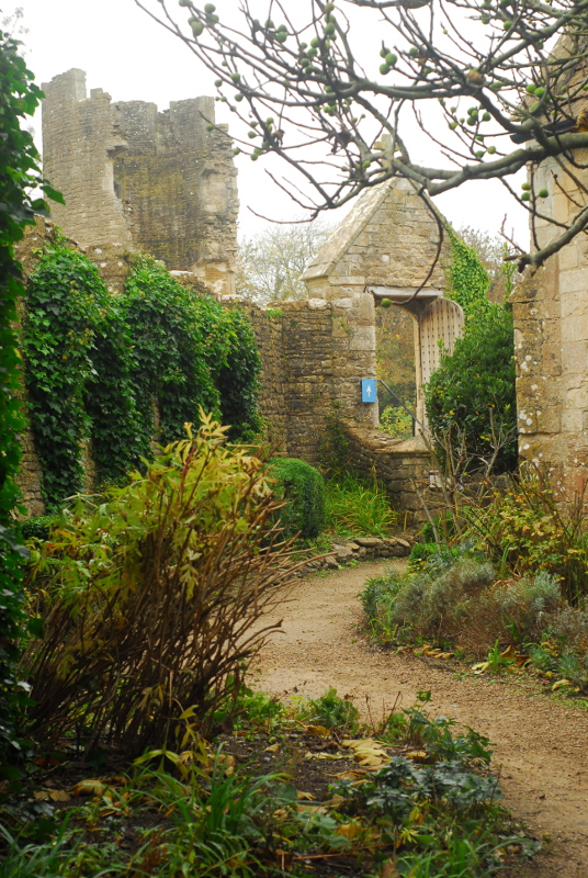
So, yesterday’s post was originally going to be this blog’s sole Hallowe’en post for this year. As it happened, though, the other thing I did yesterday was take The Children out to visit one of the local castles, which turned out to have at least its fair share of autumnal creepiness and gloom. It was Farleigh Hungerford Castle, just to the south of Bath, originally built in the 14th century by Sir Thomas Hungerford, first Speaker of the Commons. Nowadays it is almost entirely ruined, a couple of jagged towers propped up and stabilised by English Heritage concrete. The only buildings left standing are the chapel and associated priest’s house.

Farleigh Hungerford castle

Farleigh Hungerford castle

I said there was some autumnal creepiness: for one thing, the wife of one 16th-century owner allegedly spent years locked away in one of the castle towers, in top-notch fairytale fashion. The owner himself, Walter Hungerford, was later executed for treason, witchcraft and anal sex; however, how much of that actually happened and how much was just a result of being tangled in Tudor politics is rather difficult to tell.* A few decades prior to that, one lady of the house castle had reached her position by rather nefarious means. Agnes Cotell, wife of the castle steward, had her husband murdered and his body burned in the castle ovens so that she could marry the owner Sir Edward Hungerford. Presumably it was common knowledge; because only a few months after Sir Edward’s death, Lady Agnes and her accomplices were tried and hanged.

Farleigh Hungerford castle

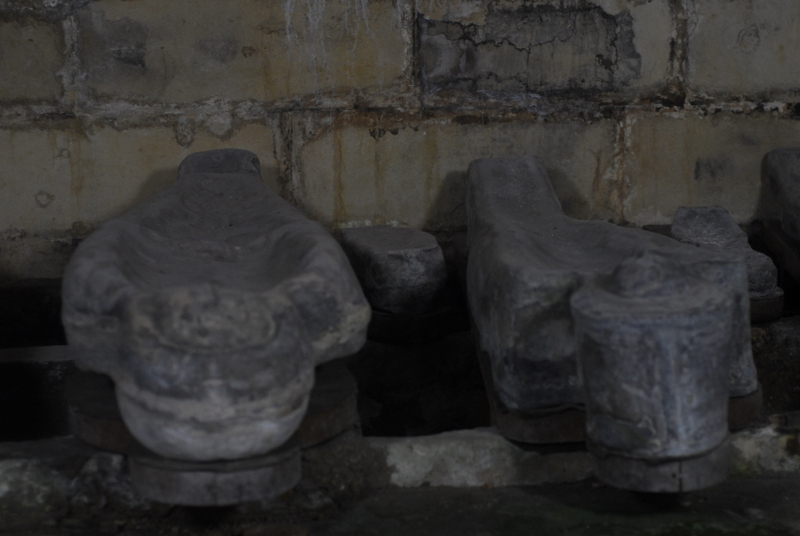
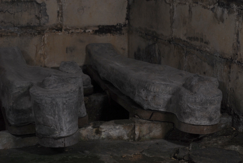
Underneath the chapel, a small crypt contains a handful of anthropomorphic lead coffins, mostly adults with a couple of infants. They sit on shaped wooden boards, bodies presumably still inside them, behind an iron gate. Aside from their silver-grey colour the look for all the world like carefully-shaped human pies or pasties, their edges tightly crimped.

Lead coffins at Farleigh Hungerford castle

Lead coffins at Farleigh Hungerford castle

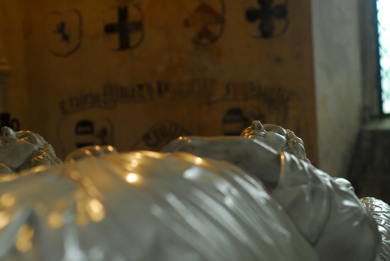
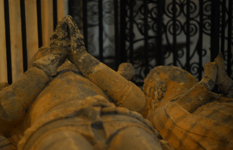
I was slightly disappointed that no ghostly emanations or mysterious mists appeared on the photos, to be honest. Upstairs in the chapel are a number of tombs and effigies, making me think (as always) of the E Nesbit story “Man-sized In Marble”, in which church effigies like this go wandering on Hallowe’en.

Chapel tomb effigy

Chapel tomb effigy

The older pair of effigies are firmly secured behind iron railings; maybe put there by someone else who knows their E Nesbit ghost stories. Maybe, though, the shiny, glossy marble pair will be getting up and going wandering tonight.

* He was a Parliamentary ally of Thomas Cromwell, and was executed alongside him. Which reminds me, I should really get a copy of The Mirror And The Light by Hilary Mantel, in which Walter Hungerford will presumably appear.

On the map

Or, a curious Ordnance Survey oddity

If you follow me on Twitter, you might have noticed the other day I posted an intriguing extract from an Ordnance Survey map I’d never noticed before: a railway station that has a long, peculiar siding shown on a particular revision of the One Inch map, that isn’t shown on other revisions of the same map; that isn’t shown on other contemporary Ordnance Survey maps of different scales, and that isn’t mentioned in any books I’ve seen that cover the railway line in question. Now, this isn’t a post about that particular map, and part of the reason is that the OS spotted my tweet, and suggested I investigate the OS-related holdings in the National Archives, as they may contain notes that answer the question. There’s also another lead I want to chase up, which might contain more information, and I didn’t really want to write half a post.

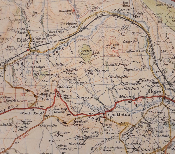
However, it did remind me of another smaller Ordnance Survey curiosity that has intrigued me for years, even though it’s not that much of a mystery. Back in the 1970s, my dad wanted to walk the length of the Pennine Way; and as part of his planning, he bought a number of guidebooks and a copy of every Landranger sheet that covered the route. It’s quite a stack of maps to take along with you, even at Landranger scale, so I’m not sure how easily he would have packed them all; however, as he never did the walk, he never faced that particular challenge. The walk—if you do it in the usual direction from Derbyshire to Scotland—starts here, on Sheet 110.

A small extract of Sheet 110

There’s Edale and there’s the start of the Pennine Way; its original route up onto Kinder Scout, not the current one. There’s Mam Tor, before the road across its flanks was permanently closed, and the railway line past Hope and Earles Sidings. Look what’s odd, though. The typefaces roughly North of Edale and roughly South of Edale are different. The north (and most of this sheet, and every other sheet of this vintage) uses a set of sans typefaces; the south uses a serif typeface.

I remember poring over all of my dad’s Pennine Way maps as a kid, and being intrigued by the sudden switch in font, which applies to a strip of land all across the bottom of this map. To be honest, though, it’s fairly easy to explain. I said earlier that this is a Landranger map; but when it was published, that name hadn’t been invented. At the time these were the “1:50,000 First Series” maps, published and prepared in double-quick time in the first half of the 1970s to keep pace with the project (never quite completed) to switch the UK over to metric measurements. The First Series were produced by taking the previous generation of One Inch maps and photographically enlarging them, to expand them from 1:63,360 scale to 1:50,000. They then had changes applied to bring major features, motorways and such, up to date. As they were published in 1974, all the county boundaries were replaced with the newly tidied up and rationalised ones. Presumably sheets covering South-East Wales had the national boundary moved from Cardiff to Chepstow, and the note about the disputed status of Monmouthshire removed from the key.

All the First Series map covers included a paragraph of information about the process, and a little diagram in the key explaining how old the maps used to make each sheet were. Here’s the diagram for Sheet 110; the wonkiness is from me holding it up to the camera badly.

The source maps

That strip along the bottom, revised 1960? That’s the part of the map that uses different fonts to the rest. Intriguingly, though, the major part of the map is from an older revision, albeit only a couple of years older. I wonder why this particular One Inch sheet with the older set of typefaces crept through to the First Series of metric maps, and why it wasn’t made consistent with the rest.

Incidentally, it’s only the First Series that were produced by enlarging the One Inch maps. The 1:50,000 Second Series were drawn from scratch, with their own new typeface, and with new, metric contours at 10m intervals. The First Series still had the 50ft contours of the One Inch maps, but relabelled to the nearest metre, giving you odd contour line measurements such as 76m and 427m.

Maybe one day I will solve the other map puzzle, search through the records at Kew, find out the answer to my railway siding puzzle and post the answer to that here too. We live in hope. As, indeed, do the people in the bottom-right corner of that map extract.

The Battle of Battle

Although we don't call it that, do we

It’s time for an anniversary! Nine hundred and fifty-four years ago tomorrow, give or take a calendrical change in the meantime, was the Battle of Hastings. An all-day affair, it is famously that One Date That Everyone Knows from all of British history. If you believe the more mouth-frothing end of the political spectrum, England has not been successfully invaded since, although that arguably isn’t really true.

Although it has become that one key fixed date in British history, the battle itself was rather more narrow than you might think. In the Traditional Whig History of Britain, that of course is completely forgotten: instead, the battle is something that in essence had to happen so that Britain could be rescued from peasants in brown robes and conquered by knights on horseback to drag us kicking and screaming into the medieval period. This is how I recall it being portrayed even as recently as the 1980s, when everyone became greatly excited about the 900th anniversary of the compilation of Domesday Book. However, one of the problems with teaching Whig History is that this whole concept, the idea that everything “good” that happened in history is both inevitable and inevitably a Good Thing, and that everything else in history is a misstep or a mistake, is an enormous fallacy propped up with industrial quantities of hindsight.

What actually happened in detail on October 14th 1066 is now probably lost to us. Despite what you might think, there have always been a number of conflicting sources as to the progress of the battle and what happened in the confusion of the fighting. Contemporary estimates of the size of the winning side vary by a factor of 10; the winning side’s estimates of the size of the losing side were in some cases 100 times more than a plausible figure. What is clear is that the English forces consisted solely of infantry; the Normans had a mixed army of infantry, cavalry and archers; the battle lasted pretty much a full day from 9am until dusk; and the Normans definitely won. Almost certainly the English king died, although there are stories he managed to escape, but how he died and what happened to his body afterwards has been retold in too many conflicting versions to know which is true. What’s also very likely is that, pretty early on in the battle, certainly before lunch, the Norman army started to think that Duke William was already dead and started to retreat from the field. William took off his helmet so they could see his face, the story goes, encouraging his men to turn around and fight, and so they did. If they hadn’t, or if doing that had led to an injury, the ending would have been very different; we would remember Hastings about as well as, say, the Battle of Largs or the Battle Of The Standard.

The question there, though, is: what would have been different. But in some ways posing a counterfactual nearly a thousand years back in time is itself a pointless exercise. Everything would have been different, yet everything would still be the same. Me, you, everyone reading this: we wouldn’t exist. None of the people you know would. England wouldn’t exist in its current form, or the UK, or the EU, or the USA. The English language would probably sound very different, too. All these things that we take for granted as basic facts about the world around us, all of them would be different in ways that are almost impossible for us to imagine. Other things, though, would be just the same. The Black Death would still have happened, and many more plagues since. We’d still have had an industrial revolution; we’d still have a climate crisis; we’d still have invented nuclear power and nuclear war, reached the Moon, and be talking to each other through an Internet of some sort. It would be in so many ways an entirely alien world, that you would be surprised just how many things wouldn’t have changed at all.

Historians aren’t really bothered overmuch with what might have happened. What actually happened is far too confusing and debatable and unknown as it is, without introducing hypotheticals that would change the world completely. Imagine, somewhere in an alternate universe, someone is reading a blog post about how the Normans might potentially have beaten the English at the Battle of Hastings, and how if so, everyone in England now might be speaking Normande, part of a single great Normandy stretching from the Meditteranean to the Trent. Of course, they wouldn’t be reading it in a language you or I would recognise as English, but they’d probably be using some sort of device like the one you’ve got, some sort of physically similar screen. Humans and physics wouldn’t have changed, after all. Sit back tomorrow, wherever you are, and think about the Battle of Hastings all those years ago. Without it, the world would be completely different even though it would be still the same.

The spread of death

Or, exploring some local history

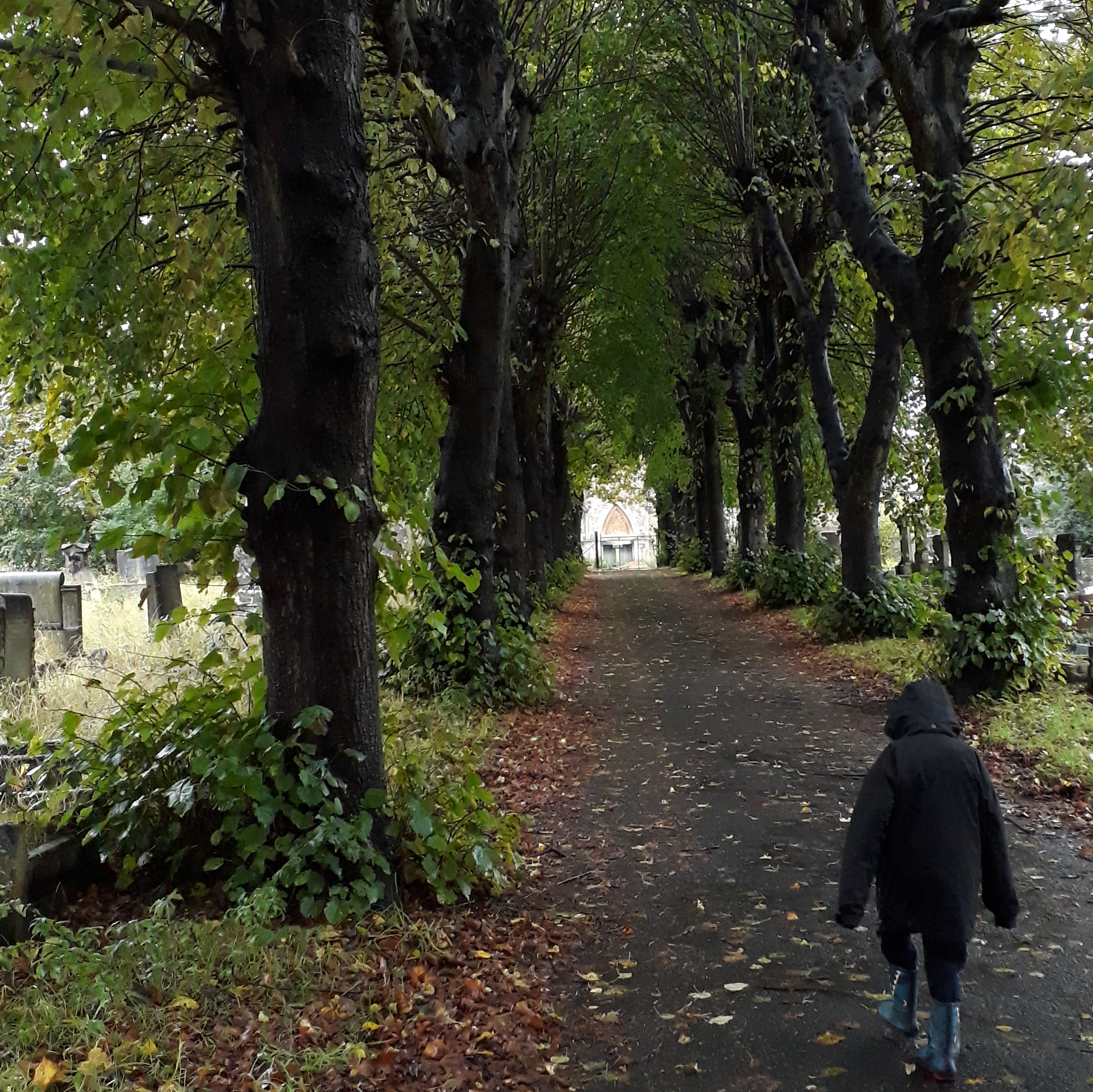
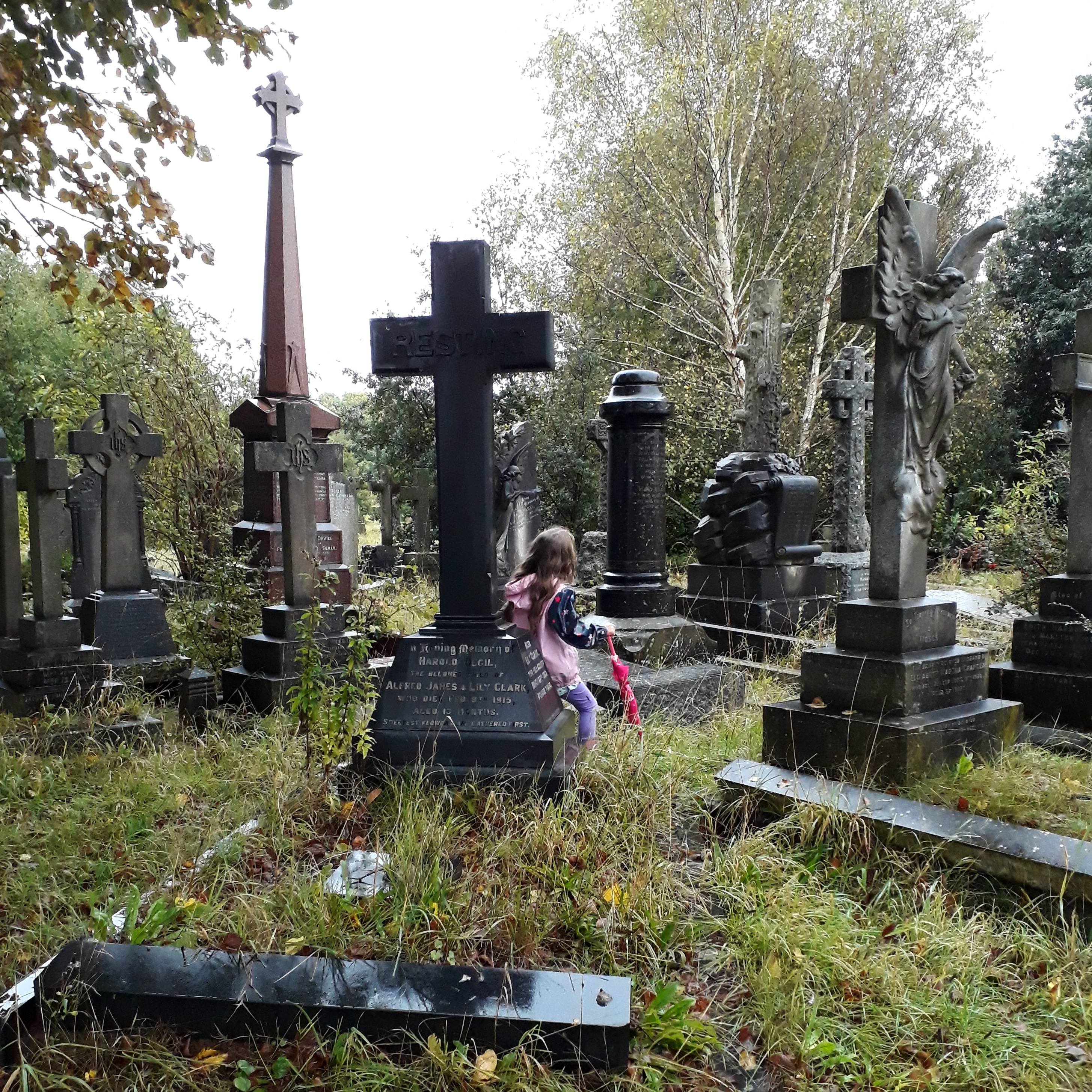
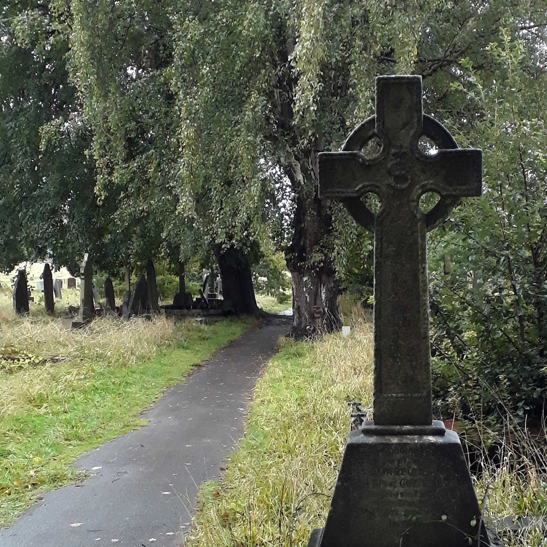
Yesterday, after the rain had stopped, we went for a walk around Greenbank, the local Victorian garden cemetery. It’s a lovely place to visit whatever the weather, but on a cold day, after a rainstorm, with drips coming from every branch and all of the colours having a dark rain-soaked richness, it is a beautiful quiet place to wander around. Even when the children are pestering you to turn around and head back home so they can have some hot chocolate and watch TV. “It is a very hot chocolate sort of day,” said The Child Who Likes Fairies.

Wandering down the avenue

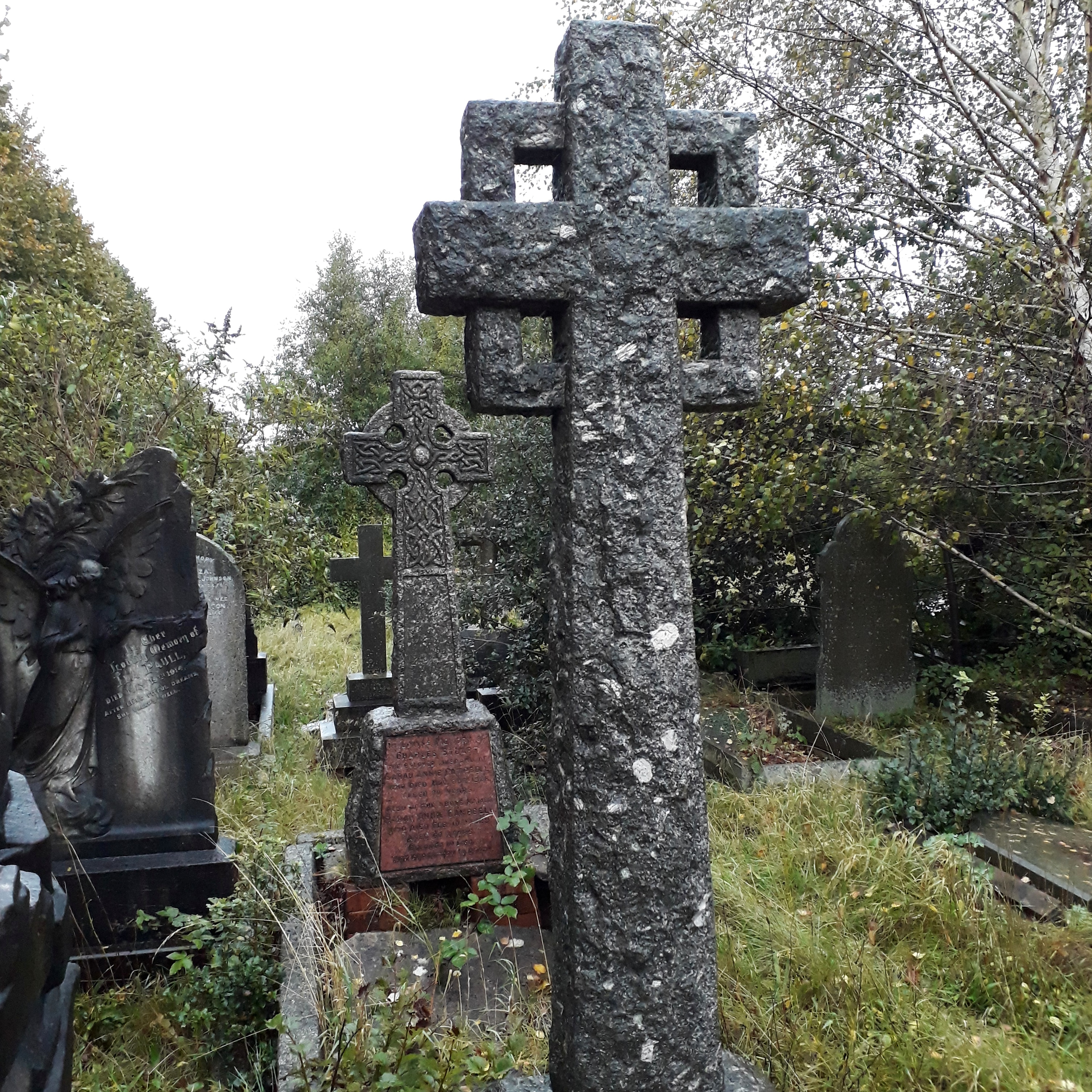
Exploring the graves

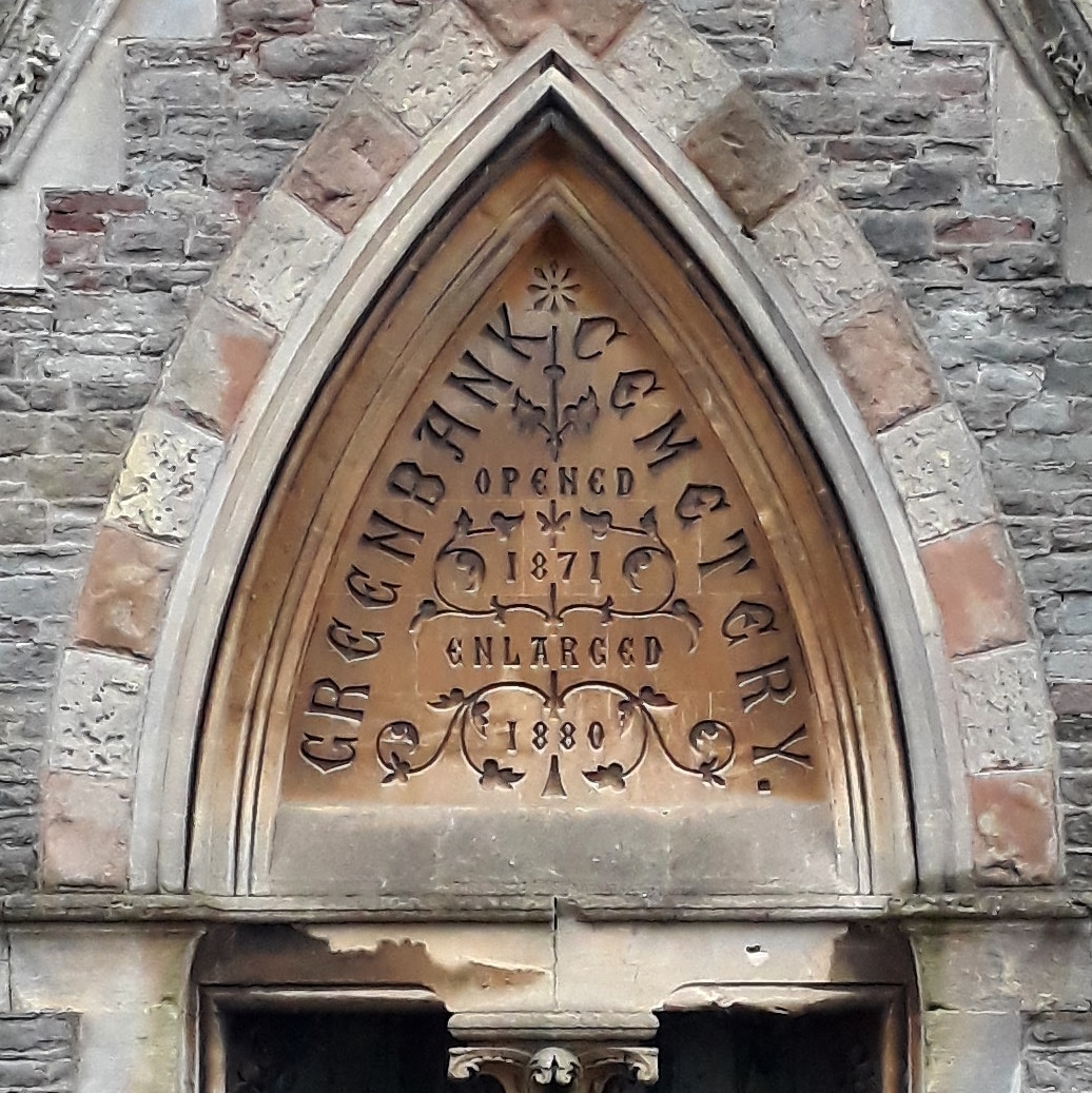
At the centre of Greenbank Cemetery is a connected pair of mortuary chapels: one for Anglicans, and a separate but identical one for other forms of Protestant. They have been derelict and fenced off for a long time, and their central wooden spire was taken down sixty or seventy years ago, but they are still surviving despite the failure of plans a few years ago to restore them and make them usable spaces once more. Above the entrance to the central atrium, between the two chapels, is a finely-carved inscription. “Opened 1871. Enlarged 1880.”

Greenbank Cemetery, Opened 1871, Enlarged 1880

Nowadays when you look at Greenbank on a map it’s surrounded in many places: by roads, by housing, on one side by a disused railway line. So I thought I’d dig into the archives to find out what its original groundplan was, and which parts were extended. Luckily, thanks to the fantastic work of Know Your Place Bristol and their maps, this was relatively straightforward to do. This first map is dated to 1880-81, so it seems to be after the first phase of enlargement of the cemetery. If you don’t know the area, note that it is bounded by an open stream to the west and north, and that Greenbank Road goes up to the cemetery gates and no further. I assume the original area of the cemetery was the part centred on the chapels, and the extension was the area east of the line of trees.

Greenbank Cemetery, c. 1881

In many ways, even without the big garden cemetery this would be a typical landscape for the fringes of a growing Victorian city: a hotchpotch mixture of farmland and unplanned speculative terrace-building. There are rows of houses without proper streets in some parts, streets laid out without houses in others, and a city-sized workhouse with its own private burial ground behind it. If I’d extended the map to the north or to the south, you’d see a typical Victorian park: Eastville Park on one side and St George’s Park on the other.

If we skip forward thirty years or so, we can see how much the landscape has “filled out”. Moreover, we can see how the cemetery has been expanded to the west. The stream has been culverted; the land to the north and south of the cemetery has been taken by allotments. This map is from 1912; I’ve traced a map from 1902 which doesn’t show this, so we can assume this expansion took place some time in the Edwardian period, more or less.

Greenbank Cemetery, c. 1912

In that thirty years huge parts of Easton which previously had just been sketched out for development have now become packed terraced streets, and some of the terraces which were built along narrow paths now have proper roads to them. Schools have been built, and a church. There’s a lot less open space, but there’s still some, here and there. Fishponds Road has acquired trams, up in the top-left corner; and the workhouse have stopped burying their dead on their own land.

If you know the area, though, you’ll know that it does still look a bit different today. To see the modern layout of the cemetery, we have to move forward to a 1950s map.

Greenbank Cemetery, c. 1955

This is the boundaries of the cemetery as it is today. Greenbank Road has been extended, and Rose Green Road has been widened to take traffic. The cemetery has swallowed up the allotments on either side of it, stretching out to reach the roads. This must have happened some time after 1938, as a 6-inch-scale map revised that year still shows the allotments. However, it can’t have happened very long after, going by the dates of some of the graves on the ground. These sections of the cemetery include a number of graves from the Second World War, including civilian victims and enemy prisoners.

What’s always puzzled me about this, though, is that still to this day the emptiest parts of the cemetery include some of the areas which were included in the original 1871 cemetery right from its opening. The north-western side of the original cemetery, which slopes quite steeply down to the course of the brook which marked the original boundary, is still empty of graves. It’s one of the areas being used nowadays for interment, along the line of a path which was put in place when the cemetery first opened. Meanwhile, the late-Victorian and the 1930s extensions are jam-packed with graves, many of them now overgrown and abandoned.

This is the point at which a proper essay on local history would be drawing to a conclusion and discussing what conclusions we can draw about the growth of cemeteries in provincial English cities. As for me, I just like looking at old maps. I think it’s a fair assumption, though, that that city council deliberately bought additional land around the cemetery with the aim of expanding the cemetery into it when required, and in the interim used it for allotment space. Of course, I also like wandering round a cold, damp cemetery, too.

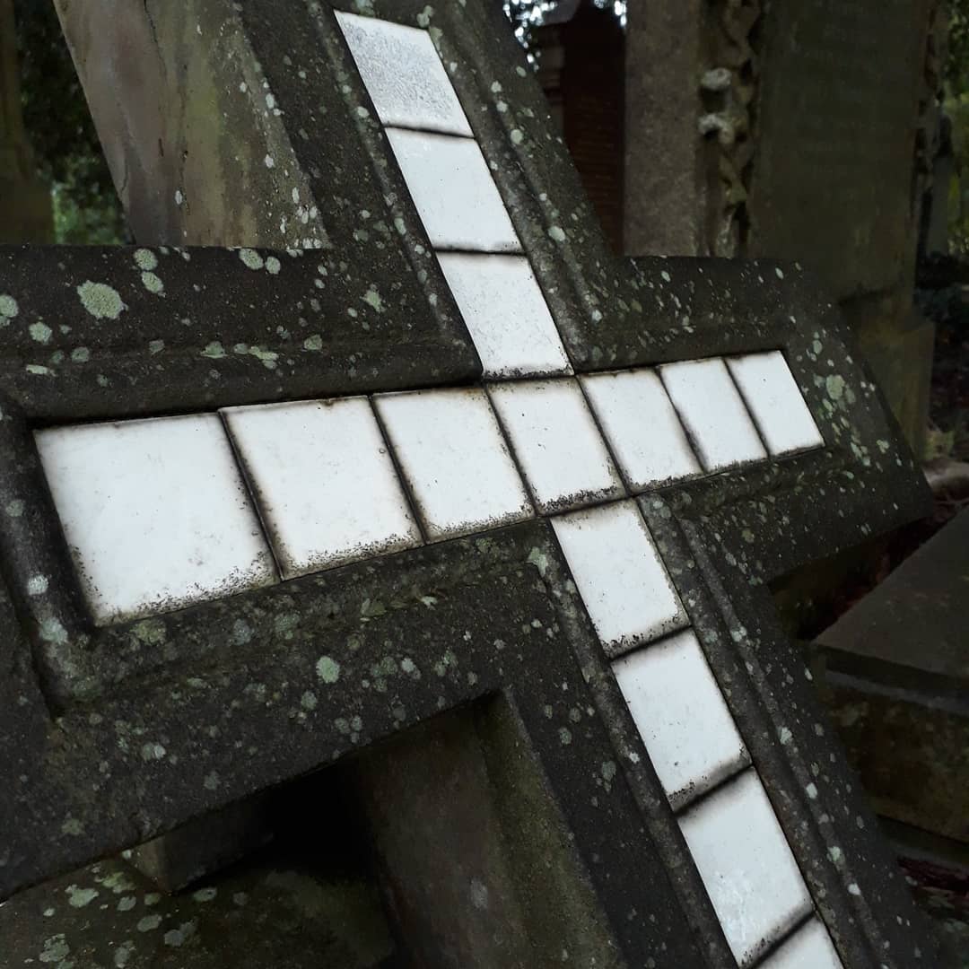
Greenbank Cemetery

Greenbank Cemetery

Greenbank Cemetery

At some point I’ll have to write more about that other burial ground marked on the map. That’s not just disused: for many years there was no sign of it at all on the ground, until a memorial was erected relatively recently. That, though, will be a story for another day.

Update, 2nd November 2020: We went back to Greenbank the other day, with my proper camera this time, to try to see if I could track on the ground any of the cemetery’s history of growth. Indeed, you can, if you know what to look for: however, it doesn’t quite marry up with the dates of the maps I’ve found. The new post about the cemetery’s history is here.

Evidence of ritual activity

Neu, es i fwyta pysgod a sglodion

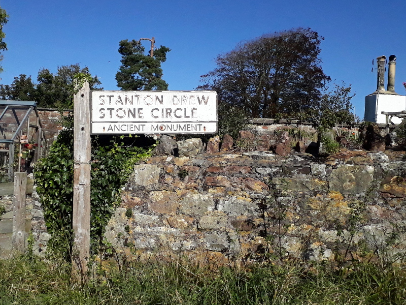
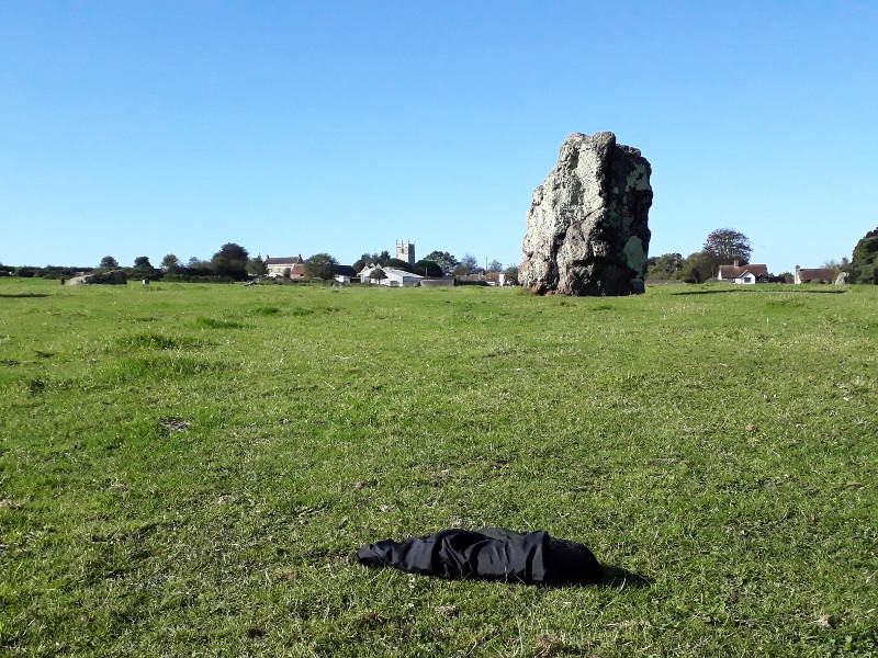
Sunday: a trip out to Stanton Drew stone circles. They are a mysterious and imposing group, relatively little-investigated and therefore with little certainty about them. The Great Circle, second in size only to Avebury, appears to be the remains of a complex henge monument containing multiple concentric circles of wooden posts and an avenue down to the nearby river: rather like Woodhenge, if you know it. The precise date or sequencing, though, is very unclear; it is almost certainly at least four thousand years old, possibly five thousand or more, a range of timescales which in the modern day would easily encompass both a medieval cathedral and the latest office blocks with a huge amount of room to spare.

Pointing to Stanton Drew

We have no real way of knowing what sort of rituals were held here, just that some sort of ritual presumably was, and that over time it will have changed radically. To the last prehistoric people to carry out a religious act here, it might have said to have been immeasurably old, here before the start of the universe; or it might have said to have been built just beyond the touch of living memory, in their fathers’ mothers’ fathers’ time. What we do know is that in reality it may well have been in continuous use for fifty generations or more. In that time there may have been considerable change in language, belief and ritual, or it may have been relatively static. Modern reconstructions of the site, which you can see on the English Heritage website, show an almost-alien forest of posts, completely foreign when compared to any modern-day religious rituals or structures.

Of course, people still carry out religious rituals at Stanton Drew today. They have no real relationship with the religion the site was originally built for, but they do have a deep spiritual and emotional connection to the site itself, as we today see it: to the land, the landscape, and the goddesses and gods that the people of today call upon.

Walking around and exploring the site, we looped around two-thirds of the Great Circle and wandered over to the North-East Circle, much smaller and on a much more human scale. It, too, had its avenue down to the river, and may have had some sort of four-post structure in its centre. Today, at its centre, we found a dead crow. Wrapped in black silk and placed there carefully face-down.

Crow in the circle

We had no way to tell if it had been sacrificed deliberately, or had died a natural death. We had no way to tell who had placed it there, or why, other than that they clearly cared, that it clearly meant something, to place it directly in the centre of the smallest circle, its head facing north. “Insects will eat it and turn it into a skeleton,” said The Child Who Likes Animals, and, indeed, we could see small flies on its soft feathers already getting to work and returning it to the soil. We stood back respectfully and let it go on its way, just as the brambles still ripening in the hedge at the corner of the field will in a few weeks time wither up probably still on the plant.

Stone circle brambles

And then, as it was barely even lunchtime, we headed off to the fish and chip restaurant at Chew Valley Lake to dine in style from cardboard boxes and with wooden forks.

Fish and chips

Hurrah, even if the peas are a bit too fancy to be proper mushy peas.