+++*

Symbolic Forest

A homage to loading screens.

Blog : Post Category : In With The Old : Page 1

Beating the bounds

On how unchanged our landscapes can sometimes stay

Recently I’ve been reading Viking Britain: A History by Thomas Williams, so far at least a very good and modern history of the Viking Period in the British Isles, evoking what we know, what we don’t know, and particularly, what experiencing the Vikings may actually have been like, and what they may have thought. In particular it is very good at making clear which stories are likely true, which are likely not true, and which were assembled to make something that may have resembled a form of poetic, literary truth, even if in truth things did not happen exactly as the sagas and chronicles describe.

This blog post isn’t about that book as a whole, though, if nothing else because I haven’t finished reading it yet. This post is about a small section in one of the introductory chapters, translating a land grant from 808 AD, from the King of Wessex to the brethren of a church in Bath. The following is my own edit, picking my favourite parts from William’s translation and the version published online in the Electronic Sawyer Catalogue of Anglo-Saxon Charters.

First from the swine ford up along the brook to Ceolnes’ Spring; along the hedgerow to Lutt’s Pit; then on to the edge of the coppice; along the edge to the road; along the road to Ælle’s Barrow; down to Alder Coombe; along Alder Coombe and out to the Avon; along the Avon to the swine ford.

“The Avon?” you might be thinking if you’re from Bath or Bristol. “The Swine Ford?” I pulled out the maps, and found Swineford, where the Avon Valley downstream of Bath starts to widen from a few hundred yards wide to a mile or two. I used to travel through it daily on the train, to and from work, looking out for the deer in the morning fields. And the land grant, as described, is very clearly still largely the modern boundary of North Stoke parish, although it gets a bit hard to trace up towards Landsdown and near the racecourse. This map is from the 1950s, partly for aesthetics and partly for copyright reasons, but the parish boundaries haven’t really changed much since then.
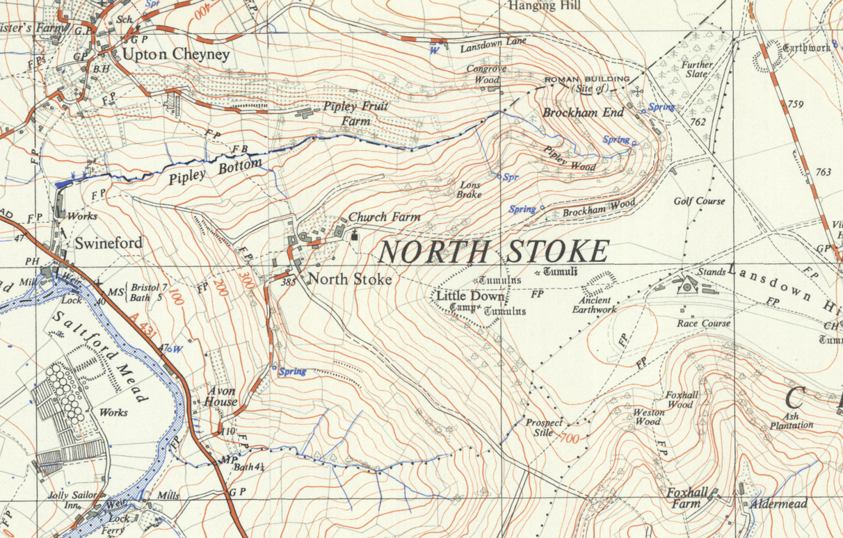
Map of North Stoke parish, Somerset

Swineford, after all, is still Swineford. The brook leading up to the spring must be Pipley Bottom; and there are a number of springs up in Pipley Wood. On Lansdown it is now hard to trace, as the road pattern has changed, the racecourse has been built and there are any number of prehistoric earthworks that could be Ælle’s Barrow; but Alder Coombe must be the small wooded valley that runs down to the river near Avon House.

It’s strange to think that this line on the map, this little patch surrounding one small village, has not in essence changed very much for around 1,200 years. No doubt there are many parishes across England where the same applies—not so much in Wales due to the rather different early medieval history of that country. In Lincolnshire, for example, parish boundaries still sometimes follow the line of Roman-period roads which were landmarks in Saxon times but today are little more than farm tracks or lines on a map.

I’ve never explored North Stoke, just seen it many times from a train window. Maybe, as the year comes in and the days grow lighter, I should try exploring the ancient boundaries of some of the places around me. Just to see what I can still trace.

Flatlander

Or, a trip to the Crowle Peatlands Railway

There are so many preserved and heritage railways in the UK—there must be something around a hundred at the moment, depending on your definition—that it’s very difficult to know all of them intimately, or even to visit them all. It doesn’t help that still, around 55 years after the “great contraction” of the railway network in a quixotic attempt to make it return to profitability, new heritage railways occasionally appear, like mushrooms out of the ground after rain.

Which is why, a few weeks ago, I decided to pop over to Another Part Of The Forest and visit one of the very newest: the Crowle Peatland Railway. It’s still only about three and a half years since the CPR first started laying track; only about ten years since the railway’s founders first conceived of the idea, and less than a year since passengers have been able to ride on it.

The CPR was built to preserve the memory of a very specific, industrial type of narrow-gauge railway, one that is associated more with Ireland than with Britain. The Crowle Peatlands are part of one of the largest lowland bogs in England, the Thorne Moors, on the boundary between North Lincolnshire and South Yorkshire. Drained from natural wetland by the engineer Cornelis Vermuyden in the late 1620s, from the mid-19th century the area started to be mined for peat, with a network of railways bringing the peat from the moors to factories at their edges for processing and transshipment. For many decades these railways used horse haulage, but from around 1950 the peat company switched to petrol and diesel locomotives.

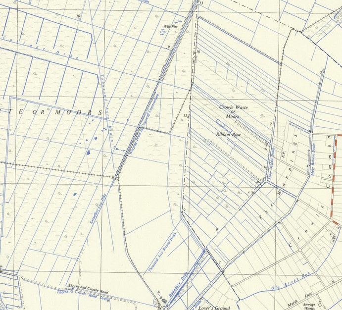
Part of Thorne Moors in the early 1950s

This map shows the Moors at around the time the railways started using locomotive power: you can see the lines of railways across the moors, following the drainage canals, making sharp, almost-hairpin corners. Even in the 1980s there were still between 15 and 20 miles of narrow gauge railway across Thorne Moors, remaining in use until peat mining ended around 2000; the newest locomotive on the railway was bought new as late as 1991.

The preserved railway is in the area shown on that map as “Ribbon Row”, west of Crowle, reached along a narrow, dead-straight lane across the flat landscape of the Moors. As soon as you are outside the town, it feels disconnected, remote, outside the normal world entirely. As I drove, in my mirrors, I saw a young deer crossing the road behind me.

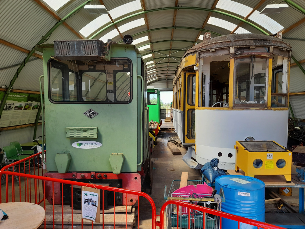
To date, the railway has a café with very nice home-made cake. a maintenance shed, and a straight line of track stretching out across the moor. The shed is full of the sort of small diesel locomotives that worked on the moors from the 1950s onwards—and also, a Portuguese tram.

Inside the maintenance shed

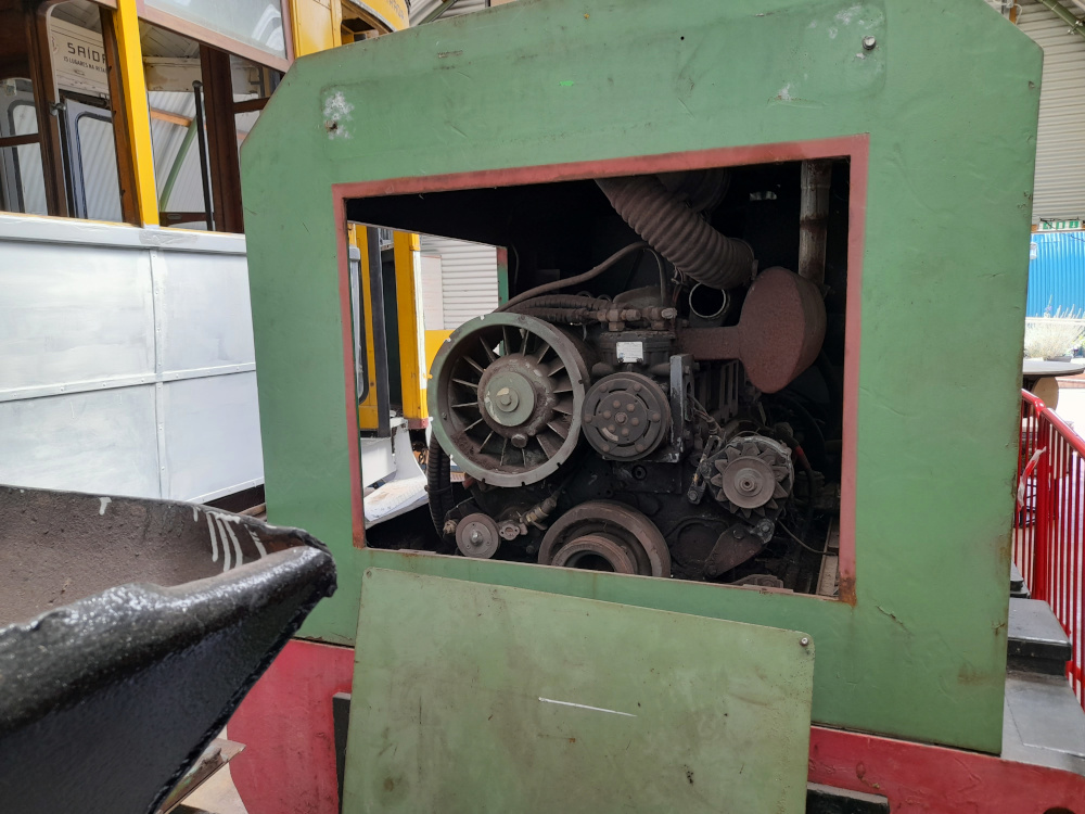
I think the loco on the left is Schöma 5130 of 1990; the diamond-shaped plate is the builder’s plate of Alan Keef of Ross-on-Wye, to mark the loco being rebuilt in the late 1990s with a more powerful engine, which you can see here.

Under the bonnet

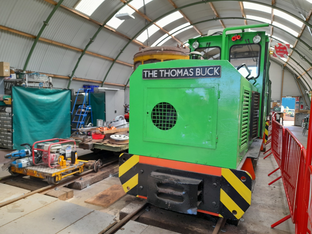
The newest loco to run on the peat railways was named after a retired member of staff in the early 1990s, shortly after it was built.

The Thomas Buck

The railway’s other locomotive is a Motor-Rail Simplex built in 1967 and abandoned around 1996 due to worn bearings.

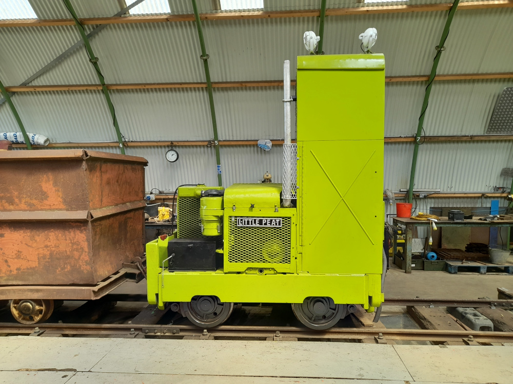
The Simplex loco Little Peat

It’s a nice little engine, much less powerful than the newer ones, but I’m not sure what I think of lime green as a locomotive colour.

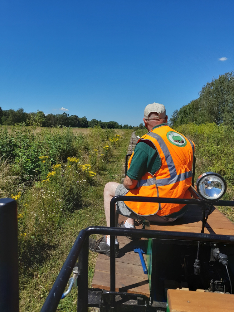
On a map—if it had made it onto any maps yet—the railway would no doubt appear as a dead straight ine; but on the ground it follows gentle curves and undulations. At 3ft gauge the track feels wide for a narrow-gauge line, especially given the small size of the powered trolley that takes you out onto the moor. On my run I was the only passenger, with a driver and guard to look after me, as we pottered out along the track, surrounded by wildflowers pressing close up to the track, fat bumblebees buzzing close to the car as we went.

The driver looks out at the road ahead

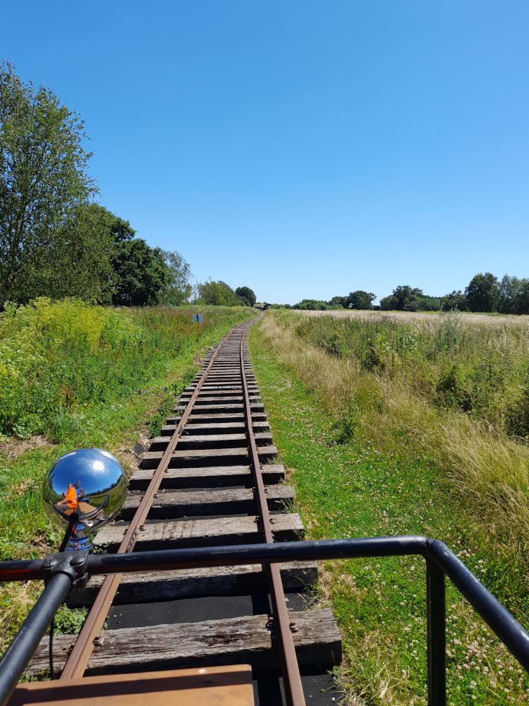
No stations; no platforms; no sidings. No signals other than a fixed distant sign warning that the track will run out soon. Just a single line of track, which stops. Back we go; with me and the guard having the best view this time, although I tried to make myself thinner and not block the driver’s line of sight.

Heading back towards the shed

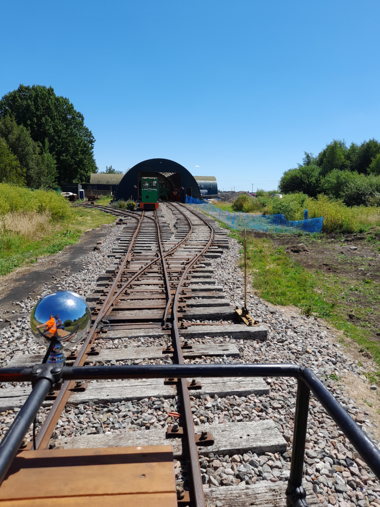
That photo shows practically the whole railway, with the shed visible in the distance. We trundled back in, feeling far faster than the handful of miles per hour we were actually doing. Retracing our steps, back to the yard.

Coming in to the shed

The Crowle Peatland Railway isn’t somewhere I’ll be going back to again that soon, because for now, I’ve seen all there is to see. But it is a nice little place to visit, a reminder that everyone starts somewhere, and that sometimes a railway is just a stretch of line running out into a field. It’s open and running trains about one weekend a month at the moment, and it’s worth visiting for the cakes. Or, indeed, if you just want to be out in a landscape where the horizon is straight as a ruler, and there are few noises beyond the wind blowing the grass.

The Paper Archives (part three)

The title of this series is maybe not quite as suitable as it was

The previous post in this series is here.

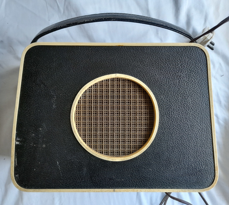
Sometimes, sorting through the accumulated junk that fills my mother’s house, I come across things that I remember from my childhood. For example: alongside the stack of modern radio transceivers that my dad used to speak to random strangers over the airwaves, is the radio I remember being my Nanna’s kitchen radio, sitting on top of the fridge.

The old kitchen radio

It’s a big, clunky thing for a portable, its frame made of leather-covered plywood. I know it has valves (or tubes) inside, not transistors, because I remember my dad having to source spare valves for it and plug them in back when my Nanna still used it daily—he was the only person in the family who knew how to work out which of the valves had popped when it stopped working.

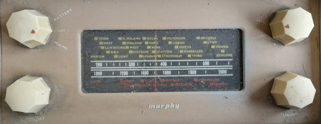
With only a vague idea how old it might be, I looked at the tuning dial to see if it would give me any clues.

The tuning dial

Clearly from before the Big BBC Renaming of the late 1960s. I’m not sure how much it can be trusted for dating, though, as Radio Athlone officially changed to Radio Éireann in the 1930s, but I was fairly sure the radio probably wasn’t quite that old. Of course, I should really have beeen looking at the bottom.

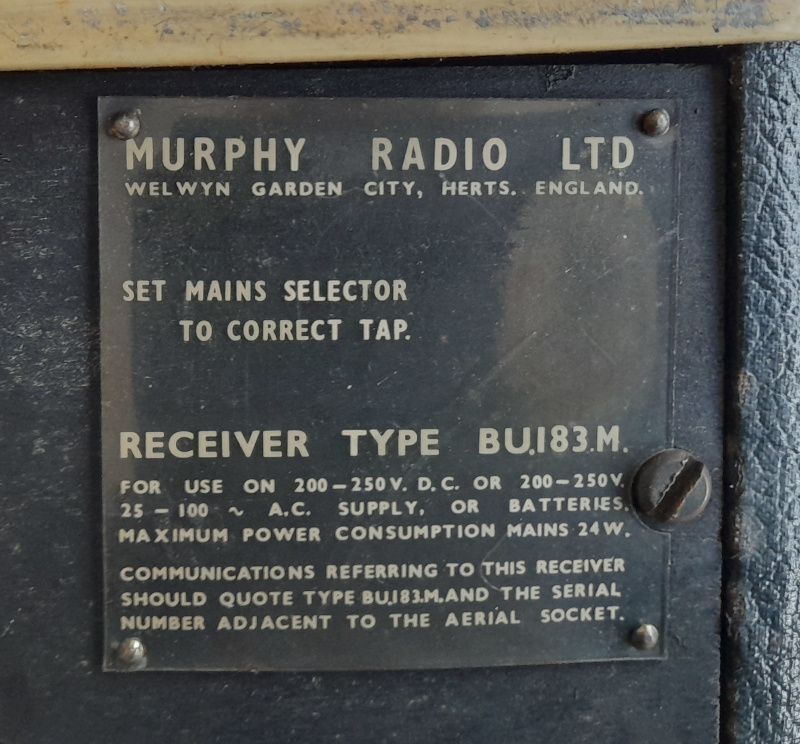
The makers' plate

And of course the internet can tell you exactly when a Murphy BU183M was first sold: 1956, a revision of the 1952 BU183, which had the same case. The rather more stylish B283 model came out the following year, so I suspect not that many of the BU183M were made.

I’m intrigued by the wide range of voltages it can run off: nowadays that sort of input voltage range is handled simply and automatically by power electronics, but in the 1950s you had to open your radio up and make sure the transformer was set correctly before you tried to plug it in, just in case you were about to blow yourself up otherwise. I suppose this is what radio shops were for, to do that for you, and potentially to hire out the large, chunky high-voltage batteries you might need if you didn’t have mains electricity. This radio is from the last years of the valve radio: low-voltage transistor sets were about to enter the marketplace and completely change how we listened to music. This beast—or the B283, which at least looks like an early transistor radio—needed a 90-volt battery to heat up the valves if you wanted to run them without mains power, not the sort of battery you can easily carry around in your handbag. The world has changed a lot in seventy years.

Voices through the wires

Or, hanging on the telephone

One of the tabs I’ve had open in my browser for a few weeks meaning to write about it here is this Guardian article about the steady decline of phone boxes in the UK.

It brought back memories, and it made me feel old at the same time. My first memories are from the early 1980s, when if you didn’t have a phone line and needed one installed, you went on a waiting list that was several months long. When we moved into a new-build house, on an estate with no phone boxes either, that meant several months of walking to the nearest one, on the main road at the edge of the estate, to make calls, and long, tedious waits—tedious if you’re a pre-schooler, at least—outside the box when you needed to receive one. We had the phone line fitted, the phone wired in because house phones were the property of BT, not you, back in those days; and then just a few months later, a lightning strike hit a phone pole a few hundred yards up the street, with a massive crash, scorching and burning out the newly-fitted phone line termination box (and presumably those of the neighbours too). We went back onto the waiting list, and by the time we reached the top again, the house was fitted with a socket and the phone had to be given a plug. The phone itself had survived the lightning strike, although its bell never quite worked properly again.

When I reached my teens, I became a heavy phone box user once more, partly because my father had bought a cordless phone—which was completely analogue, not at all encrypted, and therefore something that any nearby radio ham, such as my father, could tune in to and listen in on. I hoarded my silver coins and started phoning friends from the phone box on the main road again, feeding 10p and 20p coins into it every few minutes, occasionally getting turfed out by someone else who needed to make a call and thought I was hogging it. I’d do the same on camping holidays, finding the nearest phone box in whatever village or hamlet we were staying in. In fact, most campsites then had their own on-site phone box, for you to phone home to let people know you’d arrived safely—which my parents did religiously on the first evening of each holiday.

I remember the switch from fully-enclosed boxes, whose doors were so strongly sprung I could barely pull them open, to ones with gaps at the bottom of the glass on three sides; or in “deprived areas” like the Grimsby West Marsh, armoured-looking stainless steel phones on poles with no box around them at all. What I can’t remember, though, is when I last used one. I’ve had a mobile phone since the turn of the century; I can’t even remember the last time I had a voice call that wasn’t either for work, or with one of my elderly uncles. I probably stopped using phone boxes when I went to university, although I don’t really have any definite certainty on that. For me they’re a part of the landscape, I’d be sad to see them disappear, but I likely wouldn’t notice at all. When I lived in Bristol, the phone box on the corner of the next street had a sticker on its door saying it was due to be removed for about a year, before one day it suddenly wasn’t there any more. That must mean nobody had used it for, what, maybe a couple of years at least by that point.

Do we still need phone boxes? Yes, we undoubtedly do, but that’s just For Now. Within my lifetime, they’ll probably go completely. Still, the world moves on. They were a phase, a hundred-and-fifty year phase, but now, their time is fading. Their time will soon be past.

A walk in the park

Some South Wales railway history that is still around, but not for long

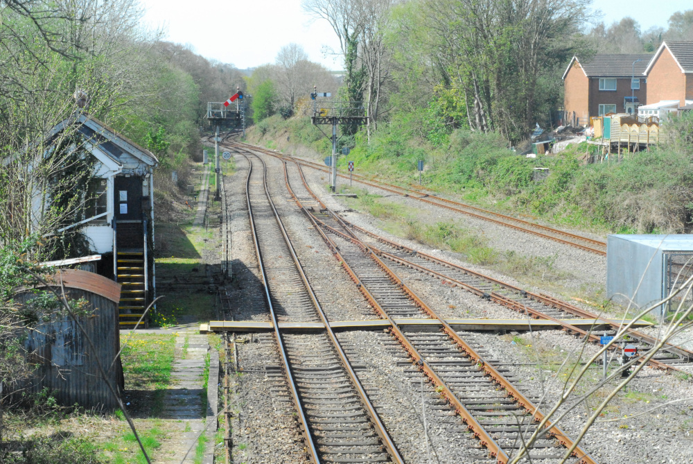
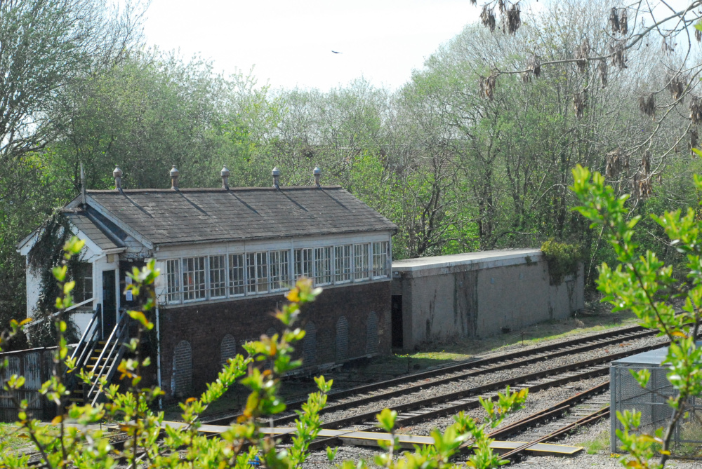
Back on to my complex and fragmentary sequence of posts about the history of the complex and fragmentary South Wales railway network. It was prompted by news that Network Rail are working on upgrading the Ebbw Vale line to allow a better train frequency than once per hour, by widening the line from one track to two for a few miles around Aberbeeg. Changing the track, though, involves changing the signalling, and changing the signalling will involve getting rid of a little island of 19th-century mechanical signalling that still exists in Casnewydd/Newport. It’s the signalbox at Park Junction, in the Gaer area of the city.

Park Junction signalbox

And there it is, with the signals pulled off for an Ebbw Vale train. This picture is from April 2021. It might not look like much from this angle, but if I swing round a bit, you can see that the box is really quite a grand affair for something that only handles a few trains per hour.

Park Junction signalbox

You’d be right to assume that, given the size of the building, it was built to control a much bigger junction than the handful of tracks in front of it today.

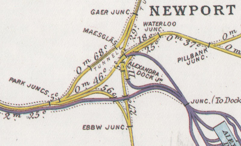
I’ve written before about the Monmouthshire Canal Company building a railway all the way back in 1805, to carry coal and iron down the Sirhowy Valley. This is, indeed, on that 1805 route. When, a few decades later, the South Wales Railway was built from Abertawe/Swansea to Casgwent/Chepstow, it burrowed under the Monmouthshire Canal Company’s railway at right-angles, and a complex mesh of interconnecting routes slowly developed. This is a map from around the time of the First World War, after the MCC and SWR had both been bought out by the Great Western, so confusingly both railways are in the same colour.

Railway Clearing House map of the area

The Monmouthshire Canal’s railway runs from left to right, the South Wales Railway from bottom to top, and Park Junction is there on the left. Nowadays, most of the tangle of lines heading towards the docks has gone, and Park Junction is at one corner of a triangle, trains to Cardiff joining the main line at Ebbw Junction and those into Newport joining it at Gaer Junction.

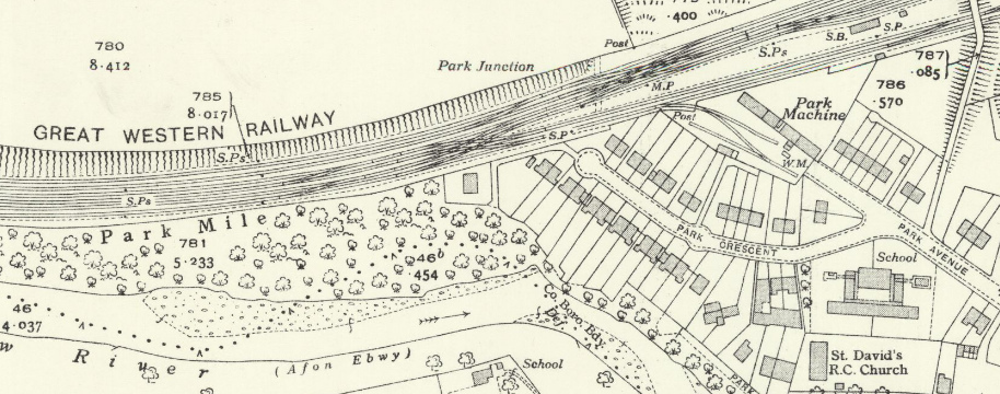
I’ve written previously about that purple line running parallel to the yellow one. That belonged to the company which had extended Newport Docks, the Alexandra (Newport) Dock & Railway Company; and they had built a line from Bassaleg, right alongside the Great Western, so that coal trains coming down the Brecon & Merthyr Railway from Bargoed, Rhymney or Bedwas could reach Newport Docks without paying tolls to the GWR. When they were built, the lines ran around the back of the signalbox, which had nothing at all to do with them. You can see this on a more detailed map from around the same time.

Ordnance Survey 25in map of 1916

Reproduced with permission of the National Library of Scotland, as was the one below.

I’ve made that one a clickthrough because it’s quite detailed; apologies for the horizontal line, but the original is split across two sheets which I’ve roughly stitched together. Three pairs of tracks in front of the box, belonging to the Great Western; and the pair behind it, separate, spreading out into a bank of sidings. About five years after this was surveyed, the Railways Act 1921 merged Newport Docks into the GWR, and within a few years they had put in additional connections at Park Junction, between the lines in front of the box and those that ran behind it.

Ordnance Survey 25in map from the 1930s

Look how much suburbia has grown up in those twenty years, too.

The route through Park Junction lost its passenger services in the early 1960s. Ostensibly this was because British Railways wanted to rearrange the platforms at Newport Station in such a way that there was no space for the Ebbw and Sirhowy Valleys services to turn around; of course, if they had really cared about keeping them, they would have been able to find a way to do it. Back then, there was still heavy freight traffic up and down the valley, from the steel works and the mines; and a large marshalling yard at Rogerstone. Over the following years that traffic dwindled away and shrank, but Park Junction signalbox nevertheless survived, opening a bit less maybe, but still there to signal freight trains up the valley when needed. In the 2000s when the line to Ebbw Vale reopened to passengers, a modern signalling panel was put into one corner of the box to control most of the Ebbw Vale line; but the box still kept its mechanical levers and the tracks past it kept their mechanical semaphore signals, as you can see on the photos above.

Now, in 2022, Park Junction is something of an isolated island given that the main line through Newport is all controlled from the Wales Rail Operating Centre, in Cardiff. When passenger services returned to Ebbw Vale, only one track was kept north of Crosskeys, meaning that the maximum service frequency on the branch is the hour that it takes a train to get from Crosskeys to Ebbw Vale and back down to Crosskeys again. To increase the service means more track; more track means more points and signals; and if you’re putting in more points and signals, it makes sense to move on with the plan to put all of Wales’s signalling into the ROC. So, Park Junction will close, some time over the course of the next few months. It’s a shame, but that’s modernisation for you. I must try to get there again to take more photographs before it goes.

The Paper Archives (part two)

More relics from the past

The previous post in this series is here.

Spending some more time going through the things The Parents should arguably have thrown out decades ago, I came across a leather bag, which seemed to have belonged to my father. Specifically, he seemed to have used it for going to college, in the 1970s. Him being him, he’d never properly cleaned it out, so it had accumulated all manner of things from all across the decade. There were “please explain your non-attendance” slips from 1972; an unread railway society magazine from 1977; and the most recent thing with a date on was an Open University exam paper from 1983. It was about relational database design, and to be honest some of the questions wouldn’t be out of place in a modern exam paper if you asked for the answers in SQL DDL rather than in CODASYL DDL, so I might come back to that and give it its own post. What he scored on the exam, I don’t know. There were coloured pencils, and an unopened packet of gum.

Juicy Fruit gum

It seems to be from before the invention of the Best Before date, but the RRP printed on the side is £0.04.

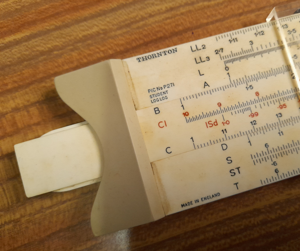
Slightly more expensive: a rather nice slide rule. Look, it has a Standard Deviation scale and all. Naturally, my dad being my dad, it was still in its case and with the original instruction book, which will be useful if I ever try to work out how to use it.

Slide rule

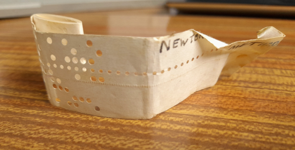
And finally (for today) I spotted what appeared to be a slip of paper at the bottom of the bag with “NEWTON’S METHOD” written on it in small capitals, in fountain-pen ink. Had he been cheating in his exams? Had he written a crib to the Newton-Raphson method down and slipped it into the bottom of the bag? I pulled it out and…I was wrong.

Paper tape

It was a rolled-up 8-bit paper tape! Presumably with his attempt at a program to numerically solve a particular class of equation using Newton’s method.

I don’t know what type of machine it would have been written for, but I could see that it was likely binary data or text in some unfamiliar encoding, as whichever way around you look at it a good proportion of the high bits would be set so it was unlikely to be ASCII. Assuming I’m holding the tape the right way round, this is a transcription of the first thirty-two bytes…

0A 8D 44 4E C5 A0 35 B8 0A 8D 22 30 A0 59 42 A0 47 4E C9 44 C9 56 C9 44 22 A0 D4 4E C9 D2 50 A0

That’s clearly not ASCII. In fact, I think I know what it might: an 8080/Z80 binary. I recognise those repeated C9 bytes: that’s the opcode for the ret instruction, which has survived all the way through to the modern-day x64 instruction set. If I try to hand-disassemble those few bytes assuming it’s Z80 code we get:

ld a,(bc)
adc a,l
ld b,h
ld c,(hl)
push bc
and b
dec (hl)
cp b
ld a,(bc)
adc a,l

This isn’t the place to go into Z80 assembler syntax—that might be a topic for the future—other than to say that it reads left-to-right and brackets are a pointer dereference, so ld c,(hl) means “put the value in register c into the memory location whose address is in register hl. As valid code it doesn’t look too promising to my eyes—I didn’t even realise dec (hl) was something you could do—but I’ve never been any sort of assembly language expert. The “code” clearly does start off making assumptions about the state of the registers, but on some operating systems that would make sense. This disassembly only takes us as far as the repeated 0A8D, though: maybe that’s some sort of marker separating segments of the file, and the actual code is yet to come. The disassembly continues…

ld (&a030),hl
ld e,c
ld b,d
and b
ld b,a
ld c,(hl)
ret
ld b,h
ret
ld d,(hl)
ret
ld b,h
ld (&a0d4),hl
ld c,(hl)
ret
jp nc,(&a050)

Well, that sort of makes some sort of sense. The instructions that reference fixed addresses all appear to point to a consistent place in the address space. It also implies code and data is in the same address space, in the block starting around &a000 which means you’d expect that some of the binary wouldn’t make sense when decompiled. If this was some other arbitrary data, I’d expect references like that to be scattered around at random locations. As the label says this is an implementation of Newton’s method, we can probably assume that this is a college program that includes an implementation of some mathematical function, an implementation of its first derivative, and the Newton’s method code that calls the first two repeatedly to find a solution for the first. I wouldn’t expect it to be so sophisticated as to be able to operate on any arbitrary function, or to work out the derivative function itself.

If I could find jumps or calls pointing to the instructions after those ret opcodes, I’d be happier. Maybe, if I ever have too much time on my hands, I’ll try to decompile the whole thing.

The next post in this series is here

Crossing the line

Or, just how long can a project take

In England, if you’re a transport nerd, it’s becoming clearer and clearer that London’s “Crossrail” project is almost ready to open. If you’re actually in London, signage is now visible on maps and in stations. On the internet, fairly frequently, you see people posting photos of their behind-the-scenes tours, or of ghost services, or of test exercises. There’s also plenty of speculation as to when it will actually open, because although the opening date is clearly close, it hasn’t actually been fixed yet.

Update, 4th May 2022: See below for an update on the above paragraph.

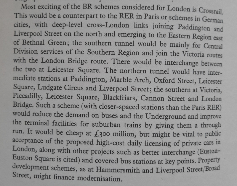
Because this blog isn’t really London-focused, I last mentioned Crossrail in an aside about fifteen years ago, when the government of the day agreed it could actually go ahead. I said at the time that the plan was about fifteen years old then, which makes it a thirty-year-old project now. However, I was recently reading a book I’d picked up on a second-hand stall and found this:

A description of Crossrail

Hold on while I transliterate that…

Most exciting of the BR schemes considered for London is Crossrail. This would be a counterpart to the RER in Paris or schemes in German cities, with deep-level cross-London links joining Paddington and Liverpool Street on the north and emerging on the Eastern Region east of Bethnal Green; the southern tunnel would mainly be for Central Division services of the Southern Region and join the Victoria routes with the London Bridge route. There would be interchange between the two at Leicester Square. The northern tunnel would have intermediate stations at Paddington, Marble Arch, Oxford Street, Leicester Square, Ludgate Circus and Liverpool Street; the southern at Victoria, Piccadilly, Leicester Square, Blackfriars, Cannon Street and London Bridge. Such a scheme (with closer-spaced stations than the Paris RER) would reduce the demand on buses and the Underground and improve the terminal facilities for suburban trains by giving them a through run. It would be cheap at £300 million, but might be vital to public acceptance of the proposed high-cost daily licensing of private cars in London, along with other projects such as better interchange (Euston—Euston Square is cited) and covered bus stations at key points. Property development schemes, as at Hammersmith and Liverpool Street/Broad Street, might finance modernisation.

In other words, the Crossrail we’re getting now is only part of what was originally on the plans, but is still recognisably the “Crossrail North” described here even if some of the route and station locations are rather different nowadays. It’s also rather telling that the Broad St property development went ahead years before any part of Crossrail was even attempted—within the next few years it’ll turn forty. Even the congestion charge, mooted here, was brought in well before Crossrail was. So when, in that case, was this actually written?

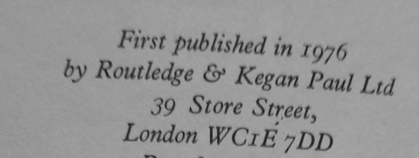
The publication date

This is a description of Crossrail as it stood in 1976!

So when Crossrail does open in a few weeks or months time, and there are innumerable speeches on how this gives London a world-beating transport system, just remember that: it was first planned nearly fifty years ago, in emulation of other schemes. I assume the references to German projects include the Munich Stammstrecke, which is just turning fifty (they opened it for the Olympics) and the Frankfurt City-Tunnel* which opened in 1978. London isn’t leading the world in any way with Crossrail; it’s trailing it by a number of decades.

The book, incidentally, was London’s Lost Railways by Charles Klapper. It’s one of those railway books written in the 1970s by an elderly man who could still when he wrote remember the railways as they were before the Great War. It’s also one of those railway books that must have been printed in vast quantities, because you find it on sale in practically every place that sells second-hand railway books, for about 50p. I’ll likely be donating my copy back to charity once I’ve read it a second time.

Update, 4th May 2022: Crossrail’s opening date was finally announced this morning as May 24th 2022. Only some fourteen-and-a-half years since the Brown government committed to building it.

* That’s actually its name in German.

On the map, again

Back to an Ordnance Survey anomaly

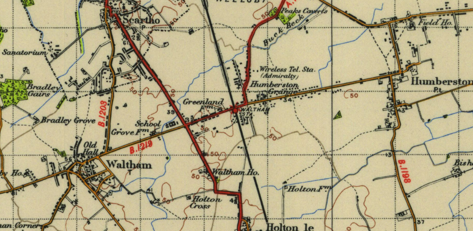
Back in 2020, I briefly mentioned a map anomaly that I was going to blog about at some point, but was going to wait until I’d done a bit more research on it. Some of that research I did do, but I still haven’t made it as far as the National Archives, which the OS themselves had pointed me towards. Nevertheless, recently some more useful information on it has been released online, so I thought it might be time to come back to it. The map in question is this one, of New Waltham in North East Lincolnshire, which when this map was published in 1947 didn’t even merit its own name on the map.

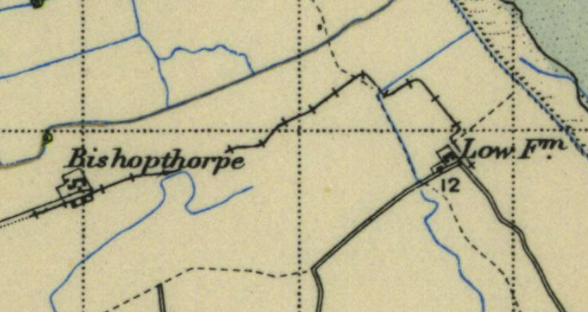
New Waltham, 1947

Reproduced with permission of the National Library of Scotland, as were the extracts below.

What is the anomaly? It’s at the railway station. There’s a little curving siding shown, branching off from the Down side of the line (where the station goods yard was) into a field, with a few buildings either side of it. What’s so curious about this? Well, it doesn’t appear on any other maps. At all. Including maps done shortly before or shortly afterwards. So my question was: was it something real on the ground, or was it just a copyright trap?

There were a couple of potential suggestions of an explanation. One—which I think was originally sent in by one of my old Geography teachers—was that it was a temporary siding connected with RAF Waltham (or RAF Grimsby), a nearby Bomber Command base which, interestingly, also isn’t shown on the 1947 map—it should be just on the bottom edge of that map extract, between Waltham and Holton le Clay. RAF Waltham had opened as a civilian airfield with grass strips in 1933, was briefly called Grimsby Airport at one point, and was requisitioned and given concrete runways in 1940. It closed operationally in 1945 as the hurriedly-installed concrete runways weren’t really up to long-term use, although they’re still very visible on the ground today. So was a railway siding briefly put in to help deliver materials or fuel? Well, maybe, but it’s quite a long way between the railway station and the RAF station, and there’s nothing about it in the one book I’ve seen on the history of the RAF station.

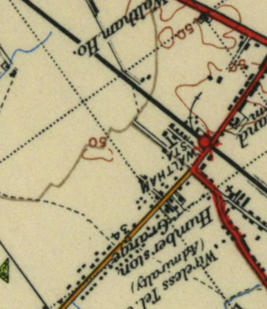
The other suggestion was that it was some sort of agricultural railway, of which there were a lot in Lincolnshire. However, there were a couple of issues with this theory. First, it’s not listed in the standard work on the subject, Lincolnshire Potato Railways by Squires. Squires’ book might not be fully comprehensive, because many Lincolnshire agricultural railways were ephemeral, short-lived things that left little trace on the ground, but it is reasonably thorough. Secondly, on the map, it just doesn’t look like an agricultural railway. This is one, a couple of miles away between Humberston and Tetney Lock.

A Lincolnshire agricultural railway

Note the differences. It’s much longer than the tiny siding at Waltham, and it doesn’t follow nice, smooth curves either. It’s laid out for a horse to pull a small wagon or two, so it’s a series of straight lines and sharp bends, likely following field boundaries.

That was the point I got to back in 2020. However, as I said at the top, something new has come up: Historic England have put their Aerial Photo Explorer online. Its collections include a cartographic-quality aerial survey of England made by the RAF in 1955; and that includes this shot of New Waltham.

On this photo, South-West is at the top, with the railway station on the right-hand side midway up the picture. If I rotate the OS map to roughly match the photo’s orientation, it might be easier to line up.

Rotated map of New Waltham

That map covers a slightly wider area than the photo, but you get the idea. The station goods yard stands out very clearly on the photo with a bright white ground surface. It the siding had existed, it would curved through the goods yard and upwards, roughly following the line you can see between two different types of vegetation. Now, although this photo is from about ten years after the siding would have existed, you can see there’s absolutely no evidence of there having been anything following the line of the railway siding on the map. Nothing at all, really, that matches up with what the map says.

So, well, there you go. Without going to look at the detailed survey records in the National Archives, I have to say I’m pretty much convinced: this railway siding was never really there. It was only ever there as a copyright trap, for the Ordnance Survey to spot as a red flag if they saw it appearing on any other maps of the area, and has likely sat there on the map almost completely unnoticed for seventy years. If any evidence comes in that it was a real feature on the ground, I’ll be very very surprised.

In the library

A Lincolnshire landmark

Yesterday I mentioned that the stack of unfinished and unwritten posts is still ever-growing, only, a few hours later, to come across a mainstream newspaper article discussing one of the things I’d considered writing a post about. The Guardian review of the new book from architecture critic Owen Hatherley opens with a discussion of a modernist building I’ve loved for a long time: Grimsby Central Library. In fact, I was in there only a few weeks ago, taking photos of some of the architectural details and so that I could maybe post them here at some point.

The seal of Grimsby by the library door

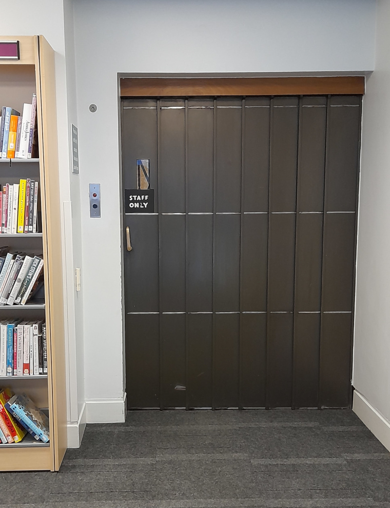
I first knew the place when I was a small child, when it still had something approaching its original layout. Children’s books in the basement, books on the ground floor, music and some of the non-fiction on the mezzanine, the reference library upstairs and an exhibition room above that. Nowadays the basement is Local History, Reference is on the mezzanine where Music used to be, and the upper floors seem to be closed and quiet, a partition blocking off what was originally a broad staircase. Nevertheless, for a 1960s building, an awful lot of the original detailing has survived. The Staff Lift looks still essentially the same as when it was installed, fifty-something years ago

Staff Lift

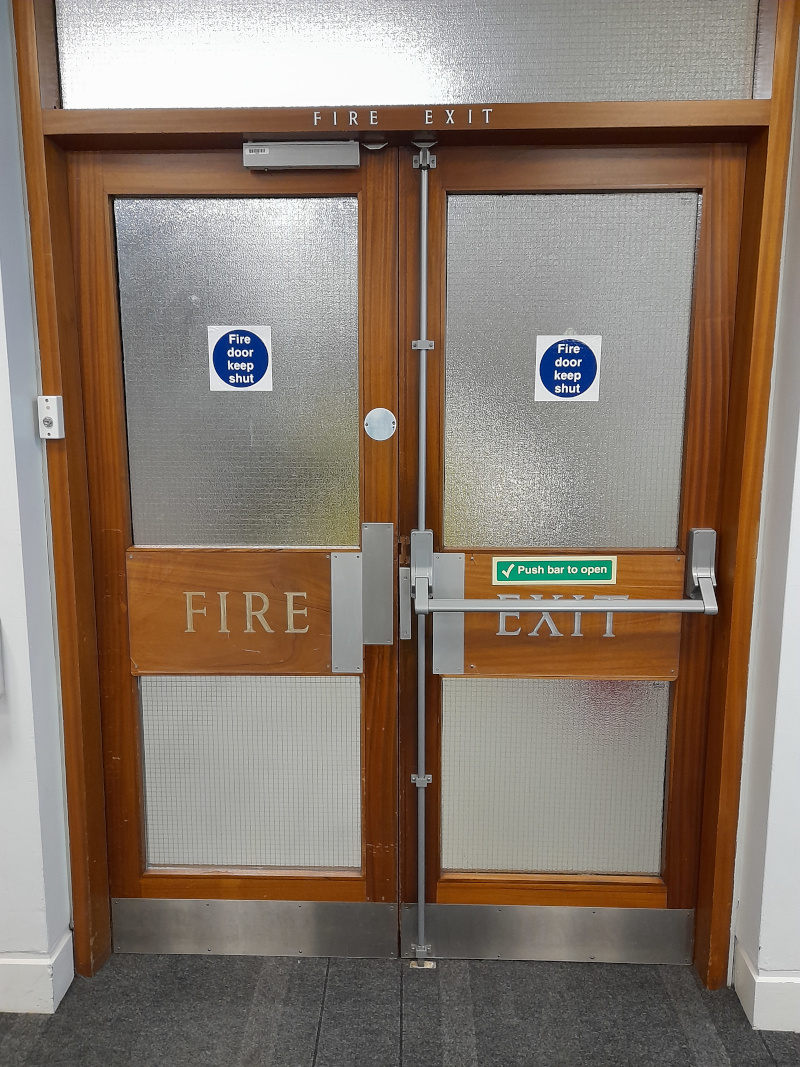
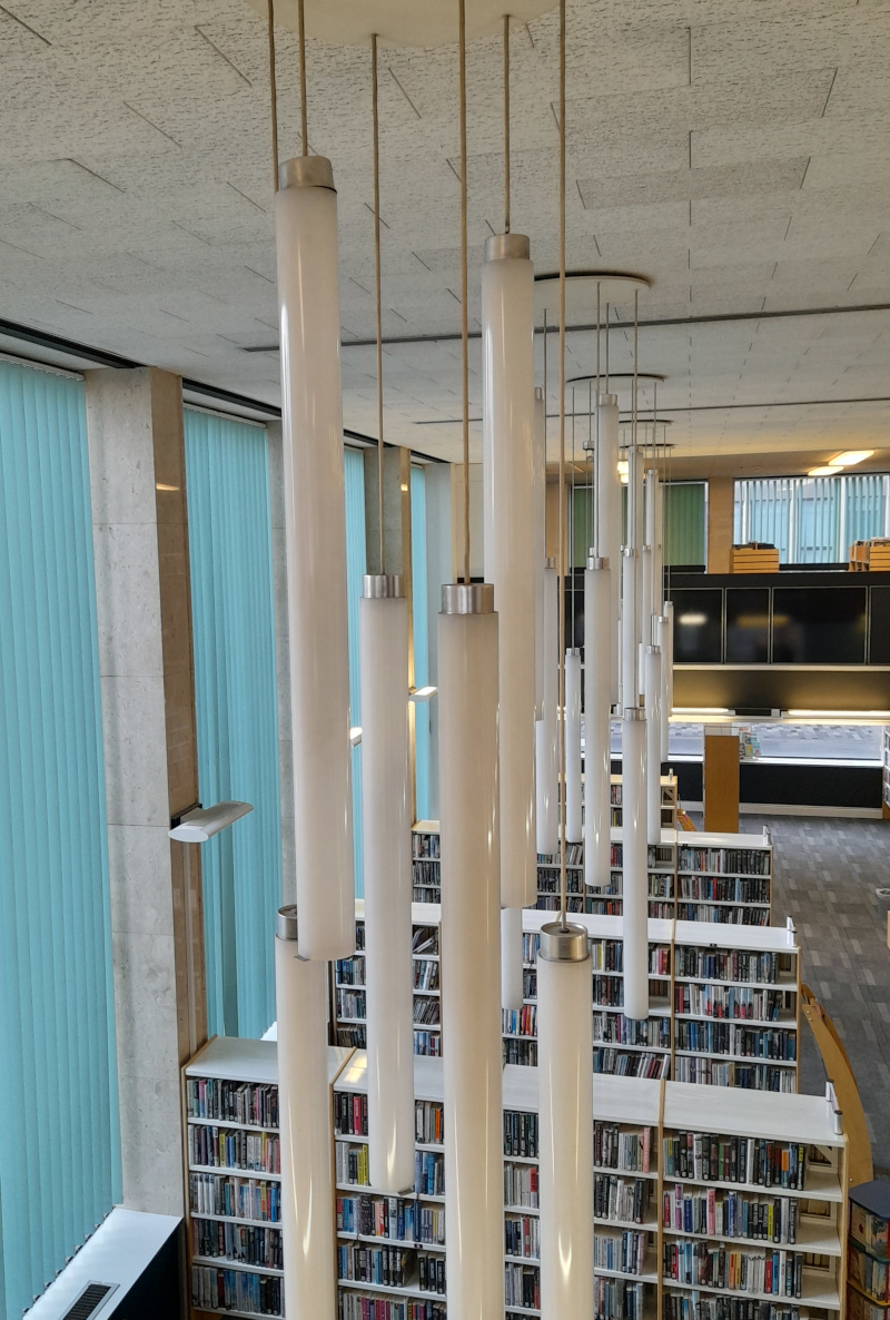
Similarly, the doors to the staff stairwell still have their original signage beneath more modern additions, and 1960 chandeliers still hang from the ceiling even if broken parts can no longer be replaced.

Fire Exit

1960s chandeliers

One thing it doesn’t have is the original shelves, which I rememeber surviving into the current century just about. They were tall, wooden, with a graceful curving profile when viewed from the side. Because of this curve, although the books at the top stood upright just as you’d expect books on a shelf to be, the books at the bottom were tipped back, tilted, so their spines were angled a few degrees in the direction of a standing reader. That little bit easier to see without bending down. I’ve never seen library shelves like them anywhere else, but I’ve always thought how ingenious they are.

It was over a month ago I took these pictures, so the librarians had put together a small display for LGBT+ History Month. I excitedly messaged a friend who used to work in the library back when we were both teenagers, just because we couldn’t have imagined it happening back then. I realise now it’s not just that we couldn’t imagine it happening, but that before 2003 it would have been illegal for an English public library to have a display about LGBT issues. Twenty years sometimes feels a very long time ago.

Book display for LGBT+ History Month

Incidentally, all my photos here are terrible quick phone snapshots taken whilst I was wondering round browsing the shelves. However, via Twitter, I did discover a blog post written by an archictecture fan a few years ago, with a whole host of much better photos of the place, particularly of the gaunt and haunting figures decorating the south side of the building, called The Guardians Of Knowledge; but also not forgetting something I remember very clearly from childhood, the floor of the foyer! Go and look!

Update, 9th July 2022: Since writing this post I’ve taken a photo of The Guardians Of Knowledge myself.

The paper archives (part one)

Or, evidence worth keeping

Back before Christmas I mentioned that I had finally persuaded The Mother to let me start clearing out some of her accumulated junk. Well, there’s a long way to go yet on that of course, but I’m slowly making progress. Slowly working through piles of things that really should never have been kept, sifting through them just in case there is anything important in there, like family photos in the middle of a stack of 40-year-old bank statements to give one real example. And then, there was one thing I came across, that potentially does have genuine historical interest. Well, there were two (one for each of my parents), but this is one.

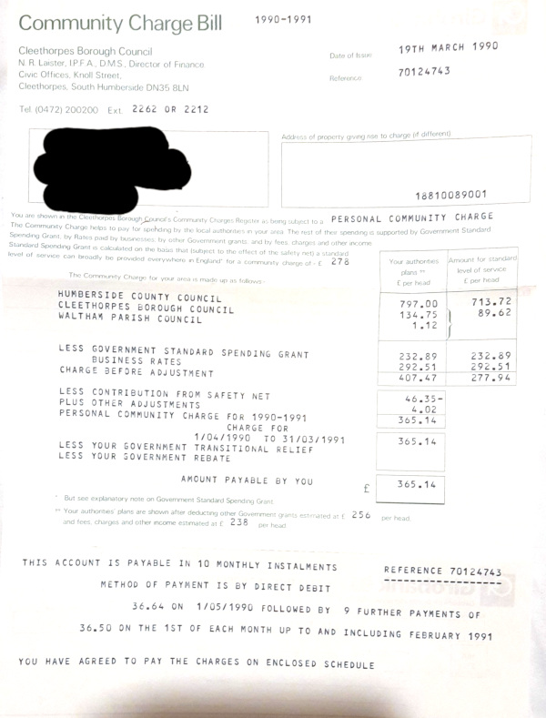
A poll tax bill

It’s a poll tax bill! Even though I was only small, I remember these arriving in the post and being a little excited that something controversial and newsworthy was now in our house.

A historical note for anyone reading: the poll tax was a controversial flat tax pushed by the right wing of the Tory Party as a way to fund local government. It replaced “the rates”, a system whose origins dated back to the final years of the Tudor period* based on nominal property values, with an almost-flat system. One single amount for every adult in the same town, unless you were seeking work, in which case there was a discount. Introduced in 1989 in Scotland, 1990 in England and Wales, it was seen as extremely unfair. In early 1990 poltiical demonstrations against in turned into fierce riots; by mid 1990 it was clear there were massive problems with collection and non-payment, and by the end of the year the Prime Minister had resigned over the issue.

This—as you can see from the date—is from the first year the poll tax was introduced in England. It ran for four years altogether, from 1989 to 1993, whilst the Major government hastily thought up a replacement for it. And I am definitely tempted to keep it, as a historical artefact. I’ve destroyed all the ancient bank statements, thrown away the gas bills, but I might keep this as a tiny little artefact of the history of the 1990s. Of course, the most quaint thing now about that period in history is that we had a Prime Minister resign honourably over a disasterous policy, rather than cling on to office with every muscle of their fingers.

There will be a few more things to come from the archives, in future weeks, once most of it has been consigned to the shredder. I do feel like I’ve turned a point, though, where some of the rooms of junk no longer look quite so overwhelmed with junk as they once were. I’m not entirely sure The Mother will appreciate it, though.

The next post in this series is here

* Specifically, the 1601 Poor Law introduced the Poor Rate to pay for social security at the parish level.