+++*

Symbolic Forest

A homage to loading screens.

Blog : Post Category : In With The Old : Page 2

The Huntsman's Pillar

FInding a landmark

In search of more historical things to write about on here, I remembered something I had once randomly happened across when I was a teenager. A memorial, in the next village, to a man who had randomly died there. So yesterday I went out, bent over against the January wind, to search for it, find it, photograph it and write about it. Having only a vague memory from years ago, I was fully prepared to have to spend hours searching for the thing. In the event, though, I couldn’t miss it.
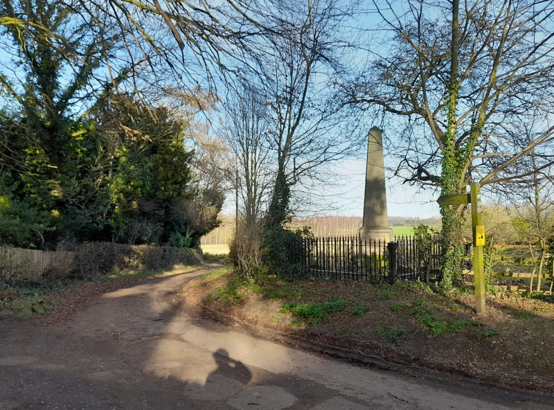
The Huntsman's Obelisk

This is the Huntsman’s Obelisk, a mid-19th-century granite memorial at the side of a quiet country lane. It commemorates the death of William Smith, a huntsman thrown from his horse in the 1840s.
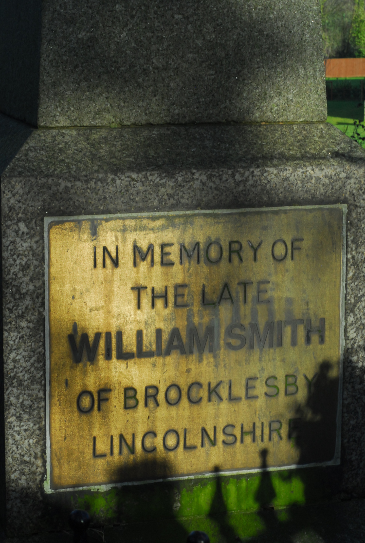
In memory of the late William Smith

In memory of

the late

William Smith

of Brocklesby

Lincolnshire

If you’re a cynic like me, you’re probably also looking at that plaque and thinking that typeface looks rather too modern for an 1860s plaque. Indeed, I think it is modern, definitely postdating the monument being listed in 1986. Around the other side, there’s another plaque, explaining the story of why the monument is here.
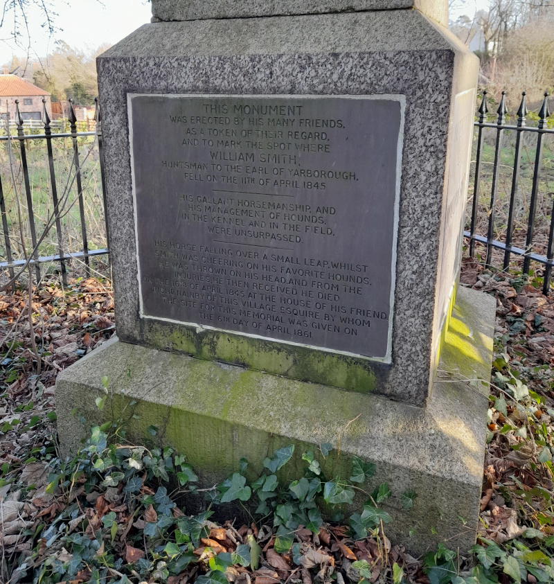
The wordy bit

THIS MONUMENT was erected by his many friends, as a token of their regard, and to mark the spot where WILLIAM SMITH, huntsman to the Earl of Yarborough, fell on the 11th of April 1845.

His gallant horsemanship, and his management of hounds, in the kennel and in the field, were unsurpassed.

His horse, falling over a small leap, whilst Smith was cheering on his favourite hounds, he was thrown on his head, and from the injuries, he then received he died on the 16th of April 1845 at the house of his friend, Richd Nainby of this village esquire, by whom the site for this memorial was given on the 6th day of April 1861.

Whatever your views on this font here, the wording, not to mention abbreviations like “Richd“, seems authentically Victorian. The reason I’m so sure that the first plaque is a modern one is that the listing entry of the monument doesn’t, at the time of writing, mention it at all. It does, though, say that one of the two plaques “contains an impressive 22-line ode to Smith by CHJA”. There’s no sign of anything like that on the monument today, and there are only two plaques mentioned in the listing. The first one above, therefore, must be later than 1986.

It’s a shame a 22-line Victorian ode in memory of a dead huntsman can disappear to be replaced with modern typography, not that I have any particular affection for hunters. Quite the reverse, in fact; I just don’t like to see history eroded. Without interpretation, most people who pass by and look at the obelisk will no doubt not even notice one of its plaques has been replaced. I wonder, too, what the ode originally was, and quite how awfully sentimental it was.

The other thing that occurs to me—and I think has always occurred to me about this memorial—is the length of time between the death and the erection. Sixteen years, and a lot had happened in those sixteen years. The Earl of Yarborough died the year after Smith, quietly on his yacht rather than out hunting. He had been chairman of the Great Grimsby and Sheffield Junction Railway, which opened to traffic* in 1848 and began the process of changing Grimsby from a medieval village into a modern industrial-scale fishing port. Moreover, nationally, Britain was changing radically. I wonder, when the obelisk was erected by a small crowd of men, sadly remembering their friend from a few years before, how much they thought about the world around them changing; how much they no doubt hated it.

Opposite the obelisk is St Helen’s Church, a lovely little building in your stereotypical overgrown churchyard. Even when I was growing up St Helen’s no longer had its own priest; the Rector of Waltham would hold an early service in their own church each Sunday, dash over to Barnoldby to hold one there and then back to Waltham for the main Eucharist. I’ve never been in, but its churchyard certainly looks like it would be worth exploring.
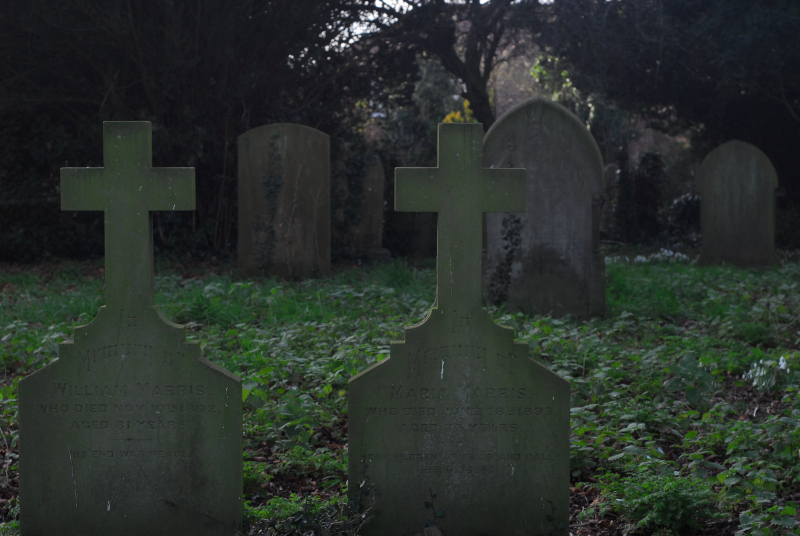
Graves of William and Maria Marris, Barnoldby

The Marrises would have been in their 30s when Smith died. I wonder if they remembered the event, or if it had passed them by.

I turned away and walked up the snowdrop-fringed lane, and out into the open fields to be blasted by the wind again.

* No train nerd would forgive me if I didn’t footnote that, by the time the railway opened, the company had become part of the Manchester, Sheffield and Lincolnshire Railway, its lines becoming part of the famous Manchester-Grimsby “Woodhead Route”

The spooky season

So, a trip to a particularly impressive tomb

It being the end of October, tonight is Halloween, or nos calan Gaeaf for any Welsh-speakers reading. I’m not in costume and I haven’t decorated the house, but I did think it might be nice to have a suitably Halloween-themed post on here. Rather than go with ghosts, ghouls or goblins, I’ve gone with a tomb, a relatively interesting one, so much so that English Heritage have designated it a listed building. It’s a place I only found out about a few months back via an Instagram post by Kate of Burials and Beyond. As it’s only a couple of miles or so from where I grew up, my immediate reaction was “why have I not heard about this place before?” So yesterday, I went down there with my camera.

The Haagensen Memorial

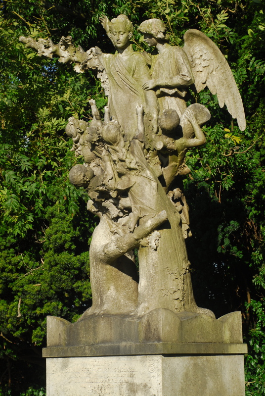
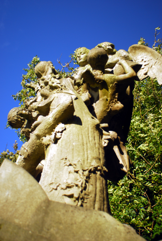
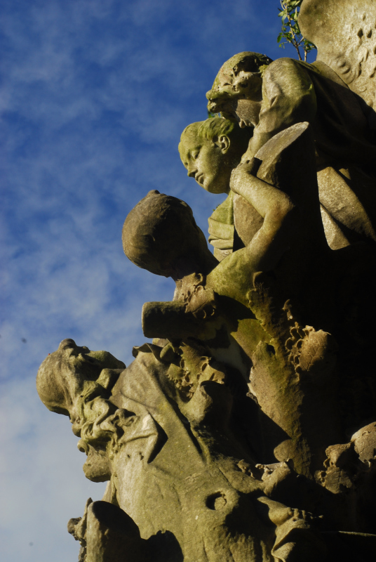
This is the Haagensen Memorial, carved from a single block of marble and desposited on a plinth in one corner of a Lincolnshire cemetery. Underneath it is a vault, the tomb of the Haagensen family. That’s them—well, most of them—in the statue: Janna Haagensen being escorted into heaven by an angel, whilst her grieving children try to drag her back to earth. The marble treestumps below almost look like the fingers of a hand, twisting around and trying to grasp her too.

The Haagensen Memorial

Janna Hagerup was Norwegian, born in Vinger in 1845. At the time Norway was not, strictly speaking, an independent country. Although self-governing, it was part of the United Kingdoms of Sweden and Norway, ruled by the King of Sweden and with its foreign policy controlled by the Swedish government. Janna married Peter Haagensen, a ship-broker, and in 1868 they moved to Grimsby to handle the English side of the family business. Three years after moving to Lincolnshire, the Swedish government appointed Haagensen as consul for Sweden-Norway in Grimsby.

The Haagensen Memorial

When Janna died in 1897 after a history of respiratory problems, Peter was—we can assume—heartbroken. Although the family lived in a large villa close to Grimsby town centre, by the junction of Bargate and Brighowgate, Peter purchased a cemetery plot out in the village of Laceby, a few miles away. The reason? He wanted to build a grand vault for the family, and (we can assume) the Grimsby cemetery authorities didn’t like the idea.

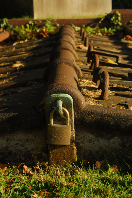
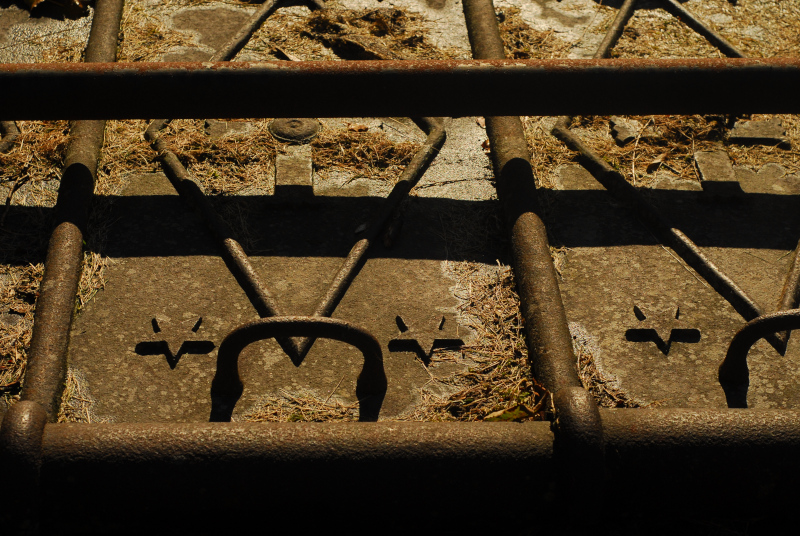
The memorial doesn’t just consist of the grand sculpture of Janna and her children. Below it, a marble-lined vault was excavated, with mosaic floor, and with spaces for both Janna and Peter’s coffins. The steps to the vault were closed with an ornate iron gate at ground level. You can see it today, firmly locked shut.

Entrance to the Haagensen Memorial Vault

The vault is still there in good condition below, though. On infrequent occasions, Laceby Parish Council open the vault to visitors, and you can go down and see the finely-carved marble, the mosaics, and the tombs of Peter and Janna themselves.

Entrance to the Haagensen Memorial Vault

Peter died 24 years after Janna, and was himself interred in the vault following a Norwegian-language funeral.* Norway had become fully independent in 1905, but I’m unclear whether Peter had remained consul of either or both countries—or, indeed, had retired from the roles completely.

What happened after Peter’s death, though, is a little unusual. The tomb was by far the largest memorial in Laceby cemetery; indeed, it was almost certainly the largest memorial to one family anywhere in the area. In the 1920s, therefore, it became something of a tourist attraction, with people from Grimsby, Cleethorpes and even further afield in Lincolnshire taking days out to Laceby to view the memorial. A tea room opened in the village to serve the tourist trade, and the Haagensen Memorial became a picture-postcard subject. China replicas were made, and Laceby tradesmen started up weekend jobs peddling them to the tourists, to take home and put on their mantelpieces. For a few years between the wars, the Haagensen Memorial was a local tourist hotspot. Earlier I doubt it could have happened, due to the difficulty of reaching railwayless Laceby, but in the 20s it was easy to take a charabanc tour out to the village to see the sculpture. I’m not sure how long the tourist boom lasted, but I would assume the outbreak of the Second World War put an end to the last dregs of the traffic.

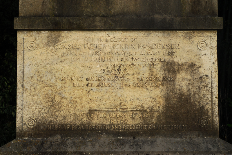
Haagensen Memorial inscription. Not original, according to postcard evidence

Norway and Sweden both still maintain small consulates in Lincolnshire today. Norway’s is in Flour Square, Grimsby, near Lock Hill; Sweden have moved theirs out to Stallingborough.** The Haagensen Memorial is still maintained and preserved by Laceby parish council, but it’s not a tourist attraction any more. Indeed, when I was there yesterday to take these pictures, I was the only person in the entire cemetery. Hence, I suppose, why I’d never heard of it until this year: it’s almost forgotten. Still, let’s remember Peter and Janna Haagensen and their grand tomb. Maybe tonight, their souls will walk abroad.

The historical info in this post was largely gleaned from the official Historic England listing of the memorial.

* I’m going on the information I uncovered. What that means in practice, particularly at the time period we’re talking about, is a bit unclear, but you can assume it means some form of Danish-Norwegian.

** Ironically, the Swedish consulate in Lincolnshire is located on Trondheim Way. Presumably they couldn’t find a street named after a Swedish city.

Pictures from the past (part one)

Some more digital archaeology

I mentioned in Saturday’s post that I’ve recently been pulling data off a hard disk I haven’t touched for more years than I care to think about, and saving the things that are worth saving. The original text of my degree dissertation, for example, which I thought I’d lost, and more than one terrible short story. Photos that are even older, that I’d had scanned in for one reason and another. I thought it might be worth sharing a few bits and pieces here.

First off, this post from May 2006 about local politics was picked to be quoted in The Guardian, for some reason. So, naturally, I saved an image of the clipping.

Me quoted in The Guardian

More people probably skimmed that quote than anything else I’ve ever written on here, at least to date, but I recall it didn’t lead to any noticeable spike in traffic, showing that people just don’t bother to type in URIs they read in newspapers.

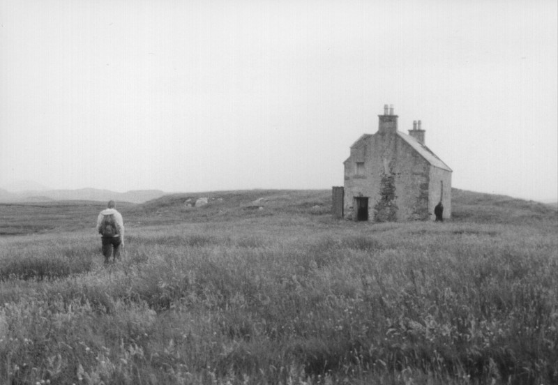
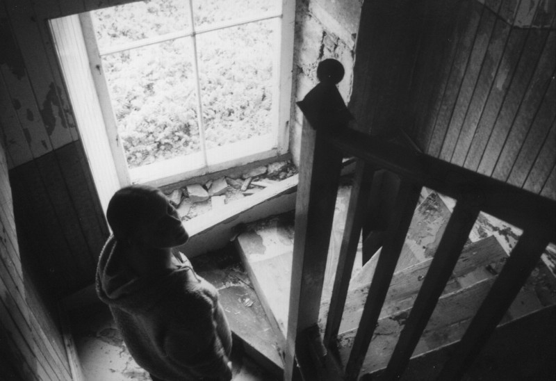
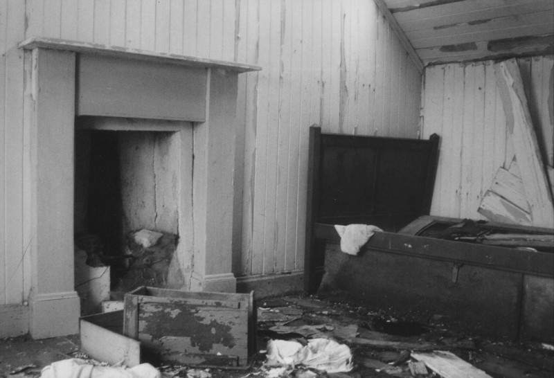
Then, among the black and white photos, these pictures of an empty croft on the edge of the village of Calanais, in the Outer Hebrides. It stood in the middle of a tongue of land sticking out into Loch Róg, with nothing but grassland all around it, so you could almost imagine you were in that famous Andrew Wyeth painting. From the fragments of newspapers we found, it had last been lived in some time in the mid-1970s.

Empty house, Calanais

Empty house, Calanais

Empty house, Calanais

When I was in the Outer Hebrides, doing archaeological things, it was standard practice to carry two cameras: one loaded with black and white film, for print, and one loaded with colour slide film, so you could lecture people. These photos are from the same trip as the empty house. The first I think shows the Ullapool ferry approaching Stornoway somewhere on the east coast of Lewis; the others are another random evening around Calanais, probably with a large supply of stubby bottles of beer. I think the croft you can see in the middle picture is the same one as in the set above.

Ferry approaching Stornoway

Around Calanais

The Calanais I stones

Some of the colour photos on that trip have never been scanned in and I think I’ve hardly even looked at them; these ones were scanned by someone I was briefly seeing, years ago, who had access to a film scanner, and scanned as many as would fit onto one CD. You never know, maybe I’ll dig the others out one day. There will probably be a few more of these posts to come, too.

Code archaeology

When things become relevant again

One thing I have been doing over the past few weeks is: finally, finally, taking the hard drive out of my last desktop computer—last used about 8 years ago at a guess—and actually copying all the documents off it. It also had stuff preserved from pretty much every desktop machine I’d had before that, so there was a whole treasure-chest of photographs I hadn’t seen in years, things I’d written, and various incomplete coding projects.

Some of the photos will no doubt get posted on here over the coming weeks, but this post isn’t about those. Because, by pure coincidence, I was browsing my Twitter feed this morning and saw this tweet from @ireneista:

we were trying to help a friend get up to speed on how to make a Unix process into a daemon, which is something we found plenty of guides on in the 90s but it’s largely forgotten knowledge

Hang on a minute, I think. Haven’t I just been pulling old incomplete coding projects off my old hard disk and saving them into Github repositories instead? And don’t some of those have exactly that code in? A daemon, on Unix, is roughly the equivalent of a “Service” on Windows. It’s a program that runs all the time in the background on a computer, doing important work.* Many servers don’t even run anything else to speak of. On both Unix and Windows systems, there are special steps you have to take to properly “detach” your code and let it run in the background as part of the system, and if you don’t do all those steps properly you will either produce something that is liable to break and stop running that it’s not supposed to, or write something that fills up your system’s process table with so-called “zombie” entries for processes that have stopped running but still need some bookkeeping information kept about them.

Is this forgotten knowledge? Well, it’s certainly not something I would be able to do, off the top of my head, without a lot of recourse to documentation. For a start all the past projects I’m talking about were written in C, for Linux systems, and I haven’t touched the language nor the operating system much for a number of years now.

None of the projects I’m talking about ever approached completion or were properly tested, so there’s not that much point releasing their full source code to the world. However, clearly, the information about how to set up a daemon has disappeared out of circulation a bit. Moreover, that code was generally stuff that I pulled wholesale from Usenet FAQs myself, tidying it up and adding extra logging as I needed, so compared to the rest of the projects, it’s probably much more reliable. The tweet thread above links to some CIA documentation released by Wikileaks which is nice and explanatory, but doesn’t actually include some of the things I always did when starting up a daemon. You could, of course, argue they’re not always needed. So, here is some daemonisation code I have cobbled together by taking an average across the code I was writing about twenty-ish years ago and adding a bit of explanation. Hopefully this will be useful to somebody.

Bear in mind this isn’t real code: it depends on functions and variables that you can assume we’ve declared in headers, or in the parts of the code that have been omitted. As the old saying goes, I accept no responsibility if this code causes loss, damage, or demons flying out of your nose.**

/* You can look up yourself which headers you'll need to include */

int main(int argc, char **argv)
{
    /* 
     * First you'll want to read config and process command line args,
     * because it might be nice to include an argument to say "dont'
     * run as a daemon!" if you fancy that.
     *
     * This code is also written to use GNU intltools, and the setup for that
     * goes here too.
     */

    /* Assume the daemonise variable was set by processing the config */
    if (daemonise)
    {
        /* First we fork to a new process and exit the original process */
        switch (fork ())
        {
        case -1:
            syslog (LOG_ERR, _("Forking hell, aborting."));
            exit (EXIT_FAILURE);
        default:
            exit (0);
        case 0:
            break;
        }

        /* Then we call setsid() to become a process group leader, making sure we are detached
         * from any terminals */
        if (setsid () == -1)
        {
            syslog (LOG_ERR, _("setsid() failed, aborting."));
            exit (EXIT_FAILURE);
        }

        /* Then we fork again */
        switch (fork ())
        {
        case -1:
            syslog (LOG_ERR, _("Forking hell x2, aborting."));
            exit (EXIT_FAILURE);
        default:
            exit (0);
        case 0:
            break;
        }

        /* Next, a bit of cleanup.  Change our CWD to / so we don't block any umounts, and 
         * redirect our standard streams to taste */
        umask (0022);
        if (chdir ("/"))
            syslog (LOG_WARNING, _("Cannot chdir to root directory"));
        freopen ("/dev/null", "w", stdout);
        freopen ("/dev/null", "r", stdin);
        freopen ("/dev/console", "w", stderr); /* This one in particular might not be what you want */

        /*
         * Listen to some signals.  The second parameters are function pointers which 
         * you'll have to imagine are defined elsewhere.  Reloading config on SIGHUP
         * is a common daemon behaviour you might want.  I can't remember why I thought
         * it important to ignore SIGPIPE
         */
        signal (SIGPIPE, SIG_IGN);
        signal (SIGHUP, warm_restart);
        signal (SIGQUIT, graceful_shutdown);
        signal (SIGTERM, graceful_shutdown);

        /* And now we're done!  Let's go and run the rest of our code */
        run_the_daemon ();
    }
}

The above probably includes some horrible mistake somewhere along the way, but hopefully it’s not too inaccurate, and hopefully would work in the real world. If you try it—or have opinions about it—please do get in touch and let me know.

* NB: this is a simplification for the benefit of the non-technical. Yes, I know I’m generalising and lots of daemons and services don’t run all the time. Please don’t write in with examples.

** “demons flying out of your nose” was a running joke in the comp.lang.c Usenet group, for something it would be considered entirely legitimate for a C compiler to do if you wrote code that was described in the C language standard as having “undefined behaviour”.

Sailing away

A visit to an iconic place

A trip away last weekend, to what is arguably one of the most iconic sites in British, or at least Anglo-Saxon, archaeology. It’s been famous since the 1930s, there have been TV series made about it, and it has shaped the way we see Anglo-Saxon Britain ever since. The site I’m talking about is: Sutton Hoo.

Sutton Hoo

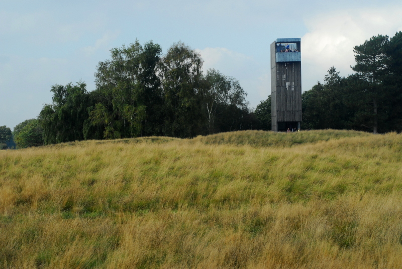
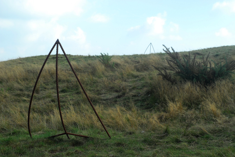
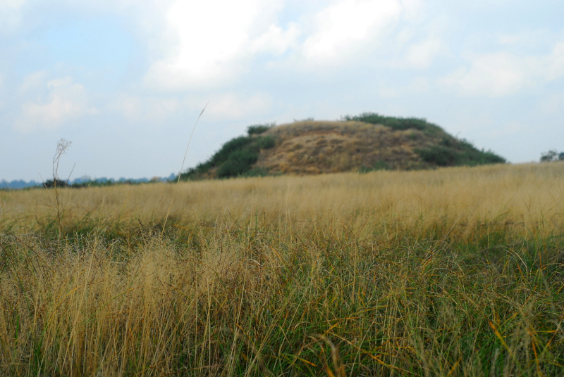
Given that Sutton Hoo is only a few miles outside Ipswich, I met up with regular correspondant Sarah from Ipswich and her husband and dog. Sarah is almost as fascinated by archaeology as I am, which is probably a good thing because at first sight there isn’t much to see at Sutton Hoo itself. The “royal burial ground”, the field where all the famous archaeology was found, is a particularly lumpy and humpy fallow field, covered in long grass with a scattering of gorse and broom bushes, and with a stark, narrow viewing tower watching over it. The famous ship burial, Mound 1, is marked by steel rods where the prow and stern of the ship originally were.

Mound 1 at Sutton Hoo

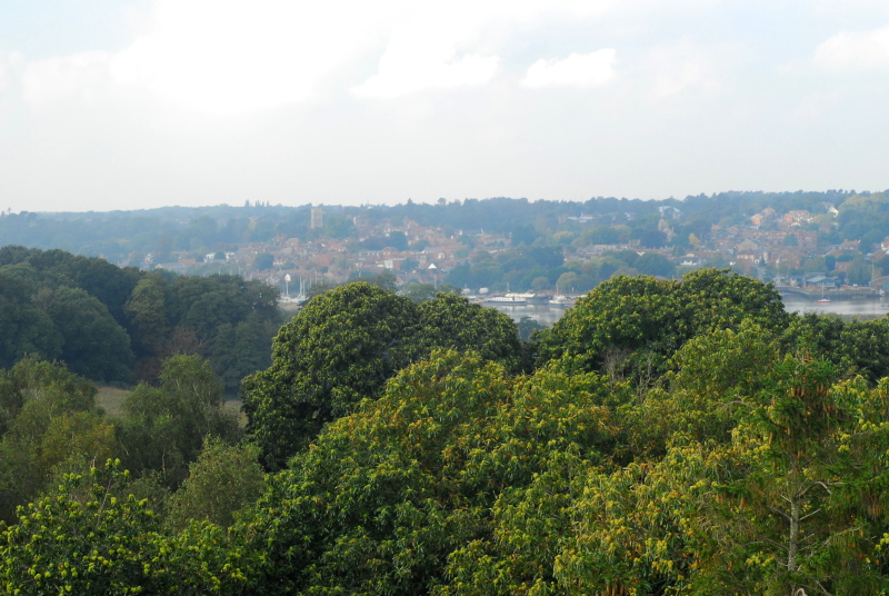
If you’re interested in history, there’s always an awful lot to be gained from visiting a site in person, not just reading about it. Archaeological literature, particularly the older sort, tends to focus very much on the confines of sites themselves without considering their wider perspective in the landscape. I hadn’t realised, for example, just how high up the burial site is above the river. When you think of a ship burial, you tend to assume it would be close to a riverbank. Sutton Hoo does overlook a river, but it’s quite a long way from it: about half a mile away and, more importantly, about a hundred feet up. In modern times a wood has grown up, but when it was built the burial mounds would have been a commanding sight from a ship on the river. One of the mounds has been reconstructed to roughly its original height, to give visitors some idea of how it might have looked within a decade or two of construction.

View of Woodbridge and the River Deben from Sutton Hoo

Mound 2 sits in the long grass

In the nearby National Trust museum, they are unequivocal that the king buried in the ship burial was Raedwald of East Anglia. This is something we will never know for certain, whatever techniques of analysis we manage to develop in the future. The chances are it was likely Raedwald, or his son Eorpwald, or with an outside chance his other son Sigebehrt. We’ll never really know, but we do know that, whoever it was, he was left-handed.

Watching from the viewing tower

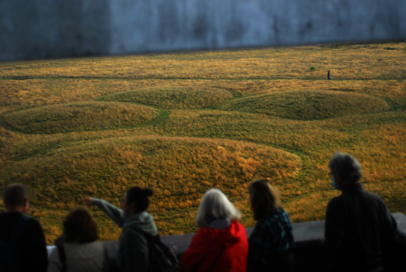
The new viewing tower, built from galvanised steel, gives an excellent bird’s eye view of the site. I couldn’t resist spending a few minutes taking photos of the scene so I could stitch it together into a panorama-collage, to give you some idea of what the whole place looks like. The view a seagull would have got, maybe, the day that Raedwald-or-whoever was interred in his warship under a great mound of bare earth.

The cemetery

No person would have seen it that way at the time, of course; very few until this year, in fact. And now we can.

Do we get a better idea of Sutton Hoo by visiting these mounds, instead of going to London and seeing the artefacts in the British Museum? I think we do. This was an important place, one which has to some degree survived when many other similar important places have been lost to us forever. It might have changed significantly in the last 1,500 years, but nevertheless, you can’t understand the site, you can’t feel its relationship with the sea, with the river, with the surrounding landscape, unless you have actually been there and seen it. It might be a field of grassy lumps, but it is definitely worth the trip.

What rhymes with...?

Or, a trip up a mountain

What do you do on a random Saturday with zero plans? Walk up a mountain? What an excellent suggestion, thank you! So yesterday morning I headed off for a gentle amble up to the summit of the Blorenge, the mountain that stands over the valley of the River Usk opposite the Sugar Loaf, and separates the urban environs of Blaenafon from the rural tranquility of Abergavenny and Crickhowell.

I say “a gentle amble” because it’s not a particularly strenous walk. It’s not like the sort of mountain where you park your car at the bottom and hike up a path so steep you’re almost too scared to come down again. The road over the mountains north from Blaenafon isn’t that much lower than the summit, only about eighty metres or so. The walk, therefore, is essentially a cross-moorland ramble more than anything else. Still, it’s definitely a good way to spend a morning.

When I thought of posting this, I was intending to turn it into something hugely informative: a long story full of history, geology, packed with information about the mountain. Unfortunately, I couldn’t quite work out how to get into it. It turned into something dry and meaningless, without flavour, when I wanted to write something evocative, something that would make you really feel you were on the mountain alongside me. What I do have, though, are pictures.

Keepers Pond

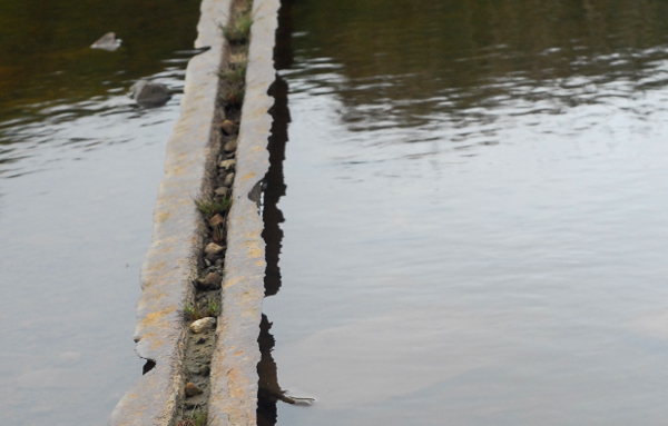
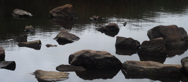
I started here at Keepers Pond; at least, that’s what it’s called on the signs. The Ordnance Survey map calls it Pen-ffordd-goch Pond—the head of the red path. Older, Victorian-era maps call it Forge Pond. The whole area around the Blorenge is filled with ancient industry: pits, hollows, old quarries and old mining tips, joined up by tracks that were once horse-drawn railways. Nowadays Keepers Pond is busy with wild swimmers, canoers and paddleboarders. The only ancient industry I found was one length of Victorian railway rail.

Bridge rail

Keepers Pond

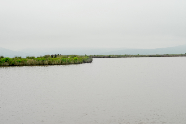
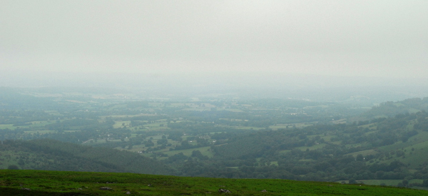
Despite all its ancient industry, the Blorenge now is a quiet place, a place where the loudest sounds are of songbirds. There are many hikers, but they walk silently, conversations blown away by the wind. In the distance you can see all the way to the Severn Sea, in the far distance the coast of Somerset, but on Saturday the skies were grey, the clouds low, and sea, sky and distant land all merged into one continuous blue-grey palette.

The view to the sea

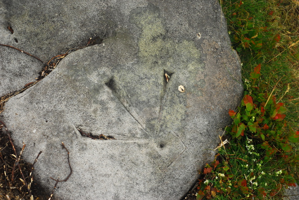
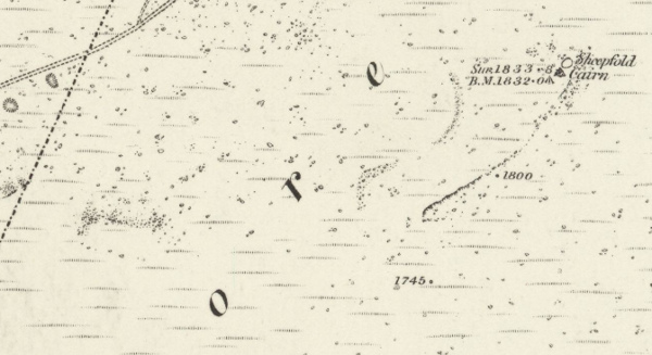
At the summit, naturally, there’s a trig point. On the ground, though, unmarked, a second benchmark was carved. An old one, by the look of its shape. Possibly, it is the benchmark labelled on an 1880s map as 1,832 feet.

Bench mark

1880s map

To the north, at first, the view was lost in cloud, leaving just impressions of a valley. Then, slowly, as I returned back to the car, it started to open up again. The valley of the Usk, the Black Mountains and the Sugar Loaf. The grand vista stretched before me, before the cloud came back down again once more.

The view

Pretentiousness?

Or, the etiquette of language

It’s been quiet on here over the past week. Other things have been keeping me busy: work, trying to sort things out for The Mother, and various other aspects of life. With all of those things to deal with, I didn’t really have time to write any well-written and properly-researched blog posts. Or, indeed, any regular ones.

I started to draft a “Readers Letters” blogpost, but was slightly wary the answers would go out of date before the post was written. When I restarted this blog last year, I went spent a few weeks of evenings going through posts from 2006 and 2007 editing out some of the things that were just a bit too in-joke and just a bit too personal and painful.* I don’t want to have to write something one week and then edit it the following week because things have changed once more.

Something has been on my mind, though, when writing the recent posts about Welsh railway history. What’s the best way to refer to Welsh place-names?

Back when I was a student, I had to write essays about the Outer Hebrides, and standard practice even then was that you would refer to place names with the current official native-language form, even if that caused confusion with the earlier literature. So, in archaeological texts,** the Callanish stone circle is now Calanais; Dun Carloway is Dun Charlabhaigh. In North West Wales, too, things are nice and straightforward. You don’t see people nowadays referring to Portmadoc or Dolgelly when they are talking about Porthmadog and Dolgellau. The main exception, to be frank, is where railway histories take the line of “we’re going to use the HISTORICALLY APPROPRIATE NAME because that’s what the railways did,” as a thin cover for being unhappy about the idea of historical change.

With South Wales, though, it’s a different matter. There are really two issues here. Firstly, in the north-west we’re mostly talking about differences in spelling. In the south, there’s a much bigger number of radical differences in name: Casnewydd/Newport, Abertawe/Swansea, Casgwent/Chepstow to give just a handful of examples. Secondly, although the proportion of Welsh-speakers in the area is slowly increasing, the majority language of the south-east is still definitely English.

Because of this, it feels a little bit, well, pretentious to use phrases like “Casnewydd/Newport” as I have been trying to do in the recent history posts. Moreover it can be difficult to find Welsh names to use for some locations: Rogerstone is known in Welsh as Tŷ Du, but Pye Corner doesn’t seem to have a Welsh name that I’ve been able to discover.*** It’s easily for me to accidentally omit things, too: strictly speaking “Bassaleg” should be “Basaleg” but I tend to forget the latter and it’s hardly used locally other than at the sign as you enter the village. “Risca” should be “Rhisga”.

Switching solely to Welsh would make my posts harder to understand, if you’re not already aware of the Welsh names of places, given that they’re virtually completely in English. However, although combined forms like “Caerffili/Caerphilly” might be clunky to write and clunky to read, they do act as a constant reminder that Wales does have its own language and that English is a relatively modern incomer to most of the country. Would it be best, in the long run, to stick to them? Should I use them only the first time I mention a place? Or how about one in brackets after the other, like “Casnewydd (Newport)” or vice-versa?

In short, I’m not really sure the best way to go on this, editorially. Does anyone have any opinions or suggestions to add? If nothing else, I can include it in my Readers’ Letters.

* Although for some reason I kept some of the most personal and painful ones.

** It’s been so long since I graduated I don’t think I need to specify “modern archaeological texts” any more.

*** I did however find some 19th century journalism calling it “Pie Corner”.

Pye in the sky (part two)

Some more local railway history

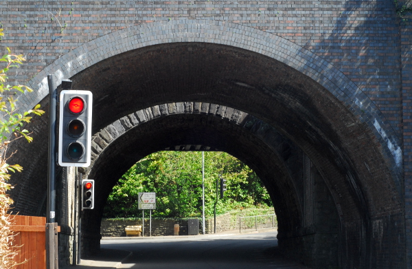
Last week, I posted a little bit about the history of the railway junction at Pye Corner, just outside Casnewydd/Newport. There, the original route of the horse-drawn tramway opened around 1805 is now a quiet, grassy back alleyway, with the railway that replaced it a few yards away. That railway line, now just a single-track branch, strides over the road into Bassaleg with a complex series of three parallel railway bridges, imposing and monolithic.

Pye Corner bridges

Looking through the tunnel of bridges, you can just about in this picture make out three different ones. In the middle, a stone arch. Beyond it a steel girder bridge and this side of it an arch in blue engineering brick. Three separate phases.

The stone arch is, I presume, the mid-19th-century bridge built by the Monmouthshire Canal Company when the railway line was rerouted from the back alleyway route it formerly took. On the far side: where the bridge was widened by the Great Western Railway, circa 1910 or so, to broaden the line up to Rhisga from two to four tracks. The blue engineering bricks on the nearside? Ostensibly that’s straightforward too—but not as straightforward as I first thought.

I mentioned in the previous post that Pye Corner was a railway junction as early as 1825, when the Rumney Railway was built from Pye Corner up to Rhymney. Now, I’ve said before that the railways of South Wales are complex and confusing, and the Rumney Railway is a case in point. Back in, say, 1860, there were two railways with very similar names, both linking Rhymney to the coast.

The Rumney Railway was the first, built around 1825, and like the Monmouthshire Canal Company’s railway it was horse-drawn, for its first few years. As you might expect from the name, it served Cwm Rhymni, running down from New Tredegar* along the east bank of Afon Rhymni. Unlike most of the valleys of South Wales, Cwm Rhymni doesn’t take a particularly straight line from mountains to sea, and the Rumney Railway followed the river where it takes a sharp eastwards turn at Bedwas and flows through Machen. From there, the river takes a rambling, meandering route through rolling countryside, past Ruperra Castle and down to the sea just east of Caerdydd/Cardiff. The railway, on the other hand, cut across the narrow neck of land separating Afon Rhymni from Afon Ebwy, to reach the latter at Rhiwderin, and ending by joining the Monmouthshire Canal Company’s railway about a mile further on. How it crossed the Afon Ebwy to get there will be the subject of a later installment.

The confusion arises from the Rhymney Railway, which came along in the 1850s partly because the Rumney Railway (also sometimes known as the “Old Rumney”) was by the time it turned 30 already something of a wheezing, antiquated and outdated little line, upgraded to steam but still using horse-era track. The Rhymney Railway was built to give Cwm Rhymni a proper, modern railway, and it doesn’t really concern us here save to say that it didn’t stick with the river as the Rumney Railway did: it headed into Caerffili town centre, then burrowed southwards through the hills into Caerdydd with a tunnel over a mile long. The Rumney Railway’s owners were worried they were getting left behind but didn’t have the money to upgrade their line; within five years of the Rhymney Railway opening, they had sold the older line to the Brecon & Merthyr Railway, so that the latter railway could use it as a stepping-stone to reach the sea. They did have the money in the bank to rebuild the Rumney Railway in a modern fashion, and did so, building further connections from Machen to Caerffili.

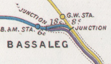
This doesn’t explain where that brick-built bridge comes from, though. Here’s a map of the railway connections around Pye Corner circa 1914. This is from the Railway Clearing House junction diagrams, which were made to give definitive plans of where railways interconnected and what the distances between junctions were, in order to be able to work out per-mile traffic rates.

Junction diagram

Yellow is the Great Western Railway (the former canal company line), blue is the Brecon & Merthyr, and you can see both companies have their Bassaleg stations. What’s the purple line though? That belonged to the company which owned the local docks, the grandly-named Alexandra (Newport & South Wales) Docks & Railway, or AND&R to its friends. They had wanted the collieries of Cwm Rhymni to be able to get their coal to the docks of Casnewydd, without having to pay any additional charges to the Great Western Railway; so they built a line parallel to the Great Western’s tracks between Pye Corner and Mendalgief, enabling coal trains to come straight off the Brecon & Merthyr and onto the dock company’s own line of route without touching the Great Western.

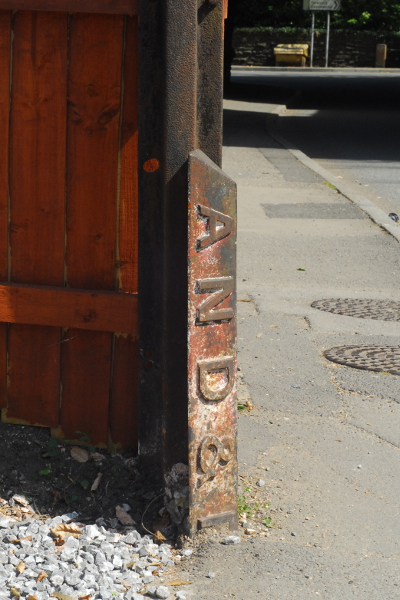
So that’s who built that imposing blue-brick bridge? Well, maybe. There’s certainly a boundary post still in the ground nearby, marking this off as AND&R land.

Boundary post

That answers the question, surely? Well, maybe not. We haven’t really looked at all of the evidence yet. However, as this post is already getting rather long, the conclusion (insofar as there is one) is sadly going to have to wait for another day.

* I’m not entirely sure where its original top terminus is. The Rumney Railway is particularly poorly-documented, so I’m not sure anyone is entirely sure quite where its original top terminus was.

Pye in the sky (part one)

Or, some pieces of railway history

For a few months now, I’ve been threatening to start writing a long series of blog posts about the railway history of South Wales, starting in Newport and slowly radiating outwards. The question, of course, is how to actually do that in a format that will be interesting and engaging to read in small chunks; and, indeed, for me to write. The “standard” type of railway history comes in a number of forms, but none of them are particularly attractive to the casual reader. Few go to the point of setting out, to a random passing non-specialist reader, just why a specific place or line is fascinating; just what about its history makes it worth knowing about. Moreover, not only do they tend on the heavy side, they are normally based either on large amounts of archival research, large amounts of vintage photographs, or both. Putting that sort of thing together isn’t really an option for me at present, especially not for a blog post.

So why would I want to write about the railways of the South Wales valleys in any case? In general, if you’re a British railway enthusiast, you probably think of the South Wales valleys as a place where GWR tank engines shuffled back and forth with short trains of passengers or long trains of coal. If you’re a specialist, and like industrial railways, you might remember it as one of the last areas where the National Coal Board still operated steam trains, at places such as Aberpennar/Mountain Ash. There are two things, though, that you probably only realise if you’re a specialist. Firstly, if you include horse-drawn railways and tramways, the South Wales railway system was the earliest and densest complex railway network in the world. Horse-drawn railways are often completely overlooked by enthusiasts, for whom railways started with the opening of the Liverpool and Manchester line in 1830. Partly, I suspect, because unlike later periods there aren’t many good maps or any photographs of most of the horse-drawn railways of this country. Although horse-drawn railways do appear on tithe maps, in most cases they are not very clearly marked and resemble a road more than anything else.

Secondly, the 19th century history of the growth of the South Wales railway network was intensely complex and entangled, and the later domination of the area by the GWR was by no means a foregone conclusion. Through the 1850s and 1860s there were a number of factions at work: on the local level, horse-drawn lines trying to modernise and make their railways part of the national network; newer steam-operated lines each serving a single valley and without any scope for a broader outlook; and nationally, the large London-based companies trying to gain “territory” and a share of the South Wales industrial traffic. In 1852 two directors of the London & North Western Railway, Richard Moon and Edward Tootal, said:

[A]ll the Narrow Gauge Lines [standard gauge] of South Wales are at present detached: & divided into separate & small Interests:- Again they are at present at War with the Broad Gauge.

(memo to LNWR board quoted in The Origins of the LMS in South Wales by Jones & Dunstone)

I’ll come to the reason why Moon and Tootal were investigating the railways of South Wales in a later post; but that, hopefully, sets the scene a little. South Wales didn’t become a GWR monoculture until, paradoxically, after the GWR itself ceased to exist. Through all of the 19th century, South Wales was a maze of twisty little railways, all different, many of them with very long histories.

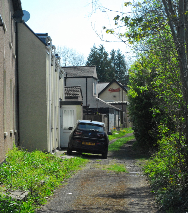
All of which, if you’ve read this far, brings us on to a fairly ordinary-looking back lane behind some houses, in a fairly ordinary suburb of Casnewydd/Newport.

An ordinary back lane

You’ve probably guessed this is actually some sort of disused railway. It is; but it’s a disused railway that, paradoxically, is actually still in use. This is the trackbed of the Monmouthshire Canal Company’s tramway; its exact date of building is a little unclear but it was started around 1801 and open for traffic in 1805.

I’ve written about the Monmouthshire Canal Company before, as a good chunk of the Crumlin Arm of its canal has been semi-restored, albeit not in a navigable state. The canal was built in the 1790s, following the valley of the Afon Ebwy/River Ebbw down as far as Tŷ Du/Rogerstone where it cut across north of Newport to reach the Wsyg/Usk.

The canal’s enabling Act of Parliament permitted anyone who wanted to use the canal (within a few miles radius) to build their own horse-drawn feeder railway linking them to the canal. This included the Tredegar Ironworks, in the Sirhowy Valley; the only sensible way they could reach the canal, however, was to build their railway all the way down along the Sirhywi until reaching the confluence of the Ebwy and Sirhiwy in Risca. The canal company built a matching line, roughly parallel to their canal for much of its length but running around the south side of Newport. The picture above is part of this line, near the modern day Pye Corner station.

Above I said that paradoxically, this is a disused railway that is still in use. The reason for that is: a line built for horses to draw trains at walking pace is not exactly suitable for use by powered trains at much higher speeds. A secondary reason is that in many cases the new “rail roads” were the best road in the area, became heavily used by pedestrians, and started to have ribbons of houses built along them in the same way that public roads do.

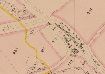
Tithe map

This is the tithe map for the photo shown above, from around 1840. As you can see it’s hard to see the difference, in this map, between the railways and the roads; but a “public road” has already been built around the other side of the buildings that have grown up along the railway, so that people don’t have to walk on the railway to get to them.

When this map was made, the railway had already been using steam engines for around fifteen years or so. Not long after, the company decided its trains needed a better line of route here, so a new line was built, parallel, only a few tens of metres to the west. That line is still in use today as Trafnidiaeth Cymru’s Ebbw Vale Line, although it’s seen many changes over the years.

I was going to segue into the later railway history of the Pye Corner area at this point, because there’s plenty to discuss. Indeed, as far back as the mid-1820s there was already a railway junction there, and on the tithe map above you can see the second line striding off to the left of the map. It’s technically no longer a railway junction. There are still two routes here, but they come together and run parallel rather than actually joining. As this is already turning into something of an essay, though, that will wait for a later day.

Buildings in the landscape

Or, a trip to a museum

Only the other day, I wrote about heading out to visit a castle now that outdoor tourist attractions in Wales are starting to open up again. And now, along comes another post about it! This isn’t going to become a blog purely about days out I’ve taken, honest.

For the past few years, we’ve gone every spring to the museum at St Fagans, just west of Cardiff. If you’re from South Wales you will undoubtedly know of it, but I was always surprised, when we lived only just over the water in Bristol, how many English people don’t. Sain Ffagan Amgueddfa Werin Cymru, or St Fagans National Museum of History,* is a museum of Welsh buildings and Welsh life on a grand scale. It was founded back in the 1940s, modelled on the Skansen museum in Stockholm: the grounds of an aristocratic stately home, St Fagans Castle, were slowly filled with exemplars of vernacular Welsh architecture, dismantled and re-erected.

The museum also has indoor galleries, in a huge 1960s-era brutalist building which—after a full refurbishment a few years ago—is a gorgeous example of the period with a wonderfully light and airy atrium space. Naturally, none of that is open at the moment. Nor are the interiors of the historic (or replica) buildings themselves. However, given that visitor numbers are being carefully limited, this does mean that we had a great opportunity to explore the grounds in detail. I should have brought my Proper Camera, because normally you don’t get to take photos with nobody else about quite as easily.

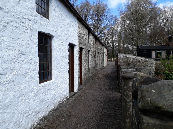
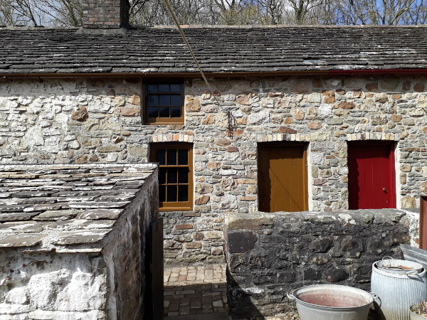
Rhyd-Y-Car Terrace

Rhyd-Y-Car Terrace

This is Rhyd-Y-Car Terrace, one of the museum’s highlights, showing the changes in a typical urban terrace over two hundred years. If nothing else, when you can go inside, it gives parents the opportunity to say “look, this is what houses looked like when I was small,” as their children gaze at a 1970s microwave, an early VCR and a model of a plate of fish fingers. The buildings themselves came from Merthyr Tydfil; railway nerds might remember that Rhyd-Y-Car Junction was the point where the Brecon & Merthyr Railway met the Great Western Railway just outside Merthyr station.

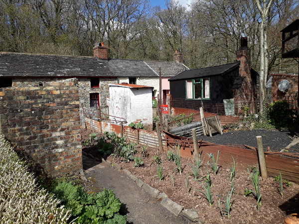
The gardens outside the terrace are similarly reconstructed and appropriate to the period of each cottage, with vegetable plots and outside toilets gaining sheds, pigeon lofts and air raid shelters, before being replaced with grass and a greenhouse.

Rhyd-Y-Car Terrace

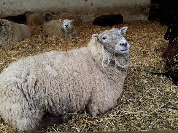
You might remember, back in the mists of time a few paragraphs ago, I said that we always tend to go to St Fagans every spring. The reason for that is: being a museum of Welsh life, it has its own sheep farm—with added geese, ducks, cows and porkers too—and every year lambing season turns into a bit of an event, complete nowadays with the lambing sheds being broadcast online on the museum’s “LambCam”. By April though lambing season is pretty much over: we could see the lambs in the fields, but not many were left indoors. Still, this one seemed happy to see us.

Sheep

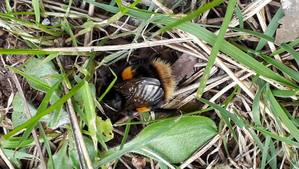
Other signs of spring were everywhere too: the ground carpeted with primroses and celandines, bluebells starting to appear in the woods, and the daffodils still in strong flower. I watched this bee flying round, scratching under grass and leaves apparently trying to dig a hole, before giving up and trying another spot.

Bee

I think she’s a queen buff-tailed bumblebee (Bombus terrestris), possibly looking for somewhere to start her nest.

* Translation note: the Welsh name doesn’t mean “Museum of History”, but it could mean “Welsh Folk Museum” or “Welsh People’s Museum”. The Welsh name has stayed the same over the years whilst the English one has changed a few times: road signs off the motorway direct you to the “Museum of Welsh Life”.