+++*

Symbolic Forest

A homage to loading screens.

Blog : Post Category : In With The Old : Page 3

We now resume your regular programming

I'll explain the pun later

With travel now allowed within Wales, and places starting to open up, we can now go out and visit castles and suchlike again. Cadw, the Welsh historic monuments service, are starting to open up a number of their sites to carefully-controlled numbers of prebooked visitors at sites where it’s feasible. You can’t see the fantastic Victorian Gothic interiors of Castell Coch, but you can go and visit many of the famous castle ruins of Wales, the most famous being the “Edwardian subjugation” castles of the North. Caernarfon or Conwy are a bit far for a day trip from here, though. Instead, we set out for somewhere a bit more local, and walked through the complex arched gateways of Castell Rhaglan, Raglan Castle.

Castle Gateway

Raglan covers a large area but is rather unusual in that its keep is a moated hexagonal tower outside the main castle bailey, with a high-level bridge linking the two—in fact, in the Tudor period, it might even have been a bi-level bridge. The various levels and arches give you fantasically complex views that are almost like the works of Piranesi.

Raglan Castle

Raglan Castle

Raglan was still a sumptuous residence all through the Tudor period, right up until the Civil War. In the Stuart period, it even had a fountain powered by some form of steam engine, which must have predated the machines of Papin or of Savery. The upshot of this today is that, compared to the castles of North Wales I mentioned earlier, it has parts of rather more modern construction. There are substantial chunks rebuilt in brick, for example; finely-detailed stone carvings; and rooms with large rectangular windows. Nevertheless, it is still a ruin: in the Civil War its aristocratic owners naturally supported the King’s side, and as a result the castle surrendered to General Fairfax in the summer of 1646. The castle was made uninhabitable, and sadly, its library destroyed. It still today has no roof to speak of, few floors, and many stone stairs leading nowhere.

Raglan Castle

Raglan Castle

Raglan Castle

Raglan Castle

In the Tudor and Stuart periods the castle was surrounded by several terraces of formal gardens, which also no longer survive. Indeed, even if the castle had survived the Civil War, the gardens would no doubt have been lost to changes in aristocratic taste in any case; very few Tudor houses have had their original gardens survive continuously. The castle today is surrounded by the rough, rounded-off and grassed-over remains of the terraces, scattered with picnic benches, and with a shed and a Nissen hut tucked away in a discreet corner. Nevertheless, you can still look out from the castle across the rolling farmland that surrounds it, over to the Blorenge and the Sugar Loaf on the horizon.

Every castle needs a shed

Looking towards the Sugar Loaf

I must go back again some time with the Proper Camera, to take a photo which shows the Sugar Loaf as clearly as it stands out to the naked eye. Moreover, if the Sugar Loaf disappeared from sight, as it did when we were there, you know it’s time to seek shelter before the weather reaches you.

Incidentally, if you read the subtitle at the top of this post, you might still be wondering where the pun is. It’s not a very good one, but it is a bilingual one. My Welsh vocabulary is slowly improving; and all day, I had the same thought going around in my head, that if I was commissioning shows at a Welsh TV station I’d have one every day called “The Raglan Programme”, just because its title would be Y Rhaglen Rhaglan. I’ve done better, I have to admit.

Original footage

In which we consider moving to the mountains

The other day I was rather pleased to discover, on YouTube, a documentary from the 1970s that I’ve known about for a while but had never before seen. The Campbells Came By Rail is a documentary about the everyday life of Col. Andrew Campbell.

Colonel Campbell had a long and successful career in the Black Watch, largely overseas, policing the crumbling corners of the British Empire. Coming out of the Army in the early 1960s, he became county solicitor for Merionethshire (as was). At auction, he bought an equally-crumbling manor house in the northern fringes of the county, which he had fallen in love with at first sight. Its name was Dduallt.

Map of Dduallt

If you’re a regular reader—or paid attention to the title of the documentary—you may well be ahead of me here. Dduallt,* when Campbell bought it, had no vehicular access, but it was alongside the Ffestiniog Railway. At the time, the Ffestiniog were not operating services over that stretch of track; so the Colonel bought a small Simplex locomotive and had a small siding built alongside his new house. The railway let him park his car at the nearest station, Tan y Bwlch, and run himself up and down by train.

The Colonel at Tan y Bwlch

The documentary shows him picking up his loco and a brakevan from Tan y Bwlch and heading off up the line to show the filmcrew round his home, describing it as part of his normal daily commute from the county council offices. Off he heads, past the cottage at Coed y Bleiddiau, up to his own Campbell’s Platform, where he puts the train away.

Shunting at Campbell's

Unlike a modern documentary, you get to see all the detail of the Colonel putting the train staff into a drawer lock, working his groundframe, and then a demonstration of how to use an intermediate staff instrument,** including a spin of the Remote Operator dynamo handle to make sure the section is clear and the instruments free.***

Intermediate METS instrument

As I said above, when Campbell moved into Dduallt, the railway wasn’t operating over the stretch of line past his house. By the time the film was made, that part of the railway had reopened to traffic, and it must have been difficult on a busy summer day to find a space in the timetable for the Colonel to run down to Tan y Bwlch in the daytime. Further north, the railway was rebuilding a couple of miles or so of line that had been drowned by a reservoir, and Colonel Campbell had provided invaluable help. For one thing, he allowed the railway’s civil engineering volunteers to use one of his buildings as a hostel provided they helped restore it, which they did complete with a large London Underground roundel sign on one wall. For another, he was a licenced user of explosives, so was called out each weekend to blow up rocks along the path of the new line. If you look in the background of the documentary you can see a couple of wagons carrying concrete drainpipes are sat in Campbell’s siding, no doubt waiting to be used on the new line.

Eventually, Campbell did get a roadway built to the house, zigzagging steeply up the side of the vale, but only in the last few months of his life. He died in 1982, the same year that the Ffestiniog Railway completed its 27-year reopening process. The Ffestiniog went through a number of significant changes in the early 1980s, and the loss of Colonel Campbell was one of them. He is still an iconic figure to the railway, though, so watching the documentary was a fascinating opportunity to have some insight into who he was, what he looked like, what his mannerisms were. In particular, the upper-class Englishness of his accent startled me somewhat, given he was on paper a Scot. That, I suppose, is what being an interwar colonial Army officer turned you into. There is a whole thesis that could be written on colonialism and the Ffestiniog, given that it was funded in the 1830s by Irish investors and re-funded in the 1950s by English enthusiasts—and considering the long, bitter and quixotic arguments the railway had with Cymdeithas Yr Iaith Gymraeg in the 1960s and 1970s, arguments characterised by a tone of disingenuous legalistic pedantry on the railway’s side. It’s certainly far too complex a topic to be summarised within this single blog post. In the documentary, Campbell was very clear that after ten years of living at Dduallt he still felt himself to be an outsider; indeed, he gives you the feeling that he didn’t think he would ever truly belong to the land and to the house in the way that his farming neighbours did.

The Ffestiniog Railway is a very different place now, with a very different attitude to the local community. Dduallt has changed hands a few times since Campbell’s death, most recently just in 2020 after sitting on the market for some years. Its final price was a bit over £700,000, less than the sellers wanted but somewhat more, I think, than when Colonel Campbell picked it up at auction. It’s in rather better condition now, of course, not to mention rather more photogenic when shot on a modern camera. Apparently, if you go there (and the Ffestiniog will start running trains past it again next month) you can still see parts of the aerial ropeway that linked the house and its station back in the 1970s.

The documentary is certainly a moment in time, and that time has now moved on. Nevertheless, if you know what the railway is like now, it’s a fascinating watch. If you don’t, maybe it will entice you to visit. It’s certainly worth it.

* The famous-but-controversial railway manager Gerry Fiennes once said that the best way to pronounce Dduallt was by sneezing, which is cruel but more accurate than pronouncing it as if the letters were English.

** Technically speaking it’s a “miniature electric train staff”.

*** The Remote Operator handle and indicator is a Ffestiniog peculiarity, developed to enable the railway to operate with unstaffed token stations and traincrew-operated signalling equipment. There is more information about it in this video about one of the Ffestiniog’s signalboxes.

Onwards and upwards

Or, a trip up a mountain

As I said last week, things are slowly opening up here once more. Last week we could travel locally; from today, in Wales we can travel for leisure anywhere in the country so long as we don’t enter or leave it. I was somewhat tempted to spend the whole day driving to Porthmadog and then back again, just because I could, even though it would be an entirely pointless and childish thing to do.

It dawned bright and sunny, and The Child Who Likes Fairies immediately said: “can we go to the beach?” Naturally, I expected the beach would be packed, as would all of the standard inland tourist honeypots: Cwmcarn Forest, the Sugar Loaf, Pen y Fan, the Blorenge. “The Welsh Government are asking people to avoid flooding beauty spots,” said the news on the radio. I looked at a map, and picked a mountain overlooking Cwmbrân instead.

Mynydd Twyn-Glas is the mountain between Cwmbrân in the Eastern Valley and Crumlin in the Western Valley. It’s really just a slight rise in a broad-shouldered plateau, named Mynydd Maen on its south and Mynydd Llwyd on its north; and the whole, being common land, is also known as Mynydd Maen Common. The southern flank drops off sharply into steep-sided ravines thickly and densely covered with plantation conifers, the southernmost being the aforementioned Cwmcarn Forest. Being traditionally common land it’s now open access land. Despite this, I was surprised just how quiet it was: birds, bees, a handful of off-road bikers and another handful of dog walkers. We wandered across the open moorland, just above the edge of the forest, occasionally shouting into the trees and hearing the echo back from the other side of the ravine.

The ravines dropping away from Mynydd Twyn-Glas

A line of pylons strides across the moor, linking the upper valleys with the power stations of Newport. The wind whistled through them with an eerie note, singing the minor-key chord of a distant angelic choir.

Pylons

We saw a distant, intriguing stone slab, looking for all the world like a gravestone in the middle of the moor. Naturally, we headed straight for it.

Not a gravestone

B H
Boundary of Minerals
Settled by Act of Parliament
1839

Apparently there a few of these stones scattered at intervals through the area: the Act in question is 2 & 3 Vict. c. 38, “Sir Benjamin Hall’s, Capel Leigh’s and others’ estates: exchange of mines and land”. Sir Benjamin Hall MP is the “B H” of the stone: MP for Marylebone for over 20 years, he played a significant role in improving British public infrastructure, and is also possibly the man who Big Ben was named after. However, despite his important role in the history of London, his background was always in South Wales, his maternal grandfather (and source of his wealth) being the Merthyr ironmaster Richard Crawshay. The other side of the stone, incidentally, has “C H L” for Capel H Leigh.

Closer to the summit of the mountain, we found another stone. This, however, is much simpler.

LUP

On top is a simple cross, and on the other side, other letters.

PP

This is a boundary between parishes, rather than mineral owners, hence I suspect rather less money was spent on it. Llanfrechfa Upper Parish, on the one side; Pontypool Parish, on the other.

Finally, we reached the summit. Being a plateau, there wasn’t a dramatic view, just gently shelving moorland. In the distance, the Severn shined silver, down by the wetlands and the mouth of the Usk. England faded away into mist. The big difference—the sign we had reached the summit—was the strength of the unobstructed wind blowing across the mountain.

The Children

“I’m freezing!” said The Child Who Likes Fairies.

“Maybe next time we go up a mountain,” I said, “you’ll wear more layers of clothes like I said you should.”

“I’m never going up a mountain ever again,” she replied. “Ever.”

“What if next time we want to go in the mountains,” I offered, “we find a train that goes near some mountains and look at them out of the window?”

“As long as it takes us back down the mountain again once we’re at the top,” she said. And that, I think, is probably a fair bargain.

Legitimacy

Or, who made you king?

There’s been in the lot in the news over the past few days about the British royal family: whether or not they are consciously, deliberately racist or whether they are just racist in passing like some ancient uncle who comes to visit at Christmas. Why this is the case probably isn’t worth going into here; I don’t see the point of me just reciting the latest news headlines. What it’s got me thinking is: why do we have a monarchy at all any more? Why are people still happy to regurgitate the old lies about what they do for us?

You don’t have to go far in discussions about the monarchy before you hear claims like “they bring a lot of money in for us, like tourists.” That doesn’t sound very likely to me. Empirically, it can’t be the case that tourists choose to come specifically to the UK because we have a monarch. If it was, Paris, Dublin, and Berlin would be struggling to attract tourists, who would all flood to London, Amsterdam and Copenhagen instead. There’s no real evidence that tourists come because we have a monarch at all; and as the campaign group Republic has worked out even if some do it has a negligible effect on British tourism as a whole. So why, then, do they exist? Moreover, why is it taken essentially for granted that the right of who should be king or queen is set in stone, frozen and immutable?

This idea, the idea that at any one time there is one person who has the right to be king or queen, and that they will be followed by their closest blood relative as surely as night follows day, is an old idea but it’s not that old. Royal legitimacy is, by any practical measure, an utterly terrible idea. If the monarch has to be the closest blood relative of the previous one, then to have good, successful monarchs, you need to have an excellent run of luck. How many times can you look at a group of brothers and sisters and be sure that, automatically, the oldest one is the best leader or the best manager? Eventually, purely by the mechanical operation of statistics, you’re going to see the job going to somebody who is always going to be a bit of a failure in that sort of role; and that’s without thinking of the sort of health problems that frequently tend to crop up in royal lineages stuffed densely with cousin-to-cousin marriages.

“They don’t really have any power,” though, the monarchist will tell you. “They’re just figureheads.” So, if that is the case, why keep them? Why not replace them with a nicely-carved statue as a figurehead instead? It’s fair to say that in modern British law the Queen has very little freedom to act, in the sense of being able to make meaningful decisions. Sovereignty is in Parliament, and the Queen must always follow whatever convention is appropriate in any given situation: appointing the person who can guarantee the Commons will vote for them as her Prime Minister and suchlike. This doesn’t make her powerless, though; it means her power is all in the soft sphere. The power that comes from having that weekly confessional chat with the person actually in charge of things, for example. The relationship benefits both the monarch and the Prime Minister. Any sort of uncodified situation always tends to reinforce the side with the greatest power to begin with: the biggest winners in the British unwritten constitution are the monarch and the government, and the losers are the opposition and the greater mass of the populace.

Legitimacy wasn’t always the way these things were done. It would probably surprise a lot of people to learn that the rules on succession changed relatively recently. In part, we have forgotten that royal succession isn’t set in stone because very few British people have encountered it or can remember the Queen’s accession. A thousand years ago—when England was only a few hundred years old—the English monarchy was a semi-elective institution. After we experimented with a dictatorial republic for a few years in the seventeenth century, Parliament made clear that the monarch ruled only at Parliament’s pleasure. Within thirty years of the Restoration, politicians had invited a Dutchman to invade and take over as king; a few decades further on, Parliament skipped over a number of potential legitimate members of the royal family to appoint a German head of state as king here. Over time the monarch’s control over government, slippery enough in any case after 1688, faded away further and further. By the 19th century it was all but gone.

An aside at this point: legitimist ideas rarely take into account the fact that different countries have someone different ideas on legitimacy. When William IV, King of Great Britain and Hannover died, his niece Victoria became Queen in Britain but his younger brother and Tory poltician the Duke of Cumberland and Teviotdale became King of Hannover, because Hanoverian law did not permit queens regnant. His son, King George V, had his kingdom flattened and squished away in the Austro-Prussian War of 1866. If Victoria had still been ruler of a German state during the slow German unification process that concluded in 1871, later history would in some ways have been very different.

So why do we still have a monarchy, and why do we still sometimes behave as if it is implicit and inevitable that we always have one? Partly, I think, because it is what we are all used to; but largely because it brings huge benefits to all who are involved with it, to everyone touched by it.

One thing is certain, though. Within the next few years, within this decade, there will be big changes. The current reign is going to come to an end; that’s just the way things are. When it does, what will happen? Nothing, no doubt, initially. King Charles will be proclaimed, although I wouldn’t be surprised if he chooses a different name to rule by. It was at one time a standard royal tradition—the Queen’s father wasn’t actually called George—but it’s one that will be shocking and alien to most people if it were to be reintroduced. The shock of the change will, I suspect, startle people into finally considering that the monarchy don’t actually have to be a fixture in our world. It will be an interesting process to watch.

Wales is not a principality

But what is it?

As it’s St David’s Day, and the shops are all full of daffodils and Welsh cakes, I thought it might be worthwhile writing something about the history of Wales, possibly even a chain of posts. And the obvious starting point for that is: well, what is Wales?

Back when I was at primary school, we had a few very traditionalist lessons about the history and geography of Britain, and one of the things stated as fact, without meaning or explanation, was that Wales is a principality. Lots of people think this, and lots of people take it for granted, and you still hear “the Principality” used to refer to the country now and again. As you might have noticed, Wales won a rugby match at the Principality Stadium the other day, but that’s named through a straightforward business deal rather than anything more ancient or romantic. But, is Wales a principality? No, not really, not in any meaningful sense. Has it ever been? No, not unless you take “Wales” to mean something rather different to what it does today. But what are the reasons for this misunderstanding? Simply put, this all comes out of the fact that the nature of the Welsh state when it existed does not fit comfortably with what you might call the English pattern of history, the pattern which takes the 19th-century nation state as the ultimate ideal form of political division and judges all historical change against it.

What is a principality, then? Essentially, a monarchy ruled by a prince. There is, of course, a Prince of Wales; but he doesn’t really have very much to do with Wales itself. His vast personal income isn’t from Wales, it’s from the tenants and the business of the enormous Cornwall estate, spread across a huge chunk of south-west England and not really a Cornish affair at all. Much as he sends interfering letters to government ministers behind the scenes, he doesn’t have any formal role to play in government, certainly not any role specific to Wales. The UK is a monarchy in that its monarch signs all its laws (and makes sure any she disapproves of don’t even reach Parliament to be debated), and appoints its government, but the Prince of Wales doesn’t have any say in the matter. Laws passed by the Senedd are signed off by the Queen in the same way that laws passed by the Westminster Parliament are signed off by the Queen. The Prince of Wales? Sits around, running his business empire, slowly curdling with frustration knowing that he has reached retirement age with the whole world seeing him as a sort of semi-comic understudy. Wales is clearly not a principality in any functional or meaningful sense.

Was Wales ever a principality, in reality? Well, parts of it were. Only, though, if you go back a rather long time. Even then, as I said, Wales does not fit very well into the English pattern of history, because it followed a very different history to England.

Everyone in England thinks of England as a unitary, unified, single state that has been around for a literal eternity. That has, indeed, been the truth for a very long time. England came together as a single unified state well over a thousand years ago, but it did so largely for one very specific reason: to define itself in order to save itself. England became a unified single country in response to “the Danelaw”, the control of most of the country by Danish and Norwegian settlers who almost wiped out the English kingdoms that resisted them. The surviving anti-Dane English aristocracy rallied and unified, producing a single kingdom of England with its centre of gravity forever fixed firmly in the South. France to some extent has a similar history: the power of the early Frankish kings around Paris rose significantly just as they had to defend themselves from Danish incursions up the Seine. In Ireland, the Norwegians ended up founding a new capital city, and in Scotland the Norwegians ruled a huge (if marginal) chunk of the modern country for about four hundred years or so. I’m aware, by the way, that I am simplifying swathes of historical argument here, thousands and thousands of pages of academic debate into one paragraph for a surface-skimming blog post. Real historians: please don’t write in. Wales simply didn’t face the same Scandinavian pressure as the rest of Western Europe. The Danes and Norwegians sailed round the coast, and gave names to many of the important coastal bits (step forward Swansea, Anglesey and Fishguard), but don’t seem to have settled in the concentrated, forceful, focused strength-in-numbers way that they did around the mouths of the Seine, the Liffey or the Humber.

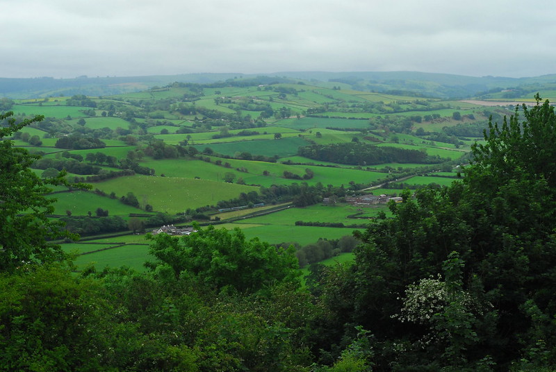
There’s also the economic determinism argument about Welsh history. Put simply: it is that the geography of Wales is distinctly different to that of England in a way that, in the pre-modern period, made it hard to unify. There are still constant complaints in Welsh politics that North-South travel is too hard and that Cardiff is too distant from Holyhead to rule it effectively or to understand its needs. There is often a call that the fact there is no North-South rail link entirely within Wales is somehow a failure of Welsh politics or of English centralism, skipping over the fact that it is a fundamental problem with Welsh geography, and that the only entirely-within-Wales links from South to North were for their whole existence extremely marginal links.* Similarly, the A470 links Cardiff with Llandudno but it is in no sense a coherent and sensible route, just a mixture of cross-country links all coloured in with the same pencil on a map so that somebody could indeed claim that there is a single South-to-North road.** The point here is that, in an age when everyone depended on food grown pretty close-by for their regular staples, and when local kings depended on a personal warband of big burly followers as an army, it was just too difficult in a country like Wales to gather together sufficient force from your own core estates and project that force into a different part of the country, to do that in any sort of way that stuck. Each of the small medieval Welsh kingdoms has this core area which could act as the motor of a pastoral economy: Ynys Môn for Gwynedd, for example, or the upper Severn valley (as pictured here a few weeks back) for Powys. Each also has a belt of less hospitable land protecting it from the others. It therefore shouldn’t be surprising that the history of medieval Wales is a history in which for a short time one of these kingdoms was able to assert itself over some or all of the others, but such assertions barely lasted more than a single reign. Or so the theory goes, at any rate; we should always be suspicious of such straightforward determinism, if you ask me. Note, too, that these were kingdoms, with kings. Not principalities.

When all those Danes who had settled at the mouth of the Seine invaded England very successfully in the eleventh century, they stopped short of invading Wales. Or, rather, their kings stopped short of invading Wales in a controlled and centralised way. However, rich and important landholders were allowed to invade Wales on their own account; and as long as they still recognised the English king as their overlord, they were effectively sovereign in their Welsh estates. This means that later medieval Wales was much more like medieval Germany in its political structure than anywhere in England or Scotland: a patchwork of relatively small states, each independent, quite martial, at each other’s throats from time to time, but most generally recognising a kind of “imperial” overlordship. It’s in this period that the Welsh leaders’ titles start to slip downwards, from king to prince. Over the course of this “marcher” period—and again I am enormously oversimplifying here—the tendency was for both types of state, both Welsh-ruled and English-ruled, to both coalesce and grow more accepting of the King of England’s overlordship. By the thirteenth century the family of the kings of Gwynedd had reached the point of taking over all of the other Welsh-ruled microstates—about two-thirds of the land area but only half the population, because the invading English lords had naturally headed for the economically best bits—and at this point they started to use the title “Prince of Wales”. Prince Llywelyn ap Gruffudd was promptly rubbed out very thoroughly by the English, with most of his family aside from one brother who Anglicised his name,*** moved East, and settled down as a quiet provincial landowner on the border of Kent and Surrey. His territory became something in-between, not part of England, but not as independent of England as the Marcher lords, with strict rules to prevent the Welsh from holding any sort of political power unless they could very definitely be trusted.

So that was the Principality of Wales: most of the Welsh-speaking people didn’t live there, and it wasn’t really ever ruled by a Welsh prince. It lasted until Tudor times, when Henry VIII shut down the last of the Marcher lordships and integrated all of Wales into his kingdom, with the aim of removing almost all Welsh political distinctiveness. It then disappeared, except in name. Wales is not a principality, and huge chunks of the modern country were never part of the principality that arguably did exist.

Will Wales ever be a principality? Well, never say never. The UK today is clearly on a path towards fragmentation; there is a tremendous energy in the UK’s extremities towards fission of the country into multiple separate parts. You don’t have to travel far in Wales right now before you see a pro-independence banner, sticker or graffito.

Independence sticker in Newport

Although the breakup of the UK is probably now inevitable, the exact form that it will take is still impossible to predict. It’s a fair bet, though, that when Wales does become independent, it will be the first time in history that a single unified and unitary state of Wales has existed; and secondly, that it will not be a monarchy of any form. Republican sentiment is already much higher in Wales than elsewhere in the UK, and this is likely to increase as support for Welsh independence increases. Wales is not a principality, and Wales is not going to be. Cymru am byth!

* Firstly, the Manchester and Milford Railway. As its name suggests it was originally meant to be a lucrative main line linking the ever-churning Satanic mills of Manchester with the Atlantic harbours of West Wales. It ended up as a sleepy rural byway linking Carmarthen with Aberystwyth. Secondly, there was also the Mid-Wales Railway which linked Brecon to Newtown via Rhyader; from Brecon you could get to either Swansea via Neath, or to Newport or Cardiff via the vertiginous Brecon and Merthyr Railway. With either of these routes, to truly get North you had to either reverse once or twice and head up the coast to Caernarfon and Bangor, or give up on the whole avoiding-England lark and go the other way via Oswestry.

** It must be a South-to-North road because of its number. If it was a North-to-South road its number would start with a 5, because Llandudno is north of the A5 and west of the A6.

*** From Rhodri ap Gruffudd to Roderick Fitzgriffin.

Photo post of the week

Ger y camlas

One aspect of moving house, especially if you move to a completely different neighbourhood or another town altogether, is the joy you can have in exploring the new area, finding all the interesting corners and places to go. In the current hospitals-overflowing stay-at-home situation, this is a bit limited; but at least there is exploration that can still be done on foot. In Bristol I was getting rather jaded of all the places I could visit on foot, even when it led to interesting local history blog posts. Now, there’s a whole new set of avenues of local history to explore.

One of the spots I can reach on foot is a quiet, sleepy canal backwater. You can’t even use it as a canal any more; most of the road bridges have been demolished or flattened out (or are roads that didn’t even exist when the canal was in use), so you can’t get any sort of boat under them. It’s essentially a long pond, busy with ducks and moorhens, and with its towpath busy with walkers.

Along the canal

Along the canalbank there are a few surviving hints of its industrial archaeology. Here, for example, is a mid-19th-century boundary post.

Canal boundary

This post must be from some decades after the canal was built, because “MR&CC” is the Monmouthshire Railway & Canal Company; and the canal company only added “Railway” into its name in the 1850s. The canal—the Crumlin arm of the Monmouthshire Canal—was built in the 1790s, but within 10 years of its opening some of its main users were looking to replace it with a railway. Not wanting to lose revenue, the canal company agreed to split the railway* midway: the lower half was built by the canal company and the upper by the owners of the Tredegar ironworks, with the dividing line at the nine-mile mark eventually becoming the village of Nine Mile Point. At opening in around 1805, the combined system was the longest railway network in the world, and quite a few stretches of the route are still in use now.

Later on, the split at Nine Mile Point was preserved. The upper section, the Sirhowy Railway, was bought by the London & North Western Railway. The canal company, though, was bought by the Great Western Railway, and some of their signage survives along the canal bank too.

GWR sign

This is a standard design of weight restriction sign—there are other GWR examples along other GWR-owned canals, and the North Yorkshire Moors Railway has a North Eastern Railway one.

No doubt I will have a lot more to say about local history in the future. As yet I’m not even sure what questions I want to ask, let alone have started to investigate the answers. At least when I do, though, I’ll be able to enjoy the scenery as I go. Even when I can only explore places I can reach on foot, there is still an awful lot to sit down and look at.

Bench

Mynydd Machen

* A quick terminology note: I’ve used the word “railway” in something of a blanket way here. The railways I’m talking about were built as what are now called “plateways”, with flanged track and unflanged wheels. At the time, in South Wales, they were generally (but not always) called “tramways” or “tramroads”.

Cofiwch Abermiwl

Like a train, this post is slightly late

A couple of days ago, it was the hundredth anniversary of a significant event in British railway history. If you’re a train nerd, you’ll know what it was from the title of this post. If you’re not, let’s start with this photo of the Severn Valley in rural mid-Wales.

The Severn Valley just west of Abermiwl

I took that photo a few years ago from the ruined battlements of the 13th century Dolforwyn Castle, and looking at it you could be forgiven for not even noticing the train in the middle of the picture. It’s on its way from Birmingham to the Welsh coast, on the former main line of the Cambrian Railways. Before 1922 the Cambrian was the largest “Welsh railway company”* in terms of route mileage, but not in terms of profit or revenue. Its main line was (and is) more like a long, rambling branchline; single-track, through small towns and tiny villages, from the Marches through to Aberystwyth and the curving coast of Cardigan Bay. That includes the line along the Severn Valley through Welshpool and Newtown, passing under the battlements of Dolforwyn Castle near the village of Abermiwl (or Abermule in its English spelling).

if you look closely you can see the train, its single track threading through fields and past farmhouses. See the white house on the left with the three chimneys? See the railway line passing behind it? A hundred years ago this week, two trains, going in opposite directions, collided head-on at that precise spot. Seventeen people were killed, including Lord Vane-Tempest, director of the Cambrian Railways and High Sheriff of Montgomeryshire.

The significant thing about the Abermiwl crash is that, in theory, it should not have happened. In theory, the single lines of the Cambrian Railways were protected by a “token system”. Without going into too much detail: the rules of a token system state that all trains travelling from “token station” to token station must be carrying a token, an arbitrary “thing” with the names of the token stations engraved upon it. The physical form of the token varies: a baton, for example, or a large key. The Cambrian Railways used “tablets”, metal discs a few inches across. Each section of line has a set of tokens, but they normally sit locked in machines called “token instruments” at each token station. The instruments are electrically wired together in a similar way to a pair of light switches at either end of a staircase, so that if you unlock one token from one instrument, you then can’t take any more tokens out of either, until a token has been locked back into one of the instruments. Ergo, assuming the drivers follow the rule on not setting off without a token—and it is one of the gravest rules in the Rule Book—nothing can go wrong.

On 26th January 1921 a westbound slow train arrived at Abermiwl and handed over its token, for the Montgomery—Abermule section of line. It was booked to wait to pass the Aberystwyth—Manchester express heading in the other direction, but the station staff were collectively unsure whether that would be happening on this particular day, or where the express currently was. In reality, the express was steaming hard in the middle of the Abermule—Newtown section of line, but none of the station staff actually knew that, and only one knew that a token had been issued for it at Newtown. Through something best described as a gruesome stage farce, or a nightmarish pantomime, the Montgomery—Abermule token was passed hand-to-hand among the station staff and back to the loco crew, who assumed it was the Abermule—Newtown token they were expecting, and didn’t look at it to check. Without anyone who knew the location of the express noticing, the slow train set off carrying the wrong token. A mile outside the station, the two trains collided. The station staff, by that point, had already realised what they had done and that the trains were doomed, but were unable to stop them.

The accident investigation report made it very clear just how the event had happened, and “Remember Abermiwl” became a watchword across railways worldwide. In India, it was written in Urdu inside the cabs of locomotives. It became standard practice for train crew to shout out the names of the stations on each token to each other, and pass the token around the cab for everyone to read aloud, so the identity of each was double- and triple-checked at each token station. If you go and visit a steam railway, you can still see and hear that happen, if you’re in the right place at the right time. The peaceful green fields in the photo above had an impact on railway working around the world; and the lesson is worth remembering in other fields too. Avoid passing jobs hand to hand; always make sure everything is clear and agreed. Cofiwch Abermiwl.

If you want to know the full details of exactly how the accident happened, who said what to who, and precisely how the Montgomery token ended up in the wrong place, it is all spelled out in the accident report written by the Board of Trade’s Chief Inspecting Officer of Railways, John Pringle. There is a postscript to this, though. Despite the importance of Abermule in railway history, a similar event almost happened in August 2019 on the miniature Romney, Hythe and Dymchurch Railway in Kent. There, the trains saw each other with enough warning to stop before colliding. However, the causes of that event were similar enough that the official government report on the incident includes Abermiwl under the heading “Previous Similar Occurrences”. Remember Abermiwl, indeed. The safest of systems can be defeated if the proper processes are ignored and slowly slip away over time. Cofiwch Abermiwl.

* Technically speaking, the head office and engineering base of the company was not in Wales, but slightly over the border in Oswestry. However, if you were to consider all of the railway companies which had the majority of their track mileage in Wales (including Monmouthshire, let’s not get silly now) as Welsh railway companies, the Cambrian was the longest.

Local cemeteries, redux

Or, improvements in photography

Regular readers might remember the post last week about Ridgeway Park Cemetery, a small and heavily overgrown cemetery bordering Eastville Park in Bristol. As our daily exercise at the weekend, I took The Children back there again, but took the Proper Camera with me this time.

Ridgeway Park Cemetery

It was an excellent winter’s day for taking the camera out, and you can certainly see the difference when compared to the previous photos.

Ridgeway Park Cemetery

We took the opportunity, as it is winter, to poke around in some of the parts of the cemetery that are completely overgrown and virtually impassable in summer.

Ridgeway Park Cemetery

I won’t post the full set of photos here because there’s quite a few, but you can go and look at them on Flickr if you’d like; I’ve tried to transcribe some of the inscriptions too.

Sons and daughters of the soil

On local history (in general)

A train of thought has been slowly easing into the station over the past few days, after I read a very interesting blog post by historian Caitlin Green about the Ridings of Lindsey and the route between Lincoln and Grimsby—at any rate, the route between Lincoln and Grimsby mapped in 1675 by the Scottish cartographer John Ogilby. Ogilby was the creator of Britannia, Britain’s first road atlas, in the form of 100 cross-country routes drawn as strip-maps at a scale of 1 inch to the mile. Nottingham to Grimsby via Lincoln is map 78.

I recall watching a documentary when I was a child about the history of mapping, which discussed Ogilby, and for some unknown-to-me-reason it was illustrated with rostrum shots of Ogilby’s Grimsby-to-Lincoln route. I was baffled and amazed. Firstly, that of all places, they had decided to show a map of the very village I was living in at the time; and secondly, that our village was on Ogilby’s map. Our village was on a route from Grimsby to Lincoln, but it certainly wasn’t on the main one.

Nowadays there are basically two reasonable routes between Grimsby and Lincoln. You have the main road, the A46, with various straightened-out parts and bypasses and suchlike. Parallel to half of it, though, is the B1203: in general it still goes through villages rather than around them, and it goes up and down a lot more. The A46 cuts across the Wolds from Grimsby to Caistor, then runs south along their foot to Market Rasen, minimising the time it spends on the hilly ground. The B-road’s route is closer to a crow-flies route from Market Rasen to Grimsby, but as a result much more of its route is in the hills. This is the route that appears on Ogilby’s map, following much the same route as the B1203 today. However, it wasn’t until I read Dr Green’s post the other day, that it really occurred to me that, of course, Ogilby’s route didn’t quite follow the same route as the modern roads. The question of exactly which routes were meant by Ogilby when compared to modern topography is a very interesting one.

My thoughts on this led to a bit of a Twitter discussion with Dr Green,as to how Waltham has developed over the years and how the pre-enclosure road from Waltham to Scartho might have survived as a footpath down to the 1950s. That’s not really what I wanted to talk about today, though, although I might possibly write something about it in the future. The train of thought that’s been wandering around in my head this week is more about the importance of fine-grained local history, and how easily it is lost.

The Mother spent a lot of time over the last twenty years researching our family tree—or, rather, her family tree, as she gave up on my dad’s when she discovered a number of things in the early 20th Century which didn’t quite tally with her views on how People Used To Behave.* From her grandmother, she inherited a Victorian Bible with lists of various marriages and dates of birth inscribed on the flyleaf, and various stories about how her family were descended from Spanish pirates who had settled in Cornwall in the 16th century. These had presumably all come from her grandmother’s parents, who had been the first generation to move out of their tiny Cornish fishing village and had moved to London to marry and have children. I don’t remember meeting my great-grandmother, but apparently she was always also very proud of her “genuine Cockney” roots, having been born in Soho. My mother got right onto all of this, feeding the information into Ancestry, linking it up with other people who could trace their roots back to the same Cornish fishing village, and so on. However, all she ever seemed to be interested in were names on a chart. She entered different ancestors’ names into the data like a birdwatcher who is only interested in ticking each species off in a book, or a trainspotter who does nothing more than gather numbers. That’s…not really what history means to me. To me, history is more about what these people actually did. How they lived their lives, and what the world was like around them.

When we moved to Waltham, before I started school, we moved to a new-build house on a clean new estate with barely any sense of history. My parents, too, seemed to have no sense of history or of the landscape around us. I remember asking The Mother one day what we might find if we did an archaeological dig in the garden, and she replied with: “nothing at all, it was just a field.” It took a few years before I realised that one farmhouse left behind on the estate was much older than all the other buildings; or before I realised that one cul-de-sac was in the middle of a mature avenue of trees. As far as my family were concerned, or anyone I knew, the village was tabula rasa, a clean slate with no history save for the old windmill and the part-Saxon church. All of the roads might for all I knew have been there for eternity, whether built two or two hundred years before. History, to me, was the sharp-angled village library, built in 1981.

At secondary school we learned about enclosure and were shown before and after maps of each of the local villages. Most of the roads, we were told, were built at enclosure, which is why they have sharp bends or zig-zags where they cross the parish boundary. So how did people travel before that? There were few if any roads marked on the pre-enclosure maps. What route was John Ogilby marking on his map, if all the roads were built later? If I thought at all to ask any of these questions, nobody quite knew how to answer them.

I recall someone from my parents’ generation who had grown up in the village telling us that a slight rise in the Grimsby road, close to the old village school, was called Pepper’s Hill. As a name, it didn’t appear on any maps, and I have no idea where it came from, or where she had got it from. Moreover, why did nobody else know about this, and why had nobody told me?

Traditionally, history was always seen as a grand progression of Great Men, of names and dates and battles and similar Important Events. That’s still believed in some regressive, reactionary circles, but it’s not true. There are many histories, and everyone’s story is a history in itself. I love the history of place, the fine-grained history and archaeology of a small piece of topography, the sort of history that asks where the roads really did run in a particular village a few hundred years ago. It’s one of the reasons I waffle on here so much about local cemeteries and suchlike, and why I think it’s worthwhile to look at just how individual places and neighbourhoods have changed. It’s even more important to look at a regular neighbourhood than it is to study the history of a castle or a palace; but so much is lost, or overlooked, or just forgotten. My great-great-grandparents left Cornwall, and left behind them so much knowledge of their tiny village and of their local towns that is all gone completely now, so much dust in the wind. I can go back to where they came from and walk the same streets; I can go to the village museum and see walls of photos of Victorian fisherman who are probably all distant relations of myself; but I have no connection with that landscape or with any of the people. My family has jumped too many times, and broken its connections at each one.

If you go all the way back, back to when the English first arrived here, just think: there is so much that has been forgotten and lost. There are so many rivers in England called Avon, and we do not know the pre-English name for any of them, because Avon is just the Welsh word for “river”. There are so many kings of Britain, from the period after the Romans left and before the English arrived, whose names and numbers and forts are forgotten and missing from the record completely, because they had the misfortune to lose a war. The history we do have now is the history of survivors, but sometimes we should remember there is a history of the forgotten too.

This post is a bit of a mish-mash, a bit of a strange ramble around my mind, but I suppose what I’m really trying to do is set out some sort of a manifesto, for why I like to study history, for why I went and got myself a degree in archaeology, and for what I think is important in those fields. Above all, this is a plea to know the land around you, know its shape and how it came about, know what was here before you and what you have inherited. I hope that wherever I live in the future I will always try to learn about the landscape around me; and hopefully now I’m an adult I will have the resources to be able to do that. This land is our land, but we merely hold it in trust for our descendents; and the same goes for our history too.

* My great-grandparents got together circa 1910 or so but never actually married—because my great-grandfather was already married to someone else. Allegedly, a few decades later someone used this fact to taunt my grandmother, and she immediately punched them to the floor. There were also other bits which would be hard to even draw on a standard family tree, such as the distant relative of my dad who got married to his stepmother’s sister.

Another human cemetery

Not Greenbank, for a change

Another day, another cemetery, although back on to a human one this time. Back in October, Twitter user @libbymiller asked if I knew Ridgeway Park Cemetery. Although I do know it, and I’ve been foraging for brambles there frequently in summer, for some reason I’ve never taken any photos. Today I woke up, saw it was a fine frosty day, so tried wandering off in that direction.

Ridgeway Park Cemetery

Ridgeway Park Cemetery

Ridgeway Park Cemetery

Ridgeway Park is only small, but its history tracks in microcosm the history of the great urban Victorian cemeteries of Britain. It opened in the 1880s as a private alternative to the nearby city-owned Greenbank Cemetery, filled up with graves, and as it filled up and plot purchases dropped off its owners could no longer make a profit from it. In 1949 the owning company was wound up and the cemetery taken over by the city council.

Ridgeway Park Cemetery, mapped

It was built behind a grand old house, Ridgeway House, which in the 1860s seems to have been the home of the private school attended by local celebrity W G Grace. The house was demolished in the late 30s, and there is now no sign of it at all above the ground as far as I’m aware, although Huyton Road runs on the line of its approach drive. Although the house has disappeared completely, the boundaries of the cemetery still follow the lines of previous boundaries. The following map is from immediately before both the cemetery and Eastville Park were laid out, but the cemetery boundaries can be clearly traced on the tithe map from 40 years earlier.

Before the cemetery was built

Unlike the still-active Greenbank, and the much-loved Arnos Vale, Ridgeway Park seems relatively forgotten as cemeteries go. The area near the gates is in reasonable condition, just with grass a little long; but as you go in further, towards the park, it becomes more and more overgrown until you are effectively in a patch of woodland with added gravestones.

Ridgeway Park Cemetery

Ridgeway Park Cemetery

Ridgeway Park Cemetery

If you’re local, this is the ideal time of year to visit somewhere quite so overgrown. If you’re not, you might have to wait a while and come back next winter. Or, indeed, in summer, when it has an entirely different atmosphere but is still just as lovely a spot.

Update, January 11th 2021: I went back to Ridgeway Park with an SLR camera and took some more photos. The new post about it is here.