+++*

Symbolic Forest

A homage to loading screens.

Blog : Post Category : Trains : Page 1

World of trains

But which trains are important for Cait's plans?

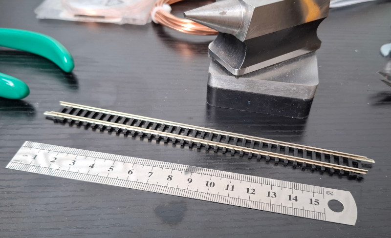
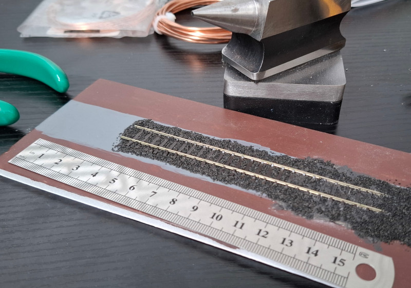
Over some recent posts, I’ve been talking about how easy it would be to build a model of the Brecon & Merthyr Railway towards the end of its life, in N gauge. And specifically, how easy is it if you start with a train set? For one thing, I’ll need to have more than just one train to play with! But is it easy to get models of the right types of train in N gauge?

As it happens, there weren’t actually that many different types of steam engine used on the Brecon & Merthyr in the 1950s. Many trains were operated by pannier tank locos: now, there were multiple different classes of pannier tank engine, but given my train set came with one, I think I can put that to one side for now. What other types of steam engine were used between Brecon and Newport?

Firstly, there’s the Dean Goods, or 2301 Class. These were small 0-6-0 tender locos, with a pretty long life: they were originally designed in the 1880s, and lasted through until the late 1950s, specifically because they were small enough to run on a number of meandering Welsh railway routes with strict weight limits. Quite a few were requisitioned by the Army in both the First World War and Second World War, and ended up operating across Europe and in Turkey as a result.

Secondly, comes the GWR 2251 Class, a small 0-6-0 tender loco from the 1930s which was intended as the Dean Goods’ replacement. It was more powerful, but slightly heavier as a result, so didn’t quite have the same range that a Dean Goods did. Nevertheless, they survived until after the Brecon & Merthyr lines had largely closed.

Thirdly, the Ivatt 2MT Class, a lightweight 2-6-0 tender loco design from the late 1940s sometimes known as the “Mickey Mouse” classs. These were brought in to the Brecon & Merthyr from the early 1950s until the line closed; indeed, they operated on all of the lines radiating from Brecon.

You could, frankly, operate a realistic model of the Brecon & Merthyr in the late 50s using only the 2251 Class, the 2MT Class, and a pannier tank or two. If you want to go back a little bit earlier, you’d need a Dean Goods as well. There were still a handful of the Brecon & Merthyr’s own engines surviving at that date, but they were relatively rarely used on the Brecon line itself; you’d be more likely to see them heading up through Risca on the Western Valleys lines.

Moreover, N gauge models of all of these locos have been produced! The Ivatt 2MT class is, indeed, still available in the shops at the time of writing. The others aren’t, but it should in theory be not too hard for me to find them on the second-hand market.

In other words, with the right time period, this aspect of the model railway shouldn’t actually be a problem. Other problems will be much harder! I’m glad, though, that the project hasn’t immediately become too hard for me to consider. On, I suppose, to the next steps.

The space between the lines

Pondering on what scale, exactly, to build the model railway

A week or so ago, I wrote about the train set I’d recently bought, as the nucleus of a model railway inspired by the Brecon & Merthyr line in South Wales. The train set is N Gauge, or N Scale. Is this, though, the best scale for me to build it in?

The term “gauge” means the distance between the inside edges of the rails, just as it does on a normal train. Model trains come in a huge variety of scales and gauges, ranging from those large enough to sit on, to those barely large enough to see. N Gauge was created by the Bavarian toy company K. Arnold in the early 1960s, and is named for the fact its gauge is nine millimetres—or neun Millimeter, I suppose. If I put a piece of the track that came with the train set next to a ruler, you can get a rough idea of its size.

A piece of model train track on a black workbench, next to a 15cm steel ruler.  You can see, by comparing the ruler and the track, that the track gauge is around nine millimetres.  The track is quite chunky, with thick rails and sleepers.

Because it’s so small, you can fit more train into a tight space; that’s always been one of the reasons I’ve struggled to build myself a model railway.

Lots of trains are made in N Gauge, off the shelf; and train sets, like the one I bought, to give you an easy start. However, it’s not the only gauge or scale that’s roughly this sort of size. The other one, in fact, is even older.

N Gauge’s scale, for British models, is 1 to 148; or a fraction over 2mm of model to every real-world foot. However, since the 1930s, modellers had already been handbuilding models to exactly 2mm to the foot. It’s an extremely similar scale, roughly 1 to 152. Given the trains are so small to begin with, the difference is barely even visible. One pioneering 2mm Scale model railway built in the 1940s, the Inversnecky & Drambuie Railway, has survived and is partially on display in the National Railway Museum in York.

Unlike N Gauge, you can’t buy any trains or train sets in 2mm Scale. There is, however, a 2mm Scale Association who produce various different products to help modellers build their own 2mm Scale trains. A while ago now, I bought one of their “starter packs”, which includes a short length of track, which you assemble yourself from rails and a plastic base. It’s much more fragile than train set track, so I glued it down to a piece of foamboard and tried to make it look ballasted.

A piece of model train track, stuck down to a small piece of painted foamboard, on the same workbench as the last picture and next to the same ruler.  You can see that the track gauge is roughly the same, but the rails are much smaller and thinner, and the sleepers are spaced more widely apart.

The track gauge isn’t 9mm, though; it’s 9.42mm instead. Very very close, but not close enough to run the same trains reliably. You can see it has much thinner rails; that’s because it tries to be an exact scale model of real track. For most of the twentieth century, most British railway line was made of individual 60-foot panels; so this piece of track is 12cm long as a result. 9.42mm is the exact width of real track, scaled down to 2mm scale; N Gauge, on the other hand, if you scaled it up to real life, would be about 10cm too narrow.

The question, then, is: which way should I go with this model? Go with N Gauge and trains I can just buy; or 2mm Scale and have to build an awful lot of stuff on my own. With the trains, at least, it’s possible to get N Gauge trains and just give them 2mm wheels; because as I said, they’re so close in size that few people can tell the difference. It might be an awkward, fiddly job though.

At the moment, I’m just not sure. Before things go much further, I’ll have to make a decision, and choose to go one way or the other. At least for now.

The impermanent way

In which we build a train set on the dining table

A few weeks ago, I posted about how I’d finally made the decision to start building a model railway, because perfection is the enemy of the possible or something along those lines.

A few days later, a box arrived.

A big cardboard box, sitting on the carpet

No, I don’t know why they sent such a big box, because the contents were much, much smaller.

If you want to model the Brecon & Merthyr Railway in the 1950s, Great Western pannier tank locos were extremely common. Conveniently, at the moment, you can easily buy an N Gauge train set containing a Great Western pannier tank, a couple of wagons, and a brake van to go on the back. Buying a set, with an oval of track and a power unit, means you bootstrap yourself: you can get everything you need to run one train in one box, even if all you can do is send one single train round and round in a circle. I’ll do a post explaining what “N Gauge” means at some point.

A tiny model of a Great Western Railway steam engine, pulling some wagons, on top of a dining table

Some people might point out that the loco is in 1945-47 condition, but the wagons are in pre-1937 condition; lots of wagons never got repainted though, so really they just need to look a bit dirtier and worn-looking than they are. You might notice I’ve also bought myself a few more wagons, the well known “BR 16 ton” type. Over 200,000 of them were built in the 1950s, and they were ubiquitous on the railways from the mid-50s through to the early 1980s. The ones I bought come in pre-rusted condition from the factory, so they’re really more like a wagon of the 1970s, after the B&M had closed; but, regardless, they’re still appropriate for the train.

Ever since I was small, also, I’ve read model railway advice that says “never run your train set on the carpet! There’s too much fluff!” So, this is on our dining table, which is also nice and friendly on my knees. I deserve comfort, you know.

Naturally, I wasn’t satisfied with just a single circle of track. It wasn’t long before another box arrived.

Pieces of model train track, in packaging, inside a freshly-opened cardboard box with brown paper padding

The track is a different brand to the train set, but it’s all the same track gauge, and also, all the track is the same shape: the curves are the same radius, the straight bits are all the same length. You’d think it would all just slot together, wouldn’t you?

Well, it didn’t.

Although the track was all compatible on paper, the “rail joiners” on the train set track were bigger and chunkier than the ones on the extra track. The extra track didn’t have enough clearance, between the rails and the plastic base, for the joiner on the train set track to slide on.

If this was a proper model railway and all of the track was fastened down, I wouldn’t care about this. I’d just pull all the joiners off and replace them with thinner ones. Because this is still just a train set, which has to be taken apart again whenever we want to stop playing trains and play a board game instead, that wasn’t really an option. Option two was to replace all the joiners anyway, and just hope that the new joiners stay in place. It would have done the job, but it also sounded like a lot of effort. Option three: buy more track. The original oval of train set track went in the spares box, and I just bought myself an oval from the other brand instead.

With that done, though, we had something you could imagine was a little station. It’s not much station and you need a lot of imagination, but nonetheless, you can shunt your train about!

A model railway on a table, with a loop and a siding.  The train is passing through the loop, and there are a few wagons in the siding

(This is a still from a video, so it’s a slightly blurry photo. Never mind that)

Where do we go from here? Well, there’s a few more things a full railway will need. More than one train, for one thing. I’ll post about that soon. For now though: there’s something extremely fun and simple about just being able to run your train round in a circle on the dining table, without really worrying about accuracy, authenticity, and anything else. Until we do need the dining table for something else.

Theory and practice

In which Cait once more attempts something she's always wanted

Occasionally, over the past few years, I’ve mentioned how I’d like a model railway, but there are just too many interesting railways to choose from. In fact, I’ve always wanted a model railway. My father also always wanted a model railway, but never quite managed to do anything about it either.

This has led me to an interesting place in life. I’ve always had many, many plans for different model railways. I’ve tried to start building them, and I’ve never got very far, but the research I’ve done has been immense. On the actual railway history side, I know my stuff. I know my Bristol & Exeter from my Bristol & Gloucester. I know my Midland from my Great Northern from my Midland & Great Northern. I know why the Great Western Railway had LNER-style signals, and I know where the LNER ran in North Wales and why. On the modelling side, I know my theory too. I know why cassettes are better than traversers, and the difference between EM and P4. I know who Edward Beal was, and how his West Midland Railway wasn’t the real one. I know John Ahern created the Madder Valley, that Barry Norman doesn’t mean the film critic, and that Cyril Freezer has had his day. I know that dyed sawdust is a thing of a past, and I’ve admired Copenhagen Fields. I know the theory. I’m just no good at putting it into practice.

Like any skill, though, this is a classic chicken and egg situation. I’m just no good at putting it into practice, because I don’t try.

The answer to that, of course, is to just pick something and start. And nowadays, model railways have come on a long way from where they were when I was a small girl. There’s so much more that is either available to buy off the shelf, or has been at some point and can be found on the second-hand market. You just have to be judicious what you choose to build. If you want to model something from after 1950 or so, it’s much easier than something before around 1925, just because the amount of diversity in the railway network dropped dramatically following the creation of British Railways and the National Coal Board.

That means that building a model of, say, the Brecon & Merthyr Railway in 1905, would be difficult for a practical beginner, even though it would be incredibly interesting and different to most of the model railways out there. A model of the Brecon & Merthyr fifty years later, though, would be relatively straightforward. A few obscure local locomotives were still around, but most were fairly common Great Western and British Railways types. All the obscure little 4-wheel coaches the line had in 1905 had been scrapped and replaced with ordinary GWR ones; all the colliery-owned coal wagons with hand-painted lettering had been replaced with plain grey British Railways 16 ton ones.

With that in mind… I’ve bought myself a treat. I’ve bought myself a regular train set with a few extra bits and pieces, so I have enough there and then to at least get something moving and give me the inspiration to build more. Let’s see where it goes from here!

Update: To see where it did go from here, read the next episode in this saga!

Self-promotion

A couple of Yuletide videos

It’s still the Yuletide season, although we’re now very much into the time-between-the-years when everybody is grazing on snacks and leftovers, has battened down the hatches against the storms, and has completely forgotten what day of the week it is.*

As it is still Yuletide, though, I thought I’d post a couple of the seasonal Lego videos I put up on my YouTube channel last week, before the holiday season had really got under way. Both of them are Lego build videos, for some seasonal sets that I picked up earlier in the month.

Firstly, a “Winter Holiday Train”…

…and, secondly, Santa’s Workshop

In a few days they’ll be going away ready for next year, but for now, I hope you enjoy them whilst you’re still feeling a little bit seasonal!

* No, don’t ask me either.

Flatlander

Or, a trip to the Crowle Peatlands Railway

There are so many preserved and heritage railways in the UK—there must be something around a hundred at the moment, depending on your definition—that it’s very difficult to know all of them intimately, or even to visit them all. It doesn’t help that still, around 55 years after the “great contraction” of the railway network in a quixotic attempt to make it return to profitability, new heritage railways occasionally appear, like mushrooms out of the ground after rain.

Which is why, a few weeks ago, I decided to pop over to Another Part Of The Forest and visit one of the very newest: the Crowle Peatland Railway. It’s still only about three and a half years since the CPR first started laying track; only about ten years since the railway’s founders first conceived of the idea, and less than a year since passengers have been able to ride on it.

The CPR was built to preserve the memory of a very specific, industrial type of narrow-gauge railway, one that is associated more with Ireland than with Britain. The Crowle Peatlands are part of one of the largest lowland bogs in England, the Thorne Moors, on the boundary between North Lincolnshire and South Yorkshire. Drained from natural wetland by the engineer Cornelis Vermuyden in the late 1620s, from the mid-19th century the area started to be mined for peat, with a network of railways bringing the peat from the moors to factories at their edges for processing and transshipment. For many decades these railways used horse haulage, but from around 1950 the peat company switched to petrol and diesel locomotives.

Part of Thorne Moors in the early 1950s

This map shows the Moors at around the time the railways started using locomotive power: you can see the lines of railways across the moors, following the drainage canals, making sharp, almost-hairpin corners. Even in the 1980s there were still between 15 and 20 miles of narrow gauge railway across Thorne Moors, remaining in use until peat mining ended around 2000; the newest locomotive on the railway was bought new as late as 1991.

The preserved railway is in the area shown on that map as “Ribbon Row”, west of Crowle, reached along a narrow, dead-straight lane across the flat landscape of the Moors. As soon as you are outside the town, it feels disconnected, remote, outside the normal world entirely. As I drove, in my mirrors, I saw a young deer crossing the road behind me.

To date, the railway has a café with very nice home-made cake. a maintenance shed, and a straight line of track stretching out across the moor. The shed is full of the sort of small diesel locomotives that worked on the moors from the 1950s onwards—and also, a Portuguese tram.

Inside the maintenance shed

I think the loco on the left is Schöma 5130 of 1990; the diamond-shaped plate is the builder’s plate of Alan Keef of Ross-on-Wye, to mark the loco being rebuilt in the late 1990s with a more powerful engine, which you can see here.

Under the bonnet

The newest loco to run on the peat railways was named after a retired member of staff in the early 1990s, shortly after it was built.

The Thomas Buck

The railway’s other locomotive is a Motor-Rail Simplex built in 1967 and abandoned around 1996 due to worn bearings.

The Simplex loco Little Peat

It’s a nice little engine, much less powerful than the newer ones, but I’m not sure what I think of lime green as a locomotive colour.

On a map—if it had made it onto any maps yet—the railway would no doubt appear as a dead straight ine; but on the ground it follows gentle curves and undulations. At 3ft gauge the track feels wide for a narrow-gauge line, especially given the small size of the powered trolley that takes you out onto the moor. On my run I was the only passenger, with a driver and guard to look after me, as we pottered out along the track, surrounded by wildflowers pressing close up to the track, fat bumblebees buzzing close to the car as we went.

The driver looks out at the road ahead

No stations; no platforms; no sidings. No signals other than a fixed distant sign warning that the track will run out soon. Just a single line of track, which stops. Back we go; with me and the guard having the best view this time, although I tried to make myself thinner and not block the driver’s line of sight.

Heading back towards the shed

That photo shows practically the whole railway, with the shed visible in the distance. We trundled back in, feeling far faster than the handful of miles per hour we were actually doing. Retracing our steps, back to the yard.

Coming in to the shed

The Crowle Peatland Railway isn’t somewhere I’ll be going back to again that soon, because for now, I’ve seen all there is to see. But it is a nice little place to visit, a reminder that everyone starts somewhere, and that sometimes a railway is just a stretch of line running out into a field. It’s open and running trains about one weekend a month at the moment, and it’s worth visiting for the cakes. Or, indeed, if you just want to be out in a landscape where the horizon is straight as a ruler, and there are few noises beyond the wind blowing the grass.

A walk in the park

Some South Wales railway history that is still around, but not for long

Back on to my complex and fragmentary sequence of posts about the history of the complex and fragmentary South Wales railway network. It was prompted by news that Network Rail are working on upgrading the Ebbw Vale line to allow a better train frequency than once per hour, by widening the line from one track to two for a few miles around Aberbeeg. Changing the track, though, involves changing the signalling, and changing the signalling will involve getting rid of a little island of 19th-century mechanical signalling that still exists in Casnewydd/Newport. It’s the signalbox at Park Junction, in the Gaer area of the city.

Park Junction signalbox

And there it is, with the signals pulled off for an Ebbw Vale train. This picture is from April 2021. It might not look like much from this angle, but if I swing round a bit, you can see that the box is really quite a grand affair for something that only handles a few trains per hour.

Park Junction signalbox

You’d be right to assume that, given the size of the building, it was built to control a much bigger junction than the handful of tracks in front of it today.

I’ve written before about the Monmouthshire Canal Company building a railway all the way back in 1805, to carry coal and iron down the Sirhowy Valley. This is, indeed, on that 1805 route. When, a few decades later, the South Wales Railway was built from Abertawe/Swansea to Casgwent/Chepstow, it burrowed under the Monmouthshire Canal Company’s railway at right-angles, and a complex mesh of interconnecting routes slowly developed. This is a map from around the time of the First World War, after the MCC and SWR had both been bought out by the Great Western, so confusingly both railways are in the same colour.

Railway Clearing House map of the area

The Monmouthshire Canal’s railway runs from left to right, the South Wales Railway from bottom to top, and Park Junction is there on the left. Nowadays, most of the tangle of lines heading towards the docks has gone, and Park Junction is at one corner of a triangle, trains to Cardiff joining the main line at Ebbw Junction and those into Newport joining it at Gaer Junction.

I’ve written previously about that purple line running parallel to the yellow one. That belonged to the company which had extended Newport Docks, the Alexandra (Newport) Dock & Railway Company; and they had built a line from Bassaleg, right alongside the Great Western, so that coal trains coming down the Brecon & Merthyr Railway from Bargoed, Rhymney or Bedwas could reach Newport Docks without paying tolls to the GWR. When they were built, the lines ran around the back of the signalbox, which had nothing at all to do with them. You can see this on a more detailed map from around the same time.

![Ordnance Survey 25in map of 1916](1916map-small.jpg “Ordnance Survey 25in map of 1916”)

Reproduced with permission of the National Library of Scotland, as was the one below.

I’ve made that one a clickthrough because it’s quite detailed; apologies for the horizontal line, but the original is split across two sheets which I’ve roughly stitched together. Three pairs of tracks in front of the box, belonging to the Great Western; and the pair behind it, separate, spreading out into a bank of sidings. About five years after this was surveyed, the Railways Act 1921 merged Newport Docks into the GWR, and within a few years they had put in additional connections at Park Junction, between the lines in front of the box and those that ran behind it.

Ordnance Survey 25in map from the 1930s

Look how much suburbia has grown up in those twenty years, too.

The route through Park Junction lost its passenger services in the early 1960s. Ostensibly this was because British Railways wanted to rearrange the platforms at Newport Station in such a way that there was no space for the Ebbw and Sirhowy Valleys services to turn around; of course, if they had really cared about keeping them, they would have been able to find a way to do it. Back then, there was still heavy freight traffic up and down the valley, from the steel works and the mines; and a large marshalling yard at Rogerstone. Over the following years that traffic dwindled away and shrank, but Park Junction signalbox nevertheless survived, opening a bit less maybe, but still there to signal freight trains up the valley when needed. In the 2000s when the line to Ebbw Vale reopened to passengers, a modern signalling panel was put into one corner of the box to control most of the Ebbw Vale line; but the box still kept its mechanical levers and the tracks past it kept their mechanical semaphore signals, as you can see on the photos above.

Now, in 2022, Park Junction is something of an isolated island given that the main line through Newport is all controlled from the Wales Rail Operating Centre, in Cardiff. When passenger services returned to Ebbw Vale, only one track was kept north of Crosskeys, meaning that the maximum service frequency on the branch is the hour that it takes a train to get from Crosskeys to Ebbw Vale and back down to Crosskeys again. To increase the service means more track; more track means more points and signals; and if you’re putting in more points and signals, it makes sense to move on with the plan to put all of Wales’s signalling into the ROC. So, Park Junction will close, some time over the course of the next few months. It’s a shame, but that’s modernisation for you. I must try to get there again to take more photographs before it goes.

Crossing the line

Or, just how long can a project take

In England, if you’re a transport nerd, it’s becoming clearer and clearer that London’s “Crossrail” project is almost ready to open. If you’re actually in London, signage is now visible on maps and in stations. On the internet, fairly frequently, you see people posting photos of their behind-the-scenes tours, or of ghost services, or of test exercises. There’s also plenty of speculation as to when it will actually open, because although the opening date is clearly close, it hasn’t actually been fixed yet.

Update, 4th May 2022: See below for an update on the above paragraph.

Because this blog isn’t really London-focused, I last mentioned Crossrail in an aside about fifteen years ago, when the government of the day agreed it could actually go ahead. I said at the time that the plan was about fifteen years old then, which makes it a thirty-year-old project now. However, I was recently reading a book I’d picked up on a second-hand stall and found this:

A description of Crossrail

Hold on while I transliterate that…

Most exciting of the BR schemes considered for London is Crossrail. This would be a counterpart to the RER in Paris or schemes in German cities, with deep-level cross-London links joining Paddington and Liverpool Street on the north and emerging on the Eastern Region east of Bethnal Green; the southern tunnel would mainly be for Central Division services of the Southern Region and join the Victoria routes with the London Bridge route. There would be interchange between the two at Leicester Square. The northern tunnel would have intermediate stations at Paddington, Marble Arch, Oxford Street, Leicester Square, Ludgate Circus and Liverpool Street; the southern at Victoria, Piccadilly, Leicester Square, Blackfriars, Cannon Street and London Bridge. Such a scheme (with closer-spaced stations than the Paris RER) would reduce the demand on buses and the Underground and improve the terminal facilities for suburban trains by giving them a through run. It would be cheap at £300 million, but might be vital to public acceptance of the proposed high-cost daily licensing of private cars in London, along with other projects such as better interchange (Euston—Euston Square is cited) and covered bus stations at key points. Property development schemes, as at Hammersmith and Liverpool Street/Broad Street, might finance modernisation.

In other words, the Crossrail we’re getting now is only part of what was originally on the plans, but is still recognisably the “Crossrail North” described here even if some of the route and station locations are rather different nowadays. It’s also rather telling that the Broad St property development went ahead years before any part of Crossrail was even attempted—within the next few years it’ll turn forty. Even the congestion charge, mooted here, was brought in well before Crossrail was. So when, in that case, was this actually written?

The publication date

This is a description of Crossrail as it stood in 1976!

So when Crossrail does open in a few weeks or months time, and there are innumerable speeches on how this gives London a world-beating transport system, just remember that: it was first planned nearly fifty years ago, in emulation of other schemes. I assume the references to German projects include the Munich Stammstrecke, which is just turning fifty (they opened it for the Olympics) and the Frankfurt City-Tunnel* which opened in 1978. London isn’t leading the world in any way with Crossrail; it’s trailing it by a number of decades.

The book, incidentally, was London’s Lost Railways by Charles Klapper. It’s one of those railway books written in the 1970s by an elderly man who could still when he wrote remember the railways as they were before the Great War. It’s also one of those railway books that must have been printed in vast quantities, because you find it on sale in practically every place that sells second-hand railway books, for about 50p. I’ll likely be donating my copy back to charity once I’ve read it a second time.

Update, 4th May 2022: Crossrail’s opening date was finally announced this morning as May 24th 2022. Only some fourteen-and-a-half years since the Brown government committed to building it.

* That’s actually its name in German.

On the map, again

Back to an Ordnance Survey anomaly

Back in 2020, I briefly mentioned a map anomaly that I was going to blog about at some point, but was going to wait until I’d done a bit more research on it. Some of that research I did do, but I still haven’t made it as far as the National Archives, which the OS themselves had pointed me towards. Nevertheless, recently some more useful information on it has been released online, so I thought it might be time to come back to it. The map in question is this one, of New Waltham in North East Lincolnshire, which when this map was published in 1947 didn’t even merit its own name on the map.

New Waltham, 1947

Reproduced with permission of the National Library of Scotland, as were the extracts below.

What is the anomaly? It’s at the railway station. There’s a little curving siding shown, branching off from the Down side of the line (where the station goods yard was) into a field, with a few buildings either side of it. What’s so curious about this? Well, it doesn’t appear on any other maps. At all. Including maps done shortly before or shortly afterwards. So my question was: was it something real on the ground, or was it just a copyright trap?

There were a couple of potential suggestions of an explanation. One—which I think was originally sent in by one of my old Geography teachers—was that it was a temporary siding connected with RAF Waltham (or RAF Grimsby), a nearby Bomber Command base which, interestingly, also isn’t shown on the 1947 map—it should be just on the bottom edge of that map extract, between Waltham and Holton le Clay. RAF Waltham had opened as a civilian airfield with grass strips in 1933, was briefly called Grimsby Airport at one point, and was requisitioned and given concrete runways in 1940. It closed operationally in 1945 as the hurriedly-installed concrete runways weren’t really up to long-term use, although they’re still very visible on the ground today. So was a railway siding briefly put in to help deliver materials or fuel? Well, maybe, but it’s quite a long way between the railway station and the RAF station, and there’s nothing about it in the one book I’ve seen on the history of the RAF station.

The other suggestion was that it was some sort of agricultural railway, of which there were a lot in Lincolnshire. However, there were a couple of issues with this theory. First, it’s not listed in the standard work on the subject, Lincolnshire Potato Railways by Squires. Squires’ book might not be fully comprehensive, because many Lincolnshire agricultural railways were ephemeral, short-lived things that left little trace on the ground, but it is reasonably thorough. Secondly, on the map, it just doesn’t look like an agricultural railway. This is one, a couple of miles away between Humberston and Tetney Lock.

A Lincolnshire agricultural railway

Note the differences. It’s much longer than the tiny siding at Waltham, and it doesn’t follow nice, smooth curves either. It’s laid out for a horse to pull a small wagon or two, so it’s a series of straight lines and sharp bends, likely following field boundaries.

That was the point I got to back in 2020. However, as I said at the top, something new has come up: Historic England have put their Aerial Photo Explorer online. Its collections include a cartographic-quality aerial survey of England made by the RAF in 1955; and that includes this shot of New Waltham.

On this photo, South-West is at the top, with the railway station on the right-hand side midway up the picture. If I rotate the OS map to roughly match the photo’s orientation, it might be easier to line up.

Rotated map of New Waltham

That map covers a slightly wider area than the photo, but you get the idea. The station goods yard stands out very clearly on the photo with a bright white ground surface. It the siding had existed, it would curved through the goods yard and upwards, roughly following the line you can see between two different types of vegetation. Now, although this photo is from about ten years after the siding would have existed, you can see there’s absolutely no evidence of there having been anything following the line of the railway siding on the map. Nothing at all, really, that matches up with what the map says.

So, well, there you go. Without going to look at the detailed survey records in the National Archives, I have to say I’m pretty much convinced: this railway siding was never really there. It was only ever there as a copyright trap, for the Ordnance Survey to spot as a red flag if they saw it appearing on any other maps of the area, and has likely sat there on the map almost completely unnoticed for seventy years. If any evidence comes in that it was a real feature on the ground, I’ll be very very surprised.