+++*

Symbolic Forest

A homage to loading screens.

Blog : Post Category : Photobloggery : Page 4

In the footsteps of Fox Talbot (part two)

Or, recovering from mistakes

At the weekend, I did a bit more work on the papercraft pinhole camera I posted about the other week.

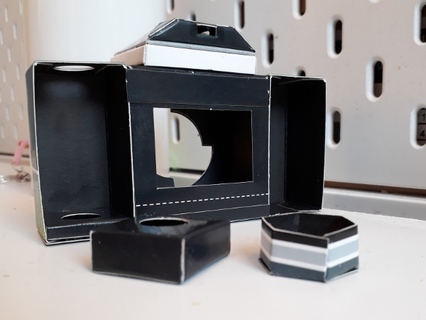
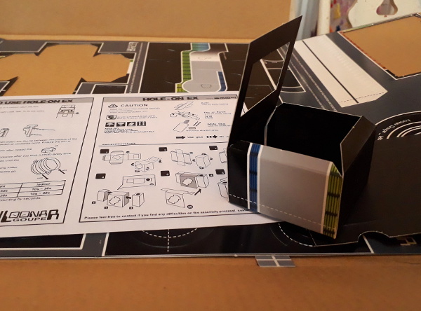
Camera, from behind

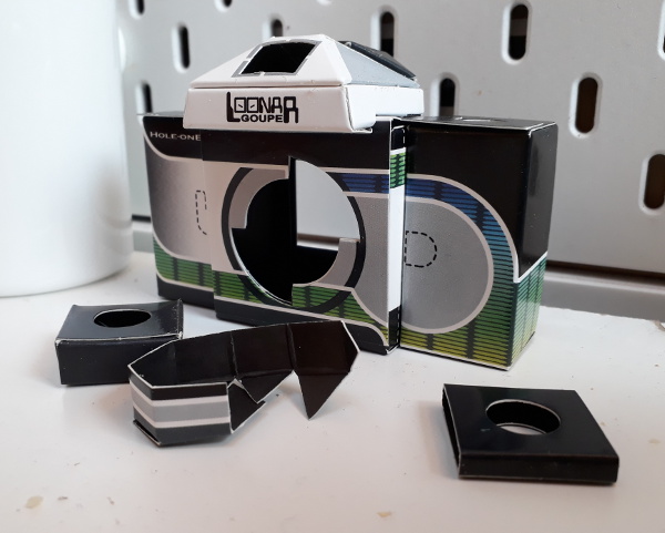
Can you see the mistake I made near the start, but didn’t realise until everything was set truly firm and solid? The dashed lines marked on the card are a bit of a clue. The entire central portion of the body is upside-down. Because the film passes through the body off-centre, this means that the frame mask is in the wrong place: it’s about 3mm or so too high. The photos this camera takes are going to have their bottom sprocket holes exposed, but (unless I take a scalpel to the frame mask) will have a black band along the top. Oh well: it’s not as if they were ever going to be perfect photos in any case. I did, at least, realise this before sticking on the film guide rails, because if I’d put those the wrong way round, with the fat one at the bottom and the thin one at the top, the camera would be completely unusable. As a 35mm film canister is handed, they have to be the right way round for the film to slot properly into place. Luckily, I decided to measure up the guide rails against the leader of a new film, and immediately realised what I’d already got wrong.

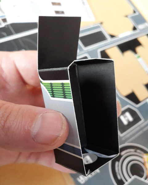
Camera, from the front

The next step is the takeup reel, which worries me because, even more so than the “shutter”, it’s the one part of the camera that’s made from card but needs to function mechanically. It feels as if the tolerances in this part of the machine are quite tight, which should hopefully help, so long as they’re not too tight that it takes a camera-destroying force to turn the wind-on knob. You can see that in these pictures: a hollow card hexagon which I would imagine is quite easily distorted if the wind-on action is a bit stiff.

Incidentally this camera has no sort of rewind mechanism. The instructions suggest you take it to a photography shop to get the film out again after it’s exposed. Luckily, I have a changing bag I can use to do it myself.

The next update on this project is here.

More on the spread of death

Or, the perils of trusting a map

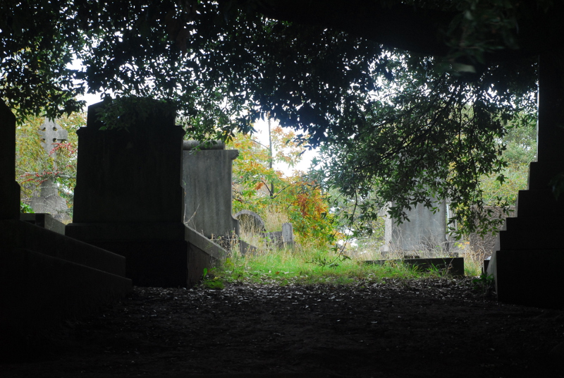
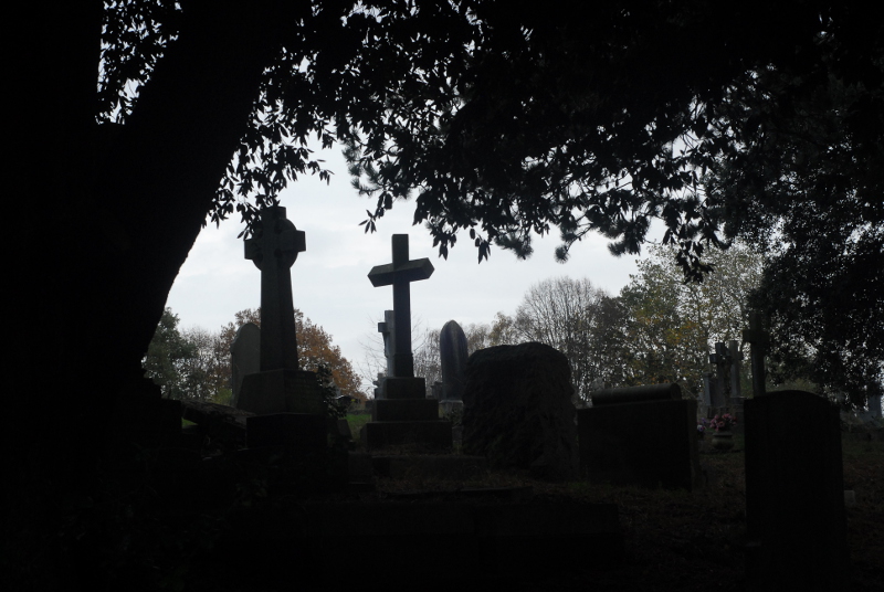
Semi-regular readers might remember that, about a month ago, I posted about Greenbank Cemetery and its history, and looked at the available historic maps online to track its growth through the late nineteenth and early twentieth centuries. This weekend I went back to Greenbank for the first time since I wrote that post, partly for the autumnal atmosphere and partly to see how much evidence is visible on the ground for the different phases of growth I identified on the maps.

The cemetery today is bounded by roads to the north and south, Greenbank Road and Greenbank View. One thing I discovered when writing the previous post is that, according to the maps, there was a phase when there were bands of allotments between the roads and the cemetery itself. The allotments seem to have been created in the Edwardian period; later, the cemetery was extended and swallowed them up. When I visited the cemetery this weekend I went to look for evidence of the northern allotment. The boundary between the cemetery and the allotments (not to mention the field that preceded them) is still clearly evident on the ground.

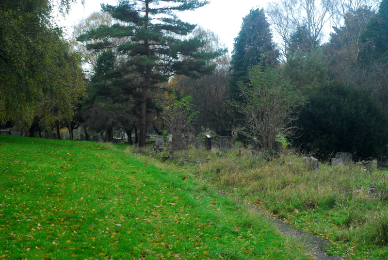
Former boundary of the cemetery, now a path

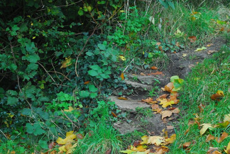
The area on the left has been part of the cemetery since, I think, its first expansion in 1880. The area on the right, where graves are packed in much more closely together, was a field at that point, then became allotments, then cemetery. If you poke around, there’s some signs that the edge of the cemetery might have been a haha-style sunken wall.

Possible former cemetery wall, with walling stones now used as makeshift steps

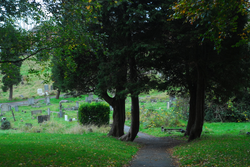
These four trees would have been on the boundary originally. I wonder if they were planted because there was a gate here from the allotments? There’s nothing marked on the map, though, and the map is quite thorough at including the cemetery’s paths, so they may not have been planted until the cemetery was extended.

Four trees straddling the former cemetery boundary - possibly a former gateway?

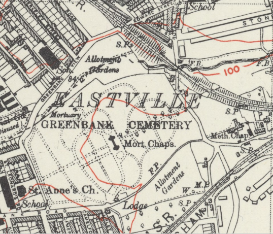
I said previously that the extension of the cemetery over the allotments “must have happened some time after 1938, as a 6-inch-scale map revised that year still shows the allotments”. That map’s available on the National Library of Scotland website; here’s an extract from it.

Greenbank in 1938, apparently

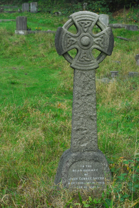
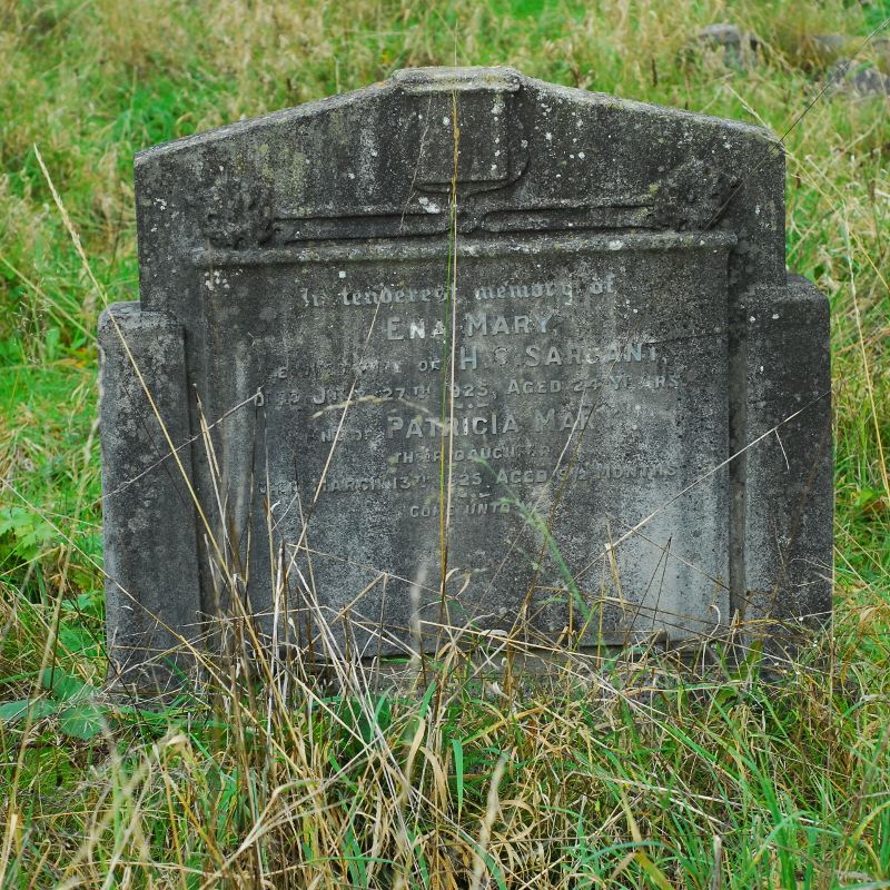
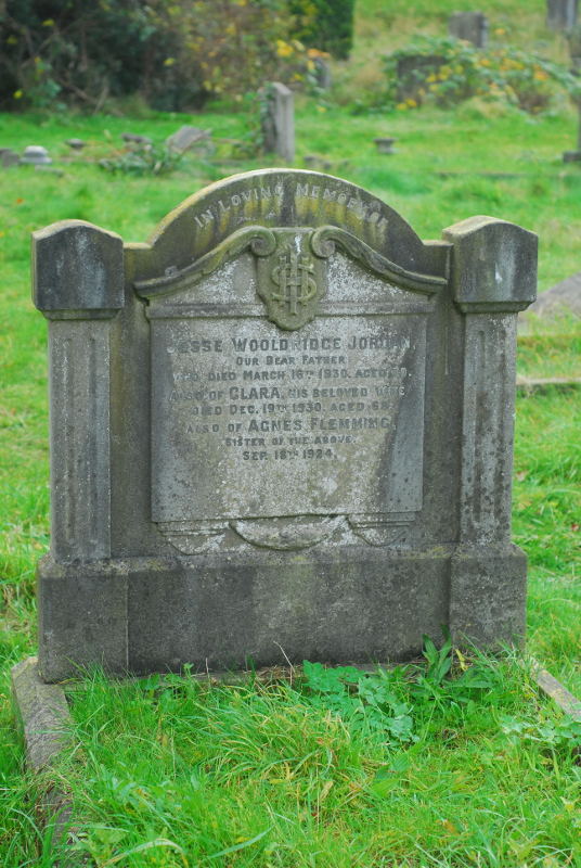
However, on walking round the area of allotments shown on this map, I quickly found that an awful lot of graves are of people who died before 1938. The dates on the headstones run back over ten years before that, to the mid-1920s.

Monument to John Smyth, d. 10th Feb 1926

Monument to Ena Sargant (d. 27th July 1925) and Patricia Sargant (d. 13th March 1925)

Monument to Jesse Jordan (d. 16th March 1930), Clara Jordan (d. 19th December 1930) and Agnes Flemming (d. 18th September 1924)

The 1920s-dated monuments run all the way up to the road, so it wasn’t a case of the cemetery taking over the allotment step by step either. Although it’s not unheard of for people to be reburied, or for people to be commemorated on headstones in spots they’re not buried in, there are so many 1920s monuments in this part of the cemetery that you can’t really use that explanation for all of them. So, unless I do at some point find some evidence that there genuinely was some sort of mass reburial and movement of graves in Greenbank Cemetery in the late 1930s, something like a Bristolian version of the building of the Paris catacombs, we have to conclude that this is a mistake on the map; or, more likely, that the map isn’t a full revision and the change in size of the cemetery was one of those changes in the real world that the Ordnance Survey didn’t bother to draw onto their maps at that point in time.

If I had copious amounts of free time, it would be very tempting to create a full catalogue of all of the monuments in Greenbank and their dates, and then develop a typology of changes in funerary design, spotting trends between different undertakers and stonemasons. It would be even more interesting still to then do the same for another large Victorian cemetery in a different part of the country, and track the regional differences. Sadly, I have nowhere near enough free time to embark on such a project. I’ll just have to wander around the cemetery, spot things like this occasionally, and enjoy the views.

Greenbank Cemetery

Greenbank Cemetery

Maps in this post were reproduced with the permission of the National Library of Scotland.

In the lead

Or, two Hallowe'en posts in one week!

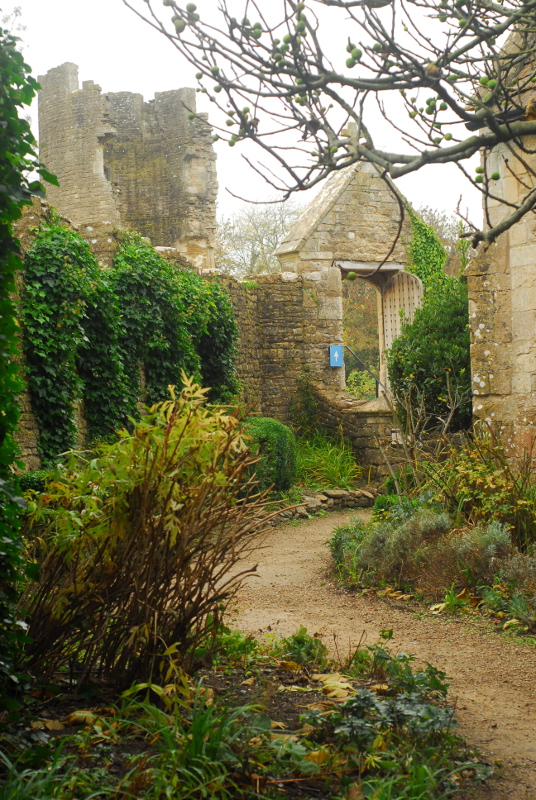
So, yesterday’s post was originally going to be this blog’s sole Hallowe’en post for this year. As it happened, though, the other thing I did yesterday was take The Children out to visit one of the local castles, which turned out to have at least its fair share of autumnal creepiness and gloom. It was Farleigh Hungerford Castle, just to the south of Bath, originally built in the 14th century by Sir Thomas Hungerford, first Speaker of the Commons. Nowadays it is almost entirely ruined, a couple of jagged towers propped up and stabilised by English Heritage concrete. The only buildings left standing are the chapel and associated priest’s house.

Farleigh Hungerford castle

Farleigh Hungerford castle

I said there was some autumnal creepiness: for one thing, the wife of one 16th-century owner allegedly spent years locked away in one of the castle towers, in top-notch fairytale fashion. The owner himself, Walter Hungerford, was later executed for treason, witchcraft and anal sex; however, how much of that actually happened and how much was just a result of being tangled in Tudor politics is rather difficult to tell.* A few decades prior to that, one lady of the house castle had reached her position by rather nefarious means. Agnes Cotell, wife of the castle steward, had her husband murdered and his body burned in the castle ovens so that she could marry the owner Sir Edward Hungerford. Presumably it was common knowledge; because only a few months after Sir Edward’s death, Lady Agnes and her accomplices were tried and hanged.

Farleigh Hungerford castle

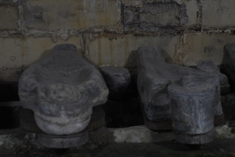
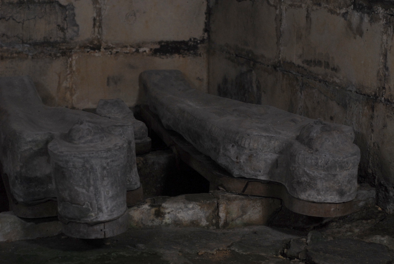
Underneath the chapel, a small crypt contains a handful of anthropomorphic lead coffins, mostly adults with a couple of infants. They sit on shaped wooden boards, bodies presumably still inside them, behind an iron gate. Aside from their silver-grey colour the look for all the world like carefully-shaped human pies or pasties, their edges tightly crimped.

Lead coffins at Farleigh Hungerford castle

Lead coffins at Farleigh Hungerford castle

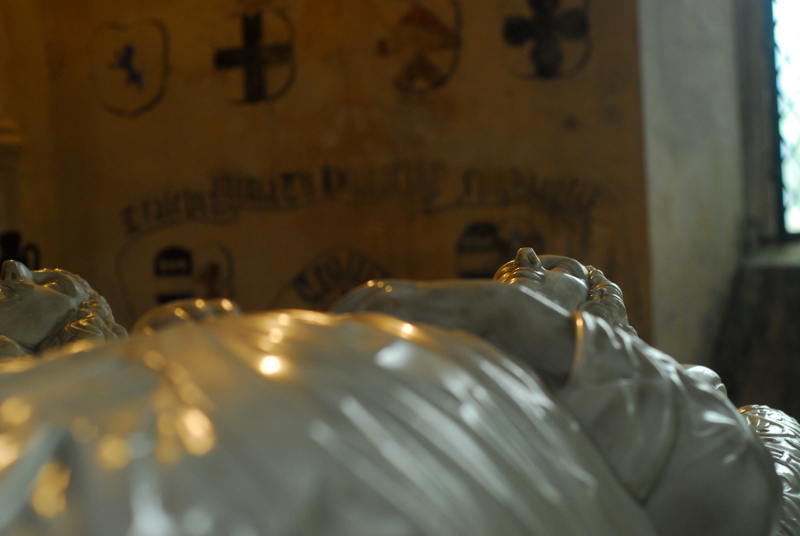
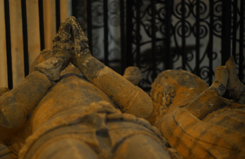
I was slightly disappointed that no ghostly emanations or mysterious mists appeared on the photos, to be honest. Upstairs in the chapel are a number of tombs and effigies, making me think (as always) of the E Nesbit story “Man-sized In Marble”, in which church effigies like this go wandering on Hallowe’en.

Chapel tomb effigy

Chapel tomb effigy

The older pair of effigies are firmly secured behind iron railings; maybe put there by someone else who knows their E Nesbit ghost stories. Maybe, though, the shiny, glossy marble pair will be getting up and going wandering tonight.

* He was a Parliamentary ally of Thomas Cromwell, and was executed alongside him. Which reminds me, I should really get a copy of The Mirror And The Light by Hilary Mantel, in which Walter Hungerford will presumably appear.

Photo post of the week

Or, autumn in the park

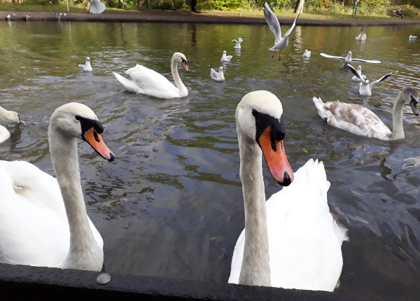
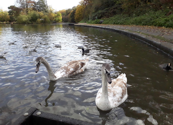
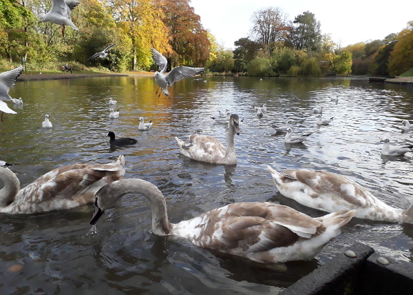
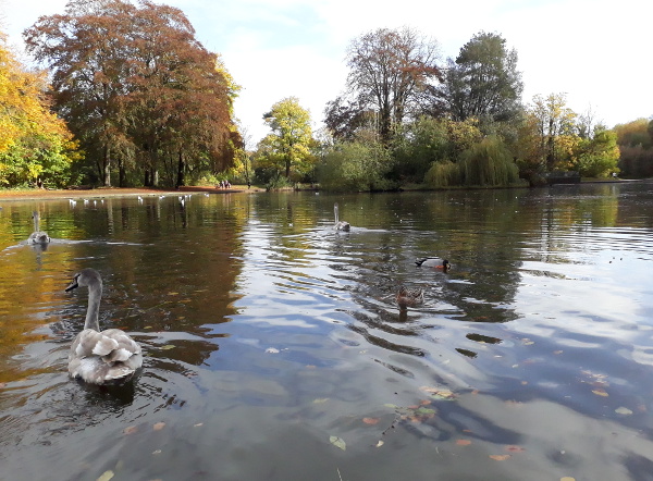
I know it can be a bit of a cliche, photos of yellow and orange leaves falling in autumn, but the park was looking so seasonally russet-hued the other day that I regretted not bringing a Proper Camera along. We fed the swans and the ducks, and caused a flurry of seagulls frenzied enough to have Du Maurier reaching for her notebook.

Birds in the park

Birds in the park

Birds in the park

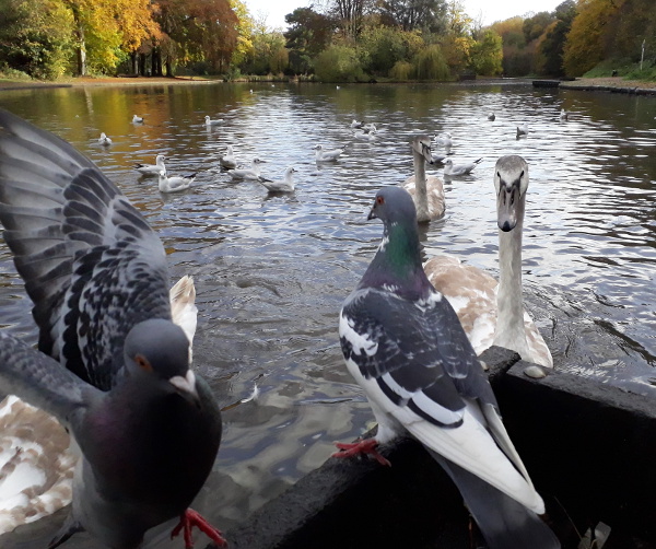
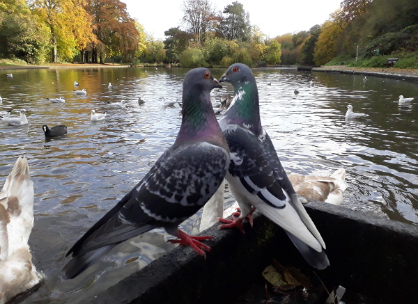
Naturally, the local pigeons also wanted to get involved, despite their inability to swim.

The pigeons arrive

The pigeons arrive

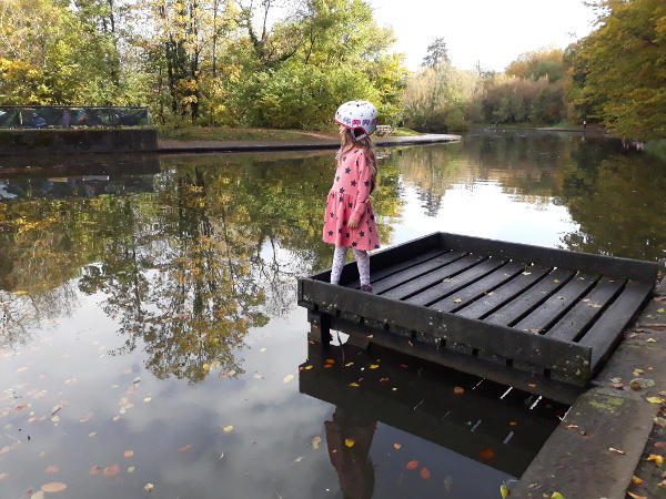
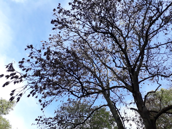
After the food was gone, all was calm again. I photographed The Child Who Likes Fairies staring pensively out across the lake, and in return she took a photo of a tree she particularly liked.

The lake quietens down

The child who likes fairies

A particularly nice tree

In the footsteps of Fox Talbot (part one)

Or, going back to the early days

The Child Who Likes Animals is a great devourer of television, particularly documentaries, and can recite great swathes of the hours of television he has watched. Usually this involves things about his usual interests, such as animals, or palaeontology, or Brian Cox talking about planets. Recently, though he’s rediscovered a CBBC series from a few years ago that has recently been repeated: Absolute Genius with Dick and Dom, in which said presenters learn about great STEM figures from history. He was rather taken with the episodes on Darwin (naturally), the Herschels, and Delia Derbyshire;* but became particularly obsessed with the inventor of the photographic negative, Henry Fox Talbot. In that one, Dick and Dom build a pinhole camera out of an industrial-size wheelie-bin, making it into a binhole camera; the episode is worth it for that pun alone. The Child Who Likes Animals, naturally, wanted us to build our own.

Making one quite that large, I pointed out, wouldn’t really be practical for taking around the place; but pinhole cameras themselves aren’t that hard to build. In fact, as it turned out, we had a papercraft one already lurking in the rainy-day-activities cupboard. Naturally I would have to do most of the building work, but why not get started?

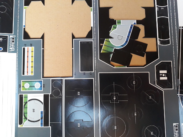
The starting point

The instructions on the packet said it could be built in as little as two hours. If you use some sort of instant-setting impact glue that might be possible, but with standard PVA (the packaging recommended “white glue”) I suspect it will take rather a lot longer, given how sensible it is to stop and let things set properly between steps.

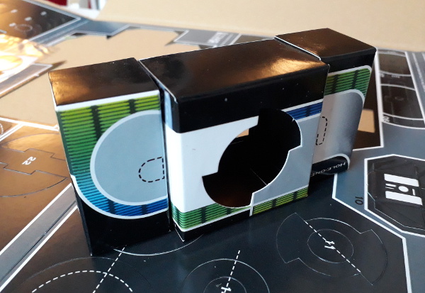
Folding up the innermost box

As expected, not only did I end up doing all of the building work, but The Children rapidly disappeared to go and watch a film or something. In theory, though, you would think a pinhole camera would be an ideal subject for papercraft, because all cameras are essentially just a black box with a hole (or lens) at one end and something light-sensitive at the other. This build seems largely to consist of folding up a few card boxes, gluing them together, and attaching a fiddly-looking but entirely cosmetic fake pentaprism housing on top. By the time it’s finished, I suspect it will end up 75% PVA by weight.

Folding up the takeup spindle housing, with a lot of excess glue

There are two potential issues I can see with the whole thing. Firstly, building a working and light-tight takeup spindle out of card is going to be a very fiddly exercise which might well prove to be the Achilles Heel of the project. Secondly, there are a couple of card edges that the film has to pass over, emulsion-side down, and I can imagine them scratching the emulsion to buggery. Oh well, I wasn’t exactly expecting it to take pin-sharp perfect results in any case.

The basic carcass of the thing

I have to admit that previous papercraft projects have foundered, incomplete, after one or two building sessions. Hopefully given that this thing is at least intended to produce something usable, I’ll manage to get it finished to the point of being able to put a film through it. Whether anything will be visible on the film afterwards (and whether The Child Who Likes Animals will actually want to use it) is another story. I’ll keep you posted.

The next update on this project is here. Part three is here.

* Personally I rather liked the episode about James Watt, which featured the Newcomen Engine at the Black Country Living Museum, the Crofton Pumping Engine, and a few brief moments of the Severn Valley Railway’s Stanier Mogul 42968 at Kidderminster.

The railway in the woods

Or, some autumnal exploration

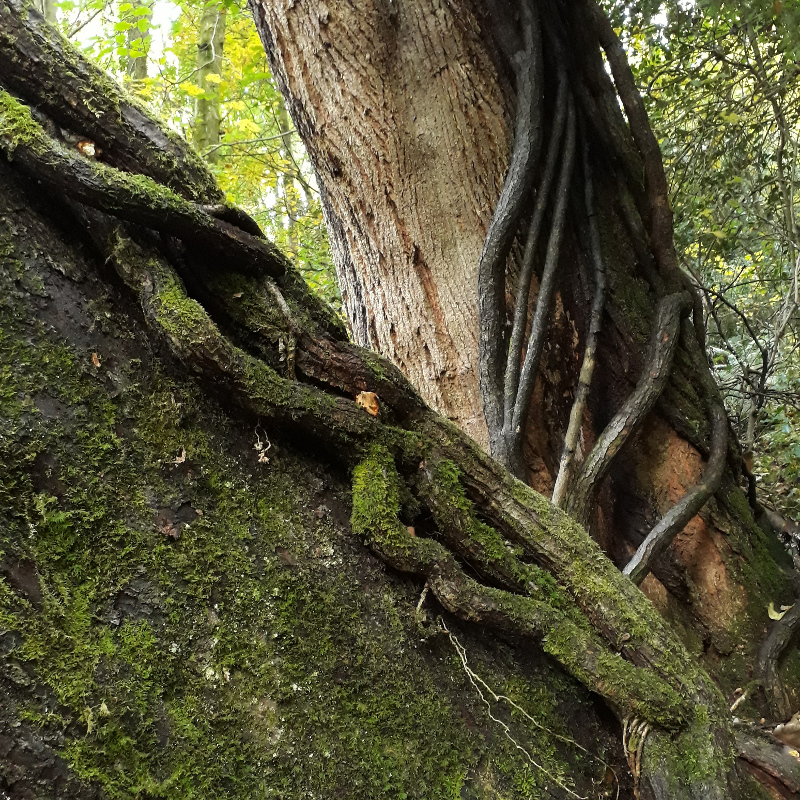
Today: we went to wander around Leigh Woods, just outside Bristol on the far bank of the Avon Gorge. It’s not an ancient woodland: it is a mixture of landscapes occupied and used for various purposes for the past few thousand years. A hillfort, quarries, formal parkland, all today merged and swallowed up by woodland of various forms and patterns, although you can see its history if you look closely. I love walking around damp, wet countryside in autumn; although today was dry, everything had a good soaking yesterday and earlier in the week. The dampness brings out such rich colours in photos, even though I didn’t have anything better than the camera on my phone with me.

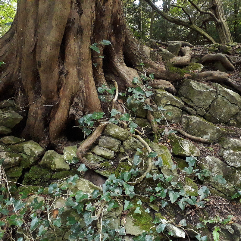
Twisted roots

Twisted trunks

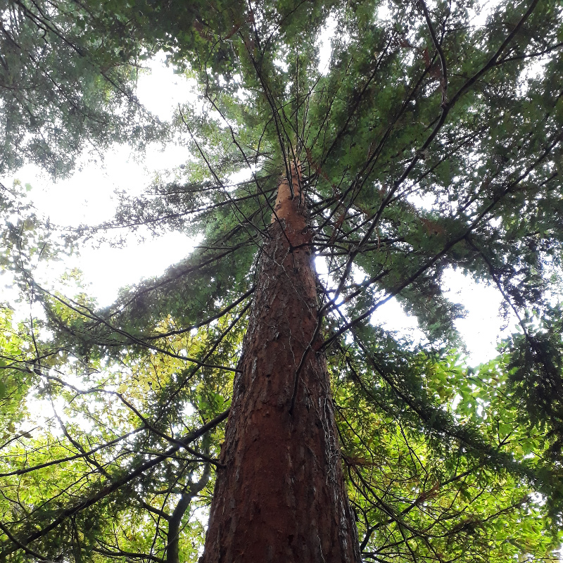
Part of the woods, “Paradise Bottom”, belonged to the Leigh Court estate and was laid out by Humphry Repton, the garden and landscape designer who should not be confused with Boulder Dash. It includes a chain of ponds which are now very much overgrown, their water brown and their bottoms thick with silt; and some of the first giant redwood trees planted in Britain, around 160 years ago now.

Redwood, of not inconsiderable size

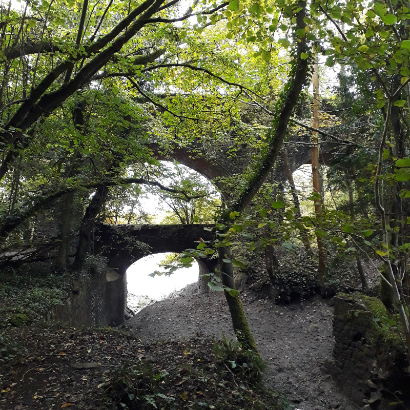
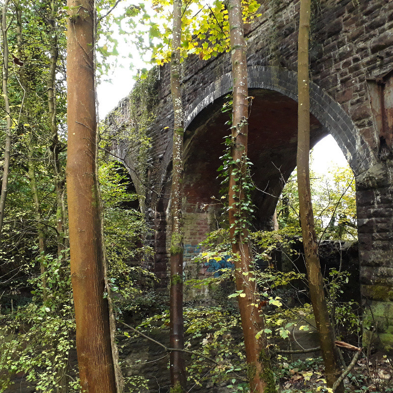
The ponds drain into a sluggish, silty stream which trickles through the woods down into the Avon, the final salt-tinged part of the stream running under a handsome three-arched viaduct built by the Bristol & Portishead Railway, back when when the redwoods were newly-planted.

Railway viaduct

Railway viaduct

If you’ve heard of the Bristol & Portishead, it may be because of the ongoing saga of when (if ever) it will reopen to passengers again. It closed to passenger traffic back in the 1960s, freight in the early 1980s, but unusually was mothballed rather than pulled up and scrapped. At the start of the 21st century it was refurbished and reopened for freight trains, but not to full passenger standards. Although there have been plans on the table for ten or fifteen years now to reopen it to passenger traffic, years have passed, the leaves in the wood have fallen and grown again, and nothing keeps on resolutely happening. The main issues are the signalling along the line (token worked, I understand, with traincrew-operated instruments) and its single track, which limits maximum capacity to one train each way per hour at the very most. Aside from putting in a station or two, these are the main factors which at present prevent it from being reopened to passengers.

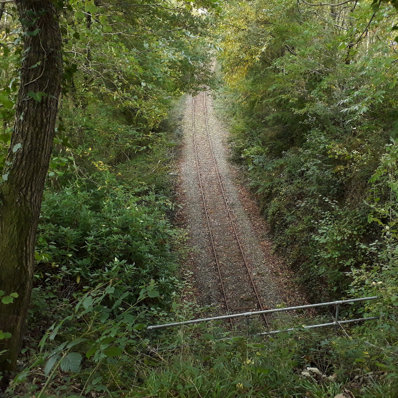
When I moved to Bristol, over ten years ago now, the Bristol & Portishead line was busy every day with imported coal traffic. Now that that is fading away, the line itself is much quieter, and indeed can go for days at a time with no trains at all. Its railheads are dull, not shiny, as it curves through the lush green woodland. I walked up to the top of one of its tunnel mouths, and looked down upon it silently.

The railway in the woods

The spread of death

Or, exploring some local history

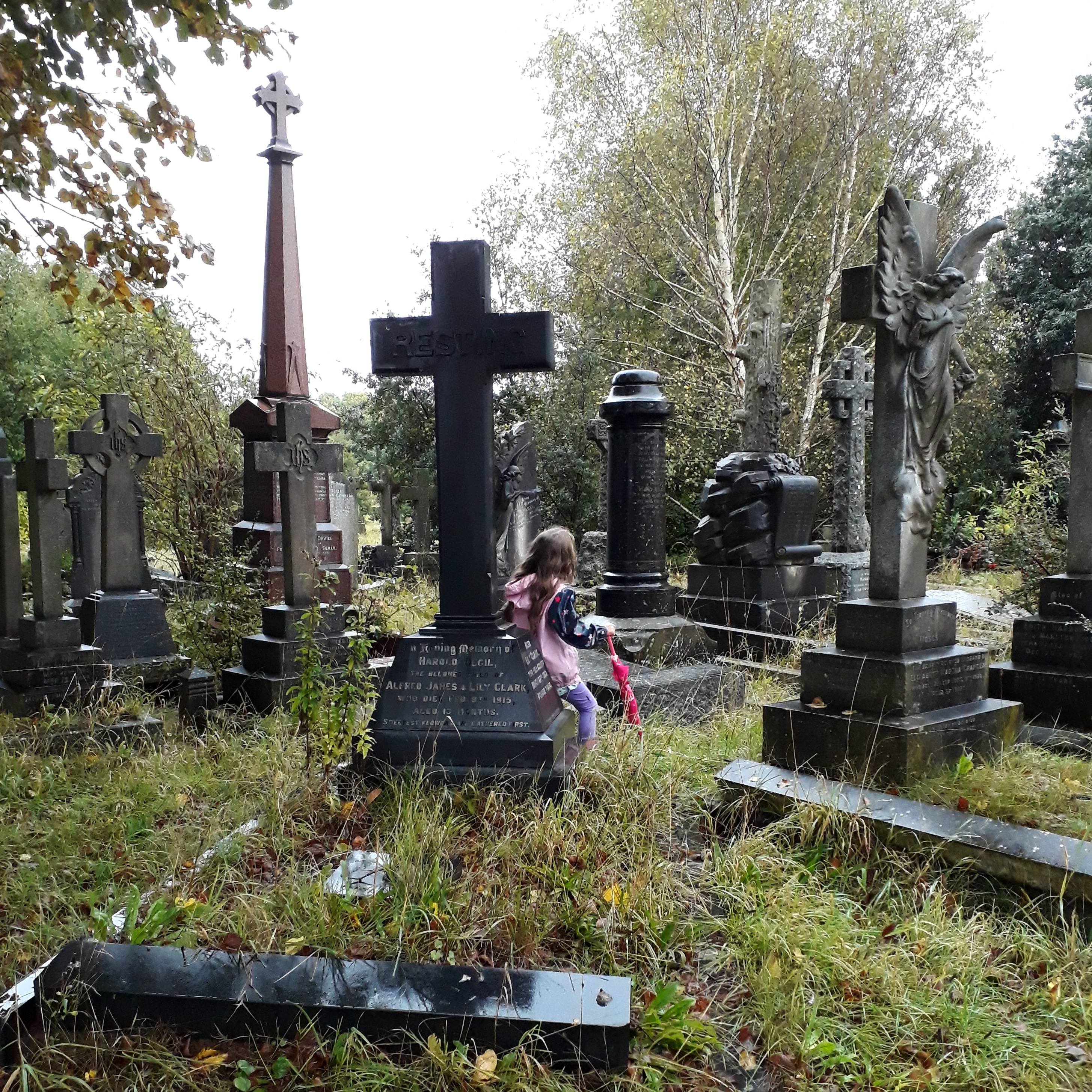
Yesterday, after the rain had stopped, we went for a walk around Greenbank, the local Victorian garden cemetery. It’s a lovely place to visit whatever the weather, but on a cold day, after a rainstorm, with drips coming from every branch and all of the colours having a dark rain-soaked richness, it is a beautiful quiet place to wander around. Even when the children are pestering you to turn around and head back home so they can have some hot chocolate and watch TV. “It is a very hot chocolate sort of day,” said The Child Who Likes Fairies.
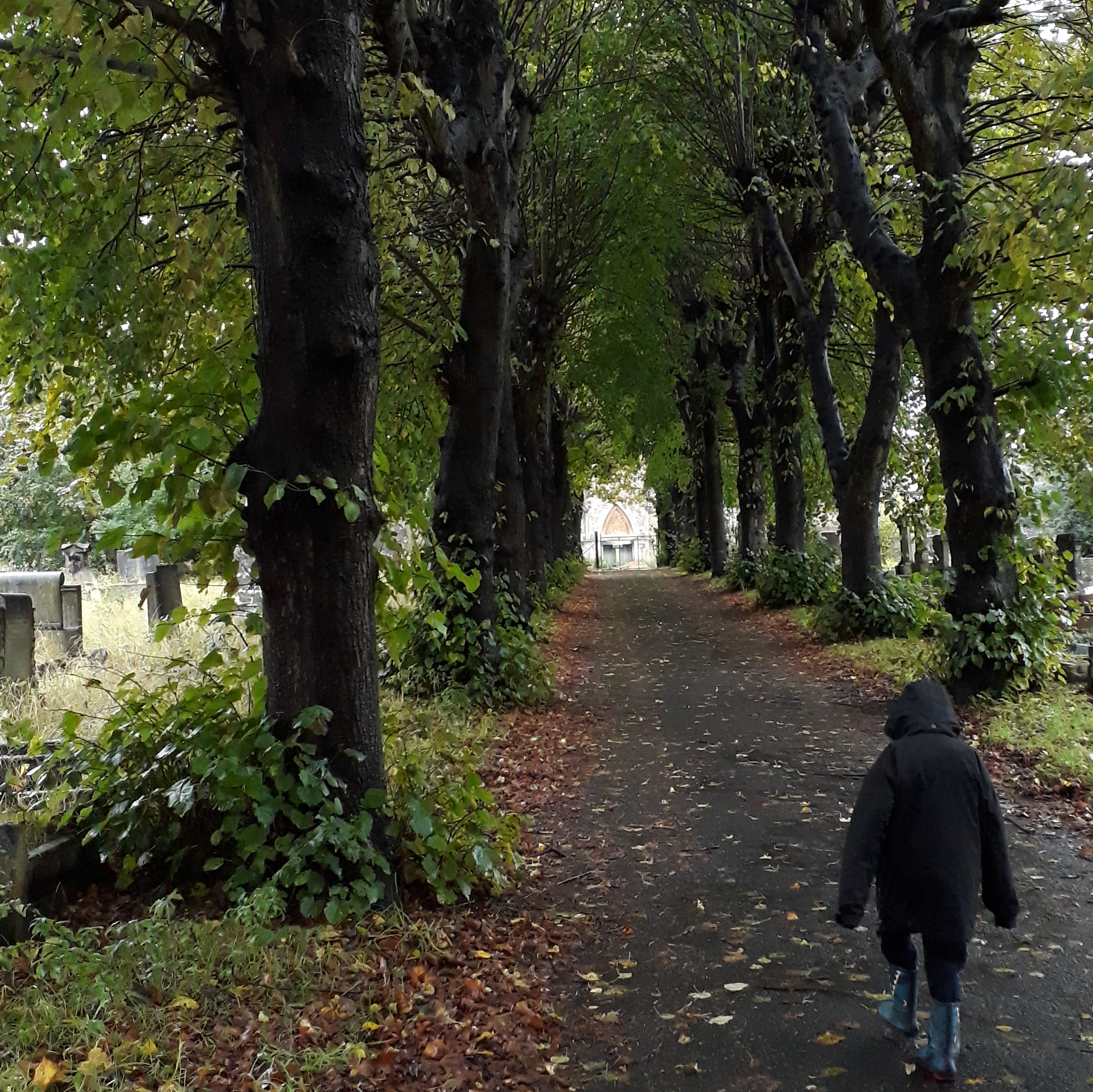
Wandering down the avenue

Exploring the graves

At the centre of Greenbank Cemetery is a connected pair of mortuary chapels: one for Anglicans, and a separate but identical one for other forms of Protestant. They have been derelict and fenced off for a long time, and their central wooden spire was taken down sixty or seventy years ago, but they are still surviving despite the failure of plans a few years ago to restore them and make them usable spaces once more. Above the entrance to the central atrium, between the two chapels, is a finely-carved inscription. “Opened 1871. Enlarged 1880.”
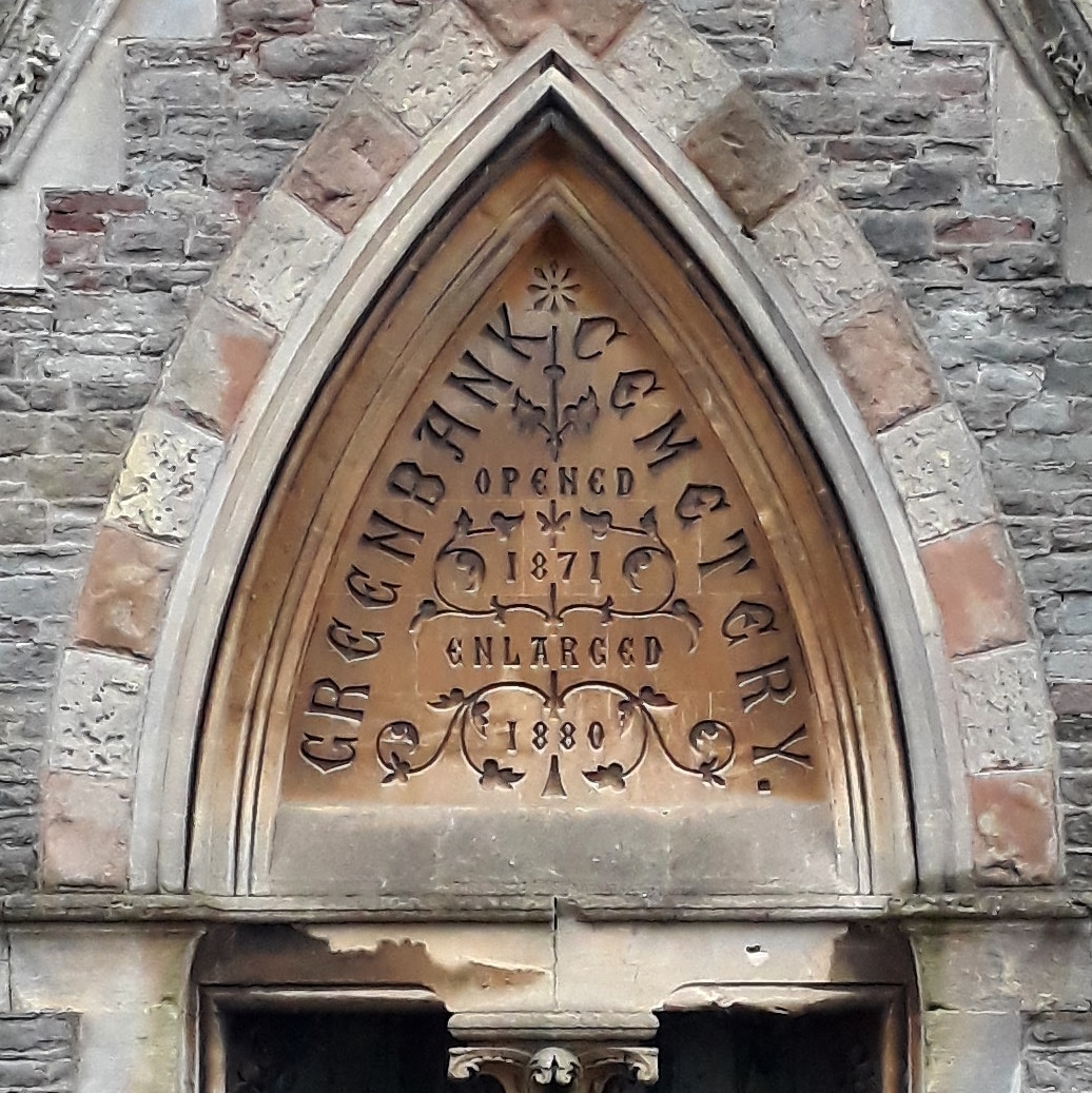
Greenbank Cemetery, Opened 1871, Enlarged 1880

Nowadays when you look at Greenbank on a map it’s surrounded in many places: by roads, by housing, on one side by a disused railway line. So I thought I’d dig into the archives to find out what its original groundplan was, and which parts were extended. Luckily, thanks to the fantastic work of Know Your Place Bristol and their maps, this was relatively straightforward to do. This first map is dated to 1880-81, so it seems to be after the first phase of enlargement of the cemetery. If you don’t know the area, note that it is bounded by an open stream to the west and north, and that Greenbank Road goes up to the cemetery gates and no further. I assume the original area of the cemetery was the part centred on the chapels, and the extension was the area east of the line of trees.

Greenbank Cemetery, c. 1881

In many ways, even without the big garden cemetery this would be a typical landscape for the fringes of a growing Victorian city: a hotchpotch mixture of farmland and unplanned speculative terrace-building. There are rows of houses without proper streets in some parts, streets laid out without houses in others, and a city-sized workhouse with its own private burial ground behind it. If I’d extended the map to the north or to the south, you’d see a typical Victorian park: Eastville Park on one side and St George’s Park on the other.

If we skip forward thirty years or so, we can see how much the landscape has “filled out”. Moreover, we can see how the cemetery has been expanded to the west. The stream has been culverted; the land to the north and south of the cemetery has been taken by allotments. This map is from 1912; I’ve traced a map from 1902 which doesn’t show this, so we can assume this expansion took place some time in the Edwardian period, more or less.

Greenbank Cemetery, c. 1912

In that thirty years huge parts of Easton which previously had just been sketched out for development have now become packed terraced streets, and some of the terraces which were built along narrow paths now have proper roads to them. Schools have been built, and a church. There’s a lot less open space, but there’s still some, here and there. Fishponds Road has acquired trams, up in the top-left corner; and the workhouse have stopped burying their dead on their own land.

If you know the area, though, you’ll know that it does still look a bit different today. To see the modern layout of the cemetery, we have to move forward to a 1950s map.

Greenbank Cemetery, c. 1955

This is the boundaries of the cemetery as it is today. Greenbank Road has been extended, and Rose Green Road has been widened to take traffic. The cemetery has swallowed up the allotments on either side of it, stretching out to reach the roads. This must have happened some time after 1938, as a 6-inch-scale map revised that year still shows the allotments. However, it can’t have happened very long after, going by the dates of some of the graves on the ground. These sections of the cemetery include a number of graves from the Second World War, including civilian victims and enemy prisoners.

What’s always puzzled me about this, though, is that still to this day the emptiest parts of the cemetery include some of the areas which were included in the original 1871 cemetery right from its opening. The north-western side of the original cemetery, which slopes quite steeply down to the course of the brook which marked the original boundary, is still empty of graves. It’s one of the areas being used nowadays for interment, along the line of a path which was put in place when the cemetery first opened. Meanwhile, the late-Victorian and the 1930s extensions are jam-packed with graves, many of them now overgrown and abandoned.

This is the point at which a proper essay on local history would be drawing to a conclusion and discussing what conclusions we can draw about the growth of cemeteries in provincial English cities. As for me, I just like looking at old maps. I think it’s a fair assumption, though, that that city council deliberately bought additional land around the cemetery with the aim of expanding the cemetery into it when required, and in the interim used it for allotment space. Of course, I also like wandering round a cold, damp cemetery, too.
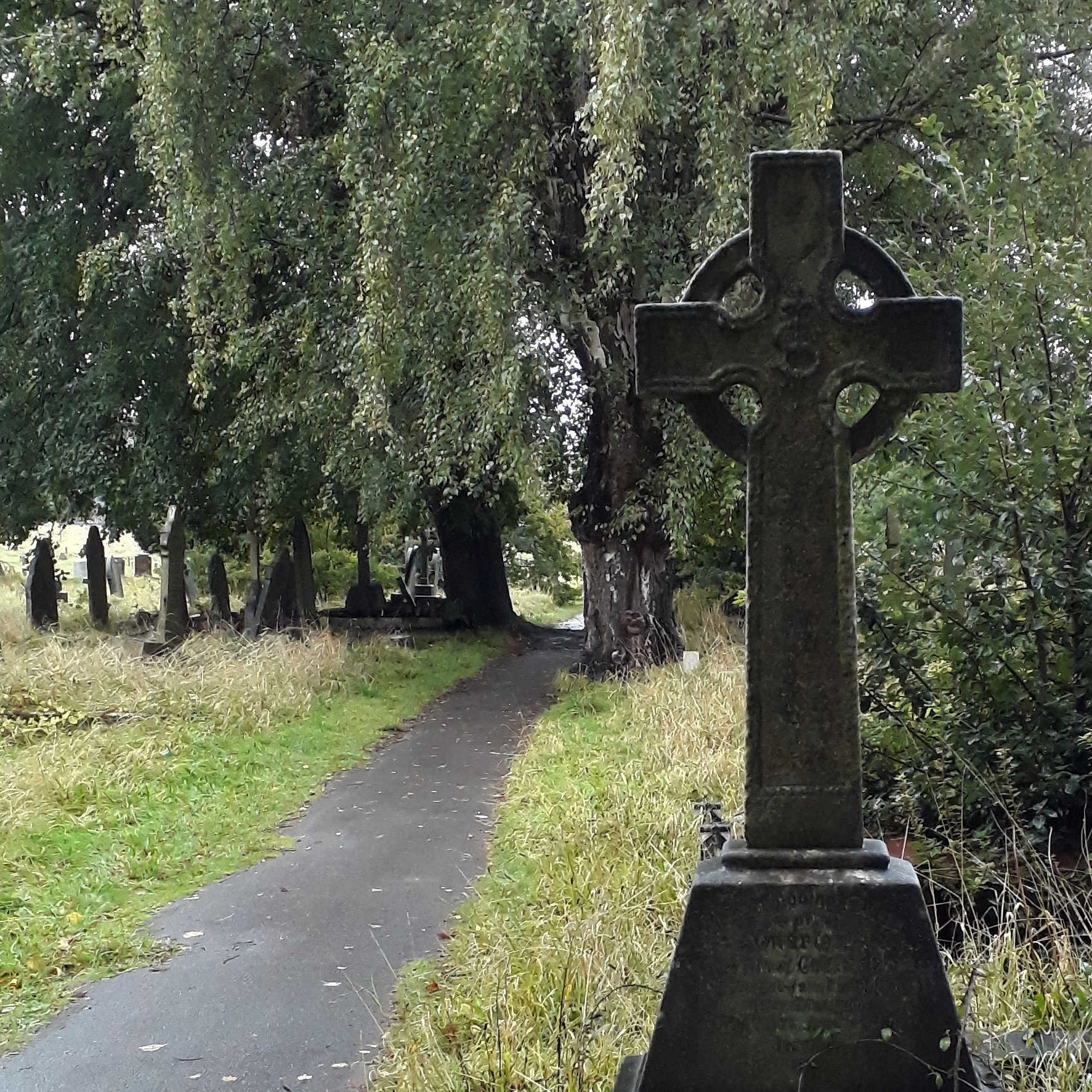
Greenbank Cemetery

Greenbank Cemetery

Greenbank Cemetery

At some point I’ll have to write more about that other burial ground marked on the map. That’s not just disused: for many years there was no sign of it at all on the ground, until a memorial was erected relatively recently. That, though, will be a story for another day.
Update, 2nd November 2020: We went back to Greenbank the other day, with my proper camera this time, to try to see if I could track on the ground any of the cemetery’s history of growth. Indeed, you can, if you know what to look for: however, it doesn’t quite marry up with the dates of the maps I’ve found. The new post about the cemetery’s history is here.

Photo post of the week

In which we hunt for fossils

They do say that if you want to go looking for fossils on a beach, you should go in winter when storms disturb things or bring clifftops tumbling down. So just after Christmas, we went to Dunraven Bay, just near the mouth of the Afon Ogwr, because frankly if you want to be able to pick fossils up randomly off the sand on a beach, the coast of South Wales between Porthcawl and Cardiff is one of the best places in the world. Dunraven doesn’t just have fossils, though, it has a haunted garden. It did have a castle, but the castle was demolished in the 1960s, leaving behind the walled garden and the ghost that lives there.

Mossy trees

The walled garden

I'm not sure this is accurate

The cliffs of Dunraven Bay

Looking out to sea

Huge ammonite, over two feet across

Smaller ammonite with coin for scale

Running about on the beach

Sadly, I didn’t get a photo of the ghost.

Trains and levers

Or, a brief pause for relaxation

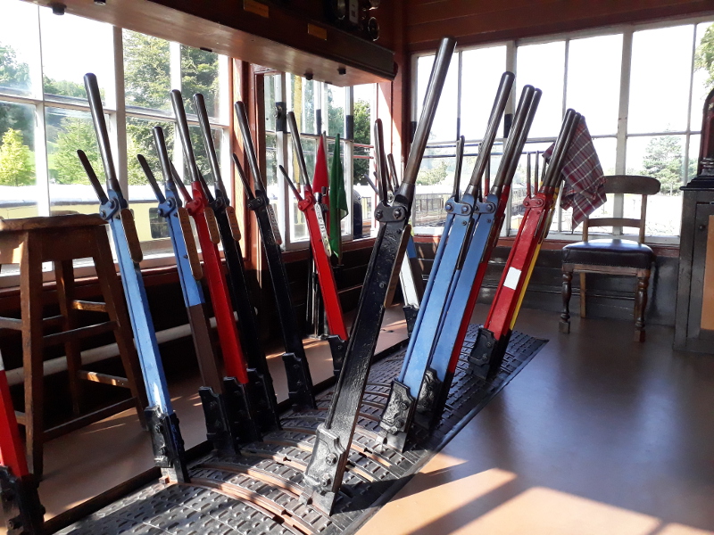
To the Severn Valley yesterday to play with trains, possibly for the last time in a while. I’m not on the roster for next month, and as the pandemic appears to be getting worse again, who knows what will happen after that point. The pandemic timetable makes it a quiet day, just four trains in each direction, and only one crossing move. Here it is, with one train waiting in the station and all the signals pulled off for the other to have a clear run through.

Signals off

In-between trains I sat and read a book of Victorian history, Mid-Victorian Britain 1851-75 by Geoffrey Body, and almost melted in the heat. It was windy outside, but hardly any of it came through the signalbox door. I watched a buzzard (I think) circling overhead, soaring slowly and sending the crows into a panic; heard pheasants and partridges squawking in the undergrowth, and listened to the frequent sound of semi-distant shotgun fire. It has been much in the news this week that shooting parties are allowed to be larger than other groups of people,* and all of the Very Online naturally have been joking about getting the guns in for their family parties; but yesterday in Shropshire and Worcestershire it felt as if people were genuinely doing just that, so frequent were the hunters’ gun-blasts.

And in small victories, at the end of the day I was proud. For I had filled in the Train Register for the day and not needed to cross any bits out. It may have been a quiet day with few trains and no unusual incidents to record; but, as I said, small victories.

Train register

When I was going through and reviewing all of the previous posts on here as part of the big rewrite, I realised the utter pointlessness of writing about some rubbish that’s on TV purely to say that I’m not going to watch it because it’s probably going to be rubbish. So, I’m not going to do that even though “some rubbish will be on TV in a few months” is all over the internet today. If you like watching rubbish then go and watch it, I’m not going to stop you. Me telling you I’m not is really just exclusionary boasting. So that’s that.

* Obviously, if you’re reading this now, just after I wrote it, you know this already. If it’s now five years in the future, you’ll have completely forgotten.

Photo post of the (insert arbitrary time period here)

Or, back to the railway

Back to the railway and the quiet post-viral timetable it is running at the moment. One nice thing about this timetable is that it gives me the opportunity to take my camera along and photograph the trains when they’re stood still, and the station when there’s no trains about. Normally you’re too busy to have chance for that sort of thing.

Bewdley station

Pannier tank

Bewdley North signalbox

2857 at Bewdley