+++*

Symbolic Forest

A homage to loading screens.

Blog : Posts from November 2008

I can see the future…

In which we confront Mario Reading, an author who got things wrong

No news on the Bristol guided busway (“Bus Rapid Transit”) scheme today, you’ll be relieved to hear.

Today, though, I thought it would be time to revisit something I wrote, back in the mists of time, when this blog was (relatively) newly-minted - insert wavy dissolve effect here. I spotted, on the telly, a chap called Mario Reading, who had just published a book claiming that according to Nostradamus, George W Bush would suffer an assassination attempt before the end of his presidency.

Lots of people have, of course, interpreted what Nostradamus wrote in different ways; and they have, consistently, been entirely and completely wrong when they produce predictions for events which haven’t happened yet. The recent US Election reminded me of Mr Reading: it reminded me that there’s not very long left for his prediction – sorry, Nostradamus’s prediction to come true – in any case, according to the table of contents of his book, it was due to have happened already by now.

I have a vague recollection at the time of Reading stating, on the telly, that he hoped that his book would be a warning to the US Secret Service, and that they would be able to use his book to foil any such assassination attempt. So maybe he’ll just say “ahh, well, clearly he would have been assassinated if it wasn’t for me.” Which begs an interesting question: what, then, for Nostradamus’s role in it all? If you publish a book that says “Nostradamus predicted that X will happen, but if you read this book you can stop it!” then does that mean Nostradamus was right or wrong? I dreamt the other night that I was going to bake myself a cheesecake for tea. I told my girlfriend – so she made us pasta instead. Clearly, this means I can see the future!

Reading’s book – Nostradamus: The Complete Prophecies For The Future – is still available on Amazon. Indeed, at a discount, which seems reasonable enough considering that now a good three years of the book’s future is our past; so we can easily judge for ourselves how accurate Mr Reading’s – sorry, Nostradamus’s future-prophesying skill is. He also has another book: Nostradamus: The Good News – all the cheerful bits. Its first prediction of the future isn’t due to occur (or not) until 2021, sadly. It turns out, too, that Reading has recently started writing a blog.* He’s got a Nostradamus-themed thriller coming out next year, and a third non-fiction Nostradamus book. How you’re meant to tell the difference between fiction and non-fiction in this context, I’m not entirely sure, but he’s clearly found a vein and is mining it for all he’s worth. Unfortunately, his blog doesn’t seem to have private contact details on it, which is a shame, because I wanted to get in touch with him. Ah, well. I’ll have to put an open letter here instead:

Dear Mr Reading,
I notice your book Nostradamus: The Complete Prophecies For The Future is still on sale, and apparently selling well according to your website. However, I note that it’s now 3 years since it was written; and that many of the events which it predicted to occur between its publication date and the present day have not, in fact, happened as you – sorry, Nostradamus predicted. Do you intend to keep the book on sale even though it contains information you now know to be wrong? Will your forthcoming Nostradamus book contain revised versions of these prophecies, and will you acknowledge the mistakes, or be issuing errata for, The Complete Prophecies For The Future?
Yours, etc…

Now, if you’ll excuse me, I’m going to go into a trance to try to predict whether or not I’ll get a reply.

Update, September 1st 2020: I’ve removed the link, because following Mario Reading’s death in 2017 his blog and indeed his entire website was taken offline. At the time of his death, he’d written a total of five allegedly-non-fiction books about Nostradamus, three Nostradamus-related novels, and three more novels apparently about the Templars (because who doesn’t love novels about Templar-related conspiracies). As I haven’t read the last three “non-fiction” books, I have no idea whether or not they did address the things he’d predicted in his first book that already hadn’t happened. Clearly, though, he found a good income-generator and milked it.

More on that guided busway

More on the guided busway, as it paves over the Bristol Harbour Railway and replaces most of Cumberland Road

As promised yesterday, I’ve been doing some closer looking at the West Of England Partnership’s guided busway – sorry, I mean “Bus Rapid Transit” plans, and some measuring up on aerial photos. It seems I made a couple of misconceptions, though. Firstly: some of the plans show the Harbour Railway converted into a sort of tramway running along the same road as the buses. Secondly, I was slightly wrong about the route in the Winterstoke Road area. My mistake was to assume that it might actually serve a residential area; I was wrong, it doesn’t, and its sole use is as a replacement for the current park-and-ride services. The council have also said it will serve the football ground; but that slightly contradicts other things they’ve said.

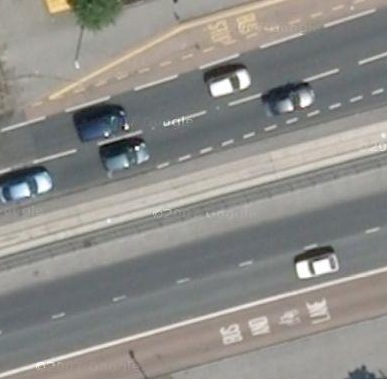
Anyway, here we go: what does a guided busway actually look like? Never mind the Partnership’s shiny traffic-free plan: here’s a real one. This is the A64 on the outskirts of Leeds, which has a single-carriageway busway down its central reservation.

Aerial shot of East Leeds guided busway

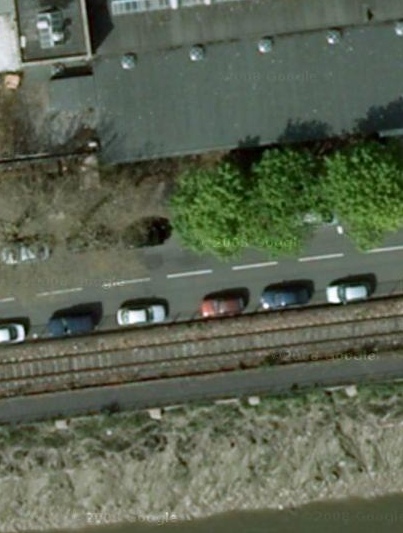
Never mind the bus lanes at top and bottom; the busway is that lovely expanse of concrete in the middle. The width of the whole thing, by my calculations,* comes out at about 3.8m. So, for a two-way busway such as the council wants to build in Bristol, you’re looking at 8m width. That’s for plain road without stops. Here’s a picture of where the council wants to build it: Cumberland Road. To the same scale, as you can tell by the cars.

Cumberland Road, Bristol

From the top: road, railway, cycle track, river.

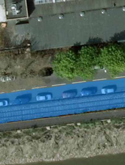
The plans include building over the railway for one side of the bus route. Remember what Councillor Bradshaw told me: the plans “do not prevent” trains being run. Does that mean no bus services at weekends when the railway’s running? Or fewer trains? Who, at present, knows? Anyway, that means, for our Militant Invective Laboratories simulation (better value that the Partnership’s, I’m sure), we only need paint over part of the road:

Cumberland Road with added busway

There goes the railway and just under 4m of the road, painted over in wobbly freehand. That’s the amount of land the council’s planning to concrete over for its posh new buses (and all the older ones which will also be allowed to use the busway).

So, goodbye to half of Cumberland Road – even by narrowing the pavement on the north side, there wouldn’t be enough room to make the road full-width. The council’s simulation does seem to show there being a bus lane in the road at this point, rather than a proper busway. However, there’s a slight problem with that: the buses and the road traffic would be going in opposite directions, unless one were to drive on the right, so no space gets saved. The published proposals go on and muddy this point by showing both buses and normal traffic driving on the right at this point – which, of course, would be no help at all.

Still to come: the even more awkward pinch-point where the busway is due to run alongside the Portbury Dock railway line, at Winterstoke Road, with a stop which will take up even more space. They seem to be planning to run the busway over Network Rail land – I wondered if Network Rail knew about that, so I’ve asked them. For that matter, I wonder who owns the land the rest of the busway will run on – presumably either Network Rail or BRB Residuary, the organisation that is one of the last remaining stubs of British Rail. BRBR’s website is a bit broken at the moment, so I can’t search their property listings to see what they do or don’t own.

* including the small width of kerb separating bus and road on the buses’ left, which is presumably needed for safety reasons.

Guided Bus

In which we discuss the West Of England Partnership’s misguided bus proposals

Through my door the other day: a leaflet from the West Of England Partnership, the organisation made up of local councils* that replaced the dead and unlamented Avon County Council. It’s about their proposals for a guided busway scheme in this part of the city. A new road, in other words, limited to buses only. Some of the buses on it would be expensive new buses cunningly disguised to look like trams, and running on “sustainable fuel”;** the rest would be the boring ordinary diesel ones that already serve this area. It would replace the current park-and-ride buses in this area, which are already the nicest and most modern buses in this part of the city. So, frankly, I don’t see why that’s the bus route that most urgently needs replacing.*** You can see their proposals for yourself, on the Partnership’s website – they very carefully avoid using the term “guided busway”, and instead call it “rapid transit”, using the word “bus” as little as possible.

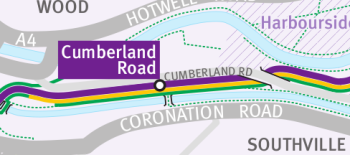
The route isn’t really any more useful than the current park-and-ride scheme, either. It’s going to be built along the old railway line that served Bristol Harbour. A small part of this is disused; some is still used by trains to the docks that are still open, but most is used by the Bristol Harbour Railway, a council-owned steam railway that chugs up and down the Avon and the Harbourside, and does a pretty good trade. Here’s an extract from the map on the website:

Proposed bus rapid transit scheme

The purple line there is the new bus route, and the yellow line is the railway. The black blob there, looking like a station, is a proposed Cumberland Road bus stop – handy for Southville, because there’s a footbridge across the river there. The green line is a cycle path.

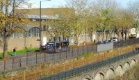
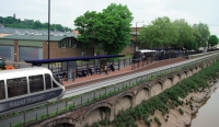
Now, so far, this is just a line on a map. Not much detail design work seems to have been done – one of the councillors responsible, Mark Bradshaw, said as much to the local paper with the words: “Residents, businesses and other stakeholders are invited to engage in this work and help shape the detail of the proposals.” However, the Partnership have gone as far as producing a mockup of the proposed Cumberland Road bus stop. Here’s their design. On the right: the new bus stop. On the left: a photo I took a few days ago from almost the same location, although I didn’t quite get the angle right.

Cumberland Road

Guided busway proposals

You can see, on my “present day” photo, the railway line – it’s behind the yellow fence and in front of the road, and you can make out the rails if you look carefully. More interestingly, you can see that on the Partnership’s artist’s impression, the railway isn’t there any more. The cycle path along the riverbank is still there; but the railway line on the other side of it has been paved over and turned into busway. So, in fact, has half of the road on the other side – you can see, the busway near the platform comes out almost as far as the centre-line of the road.

Mark Bradshaw is, as it happens, one of the councillors for my ward. I wrote to him, and my other councillor, before I’d realised that he was on the relevant West Of England Partnership committee that has put these proposals forward. Based on that artist’s impression, I wrote:

The project will be hugely expensive in infrastructure costs, [and] will apparently destroy the popular tourist attraction that is the Harbour Railway and replace it with a buses-only road

I must have been writing in Pompous Mode that day. You can see, based on the above, why I’d think that. Councillor Bradshaw replied:

The Harbour train service will continue and the BRT services will not prevent this (see yellow line on map in consultation leaflet)

Which is fair enough – you’ve already seen that yellow line on the map. The problem I have, though, is that building a busway isn’t quite as simple as drawing a line on a map, as the artist’s impression shows. If the Harbour Railway is still going to be there, why did the Partnership put out proposals for consultation that show it paved over? And how is the busway going to fit between the railway and the road? Something will have to be moved, for sure.

If this scheme does go ahead, I strongly suspect that the guided busway along that section of the route will have to be dropped, purely because there isn’t room to build it. In the meantime, I’ve replied to Councillor Bradshaw and asked why that artist’s impression shows the buses running over the site of the railway when the railway is, according to the map, still going to be there; when he replies, I’ll update this post. Tomorrow, I’ll show you – with the aid of Google Maps and existing guided busways – just how much room the proposals would need on the ground, and how much land it might take up.

UPDATE: local blogger SteveL has, in the comments, pointed me to the Partnership’s video of the scheme. Which apparently shows the railway being turned into a tramway along the southbound busway, something that wasn’t apparent on the still images. So, the busway won’t prevent trains from being run, so long as trains only want to run when there aren’t any buses about. I see.

* and “a range of social, economic and environmental partners”, they say. Personally, I think it’s a bit of a grand name for what is, in land area, only a small part of the West of England, but it’s hard to think what else they could have called it – anything with Avon in it was and is taboo, and “Greater Bristol”, although that’s essentially what it is, would no doubt irritate everyone out in the hinterlands.

** They haven’t decided what fuel, only that it will definitely be Sustainable. Buzzwordtastic!

*** except the political reason. This is going to be built in Bristol, but funded partly by the local councils in the surrounding area. Hence, it serves commuters from North Somerset who might want to park-and-ride more than it serves Bristolians.

“1000 Tide”

In which we are briefly puzzled by some art

A few weeks ago, exploring the local area, we started walking up the Ashton-Pill path. It runs along the side of the railway up the south bank of the Avon, along the Avon Gorge and under the famous Suspension Bridge, downriver towards Pill.* We walked along it until we got bored and turned around.** En-route, though, we saw something slightly unusual. A big pile of plastic bottles, on the shore, below the path but above the tide line, corralled together.

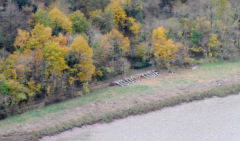
Presumably, we thought, some sort of anti-littering campaign, fishing non-degradable bottles out of the river or out of the undergrowth. But then, the other day, we were up on the Downs on the far bank, and noticed the bottles—or, what we assume is those bottles—again. They’ve been arranged into words.

1000 Tide

We have no idea, though, what it is. An art project? An advertising slogan? An anti-littering project as we originally thought? The internet doesn’t seem to be helping – the only relevant search hit at the moment is, er, that photo. We’re puzzled.

UPDATE:, November 14th 2008: Thank you to a correspondant called Liz – who was also puzzled by it – for letting me know what it is. It is, indeed, an anti-littering art project; there are apparently 1000 plastic bottles washed up on every tide,*** hence the text. It does, though, change regularly, and eventually the artist, whose name is Pete Dolby, is going to make them all into a raft. So now we know.

* as you might expect, given its name

** after all, walking down towards Pill and back another way would have been a very long walk; and any other circular routes would have involved a stiff climb through the woods.

*** in the Avon Gorge, that is. I’m not sure what the number per mile of coastline is.

Photo post of the week

In which we go to Cornwall

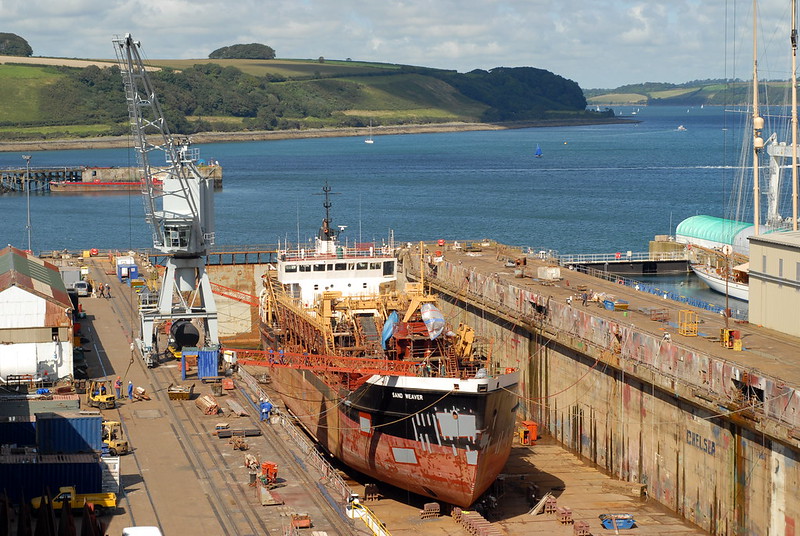
Not only have I been behind on updating this site, I’ve been getting behind on posting photos online. I generally stick to posting 6 to 8 photos per day, partly because uploading them is such a slow and tedious job that I can’t be bothered doing any more. This, however, means that I’m still only at the start of posting photos of our summer camping trip, down to Cornwall. That was: August. It’s now: November. That’s some delay. Here, though, are some examples, of hot, sunny, summer Cornish weather.

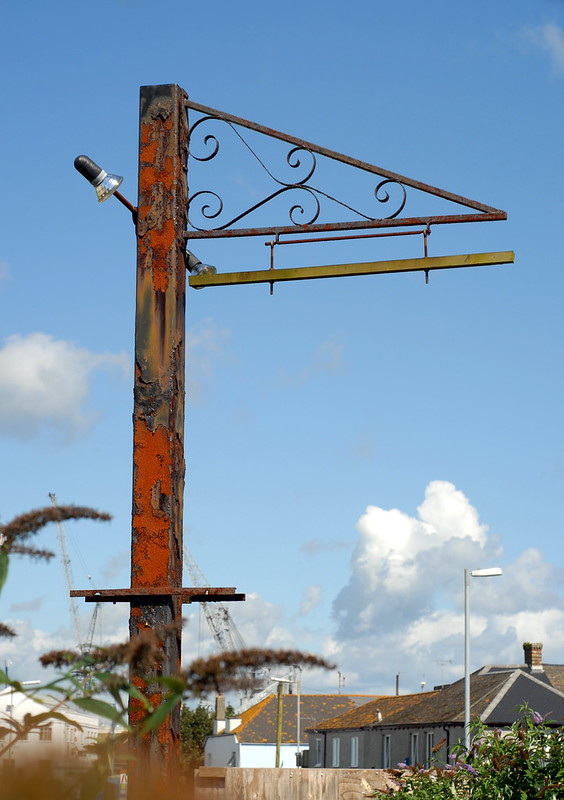
Derelict picnic bench, Falmouth

Falmouth Docks

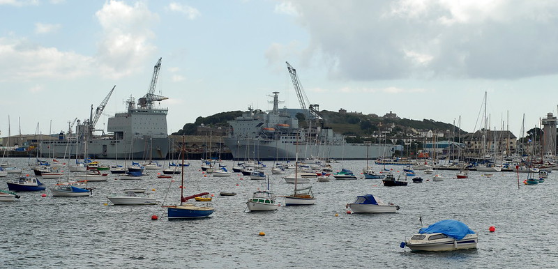
Falmouth Harbour

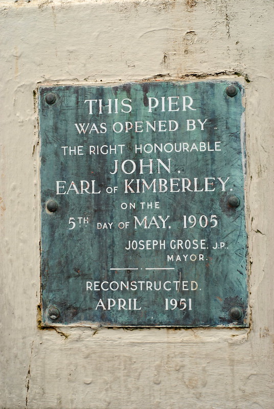
Falmouth Harbour pier

Truro Cathedral

Derelict hotel, Falmouth

Clever Girls Like Clever Boys Like Clever Music

In which we see Pelle Carlberg

We were hoping, when we moved here, that there would always be lots of exciting little gigs to go to, given that this city is always supposed to have an exciting music scene. Last night, we went to the second one we’ve been to since we moved to, to see one of our favourite Swedish indiepop acts, Pelle Carlberg. Swedish indiepop? Yes, indeed. A classic genre, I’ll have you know.

Not many other people seemed to think so, though. We were the first people there – indeed, when the first act, Made From Clouds, started, we were the only people there. “Have you heard of Flight Of The Conchords” he bantered, at the end of the first song. “This feels like the episode where Bret left the band and Jemaine was left on his own.” There’s nothing wrong with resembling Flight Of The Conchords to my mind, though.

Other people did start to filter in, although as usual at small gigs a lot of them were friends of the local bands, coming in for one band and disappearing afterwards. Pelle Carlberg arrived, too, and sat down next to us, to listen to his support. Slowly, people who had come to listen to him specifically started to appear.

The main support, who’ve been following Pelle round the country, were pretty good. Called “The School”, they’re an indiepop band of the Cardiff school, with cheerful melodies and tinkly glockenspiels. We bopped along in our seats, with smiles on our faces.

Pelle Carlberg himself tends to get compared to Belle and Sebastian. On the posters for this tour, certainly. Having a song in his set called “1983 (Pelle and Sebastian)” possibly doesn’t help that; and his gawky dancing style does remind me slightly of Stuart Murdoch. Generally, though, his songs are slightly more biting, less vague, about reality rather than hypothetical dreaming teenagers. After listening to him, you know exactly which airlines he refuses to use* or which journalists he doesn’t like any more. He’s very good at it, though, and moreover, very catchy. We might have been bopping in our chairs to The School; for Carlberg, we were bouncing about and singing along. As there were only about 15 other people in the audience, we think he probably noticed.** Rather than have a merchandising stall, Pelle had a carrier bag, and invited everyone to come up to him to buy stuff from him after the gig. We went up and bought a Pelle Carlberg cloth shopping bag, embarrassed and happy and giggling. On the side it says “Clever Girls Like Clever Boys More Than Clever Boys Like Clever Girls”, one of his best (and best-known songs).*** And then we walked home, bouncing and cheerful and whistling his choruses to ourselves.

* Ryanair, in case you were wondering.

** not counting the members of The School who had stayed to listen.

*** It’s on Youtube; I recommend it.

Overheard (again)

In which we overhear surprise

Walking down Clare Street yesterday. Behind me was a couple, late-twentysomething at a rough guess, the woman carrying a big, quite expensive clothes-store carrier bag.

Him: How are you enjoying our date?

Her, surprised: This is a date?

In darkness

In which we find art in a cave

One of the things I like, about living in this city, is the randomness of things one comes across. One will turn a corner and find something new happening, something unexpected, something undreamt.

We were ambling around the harbourside, at the weekend, along the stretch that is overlooked by red sandstone cliffs. There are caves dug into the cliffs there, gated and walled off now; but as we walked along the quayside we noticed that one of the gates was open, with a sign outside it: “photography exhibition, this weekend only”.

We looked closer; and saw a brick archway let into the cliff, with darkness inside it, no sign of anybody about. Tentatively, we stepped inside; the brick walls gave way to rough stone, and a sign warned of falling rocks. And, inside, in the darkness, we found: a photography exhibition.

It turned out to be by a local photographer, Jesse Alexander, who has taken long-exposure natural-light photographs of various underground locations. Caves, cellars, underground reservoirs, and so on. When I say “long exposure” I don’t mean “get the tripod out”, I mean “get the tripod out, set the camera up, then come back a week later”.* To show them in a suitable location, he’d found an unlit cave, printed transparencies of his work, and mounted it up on individual lightboxes. The whole installation he called “Threshold Zone”.**

It was an interesting and unusual concept. Printed normally, set up in a gallery, the prints would have been examples of technically good and well-composed photography, but without anything particularly distinguished about them. Mounted there, in a dark, quiet cave, they took on something special.

* although he loses out slightly, in the long-exposure stakes, to Justin Quinnell’s six-month pinhole camera exposures.

** If you go to his website, you can apparently download a PDF about the work. Whether you can read it is another thing; I can’t get it to open. But it might be worth a try.